
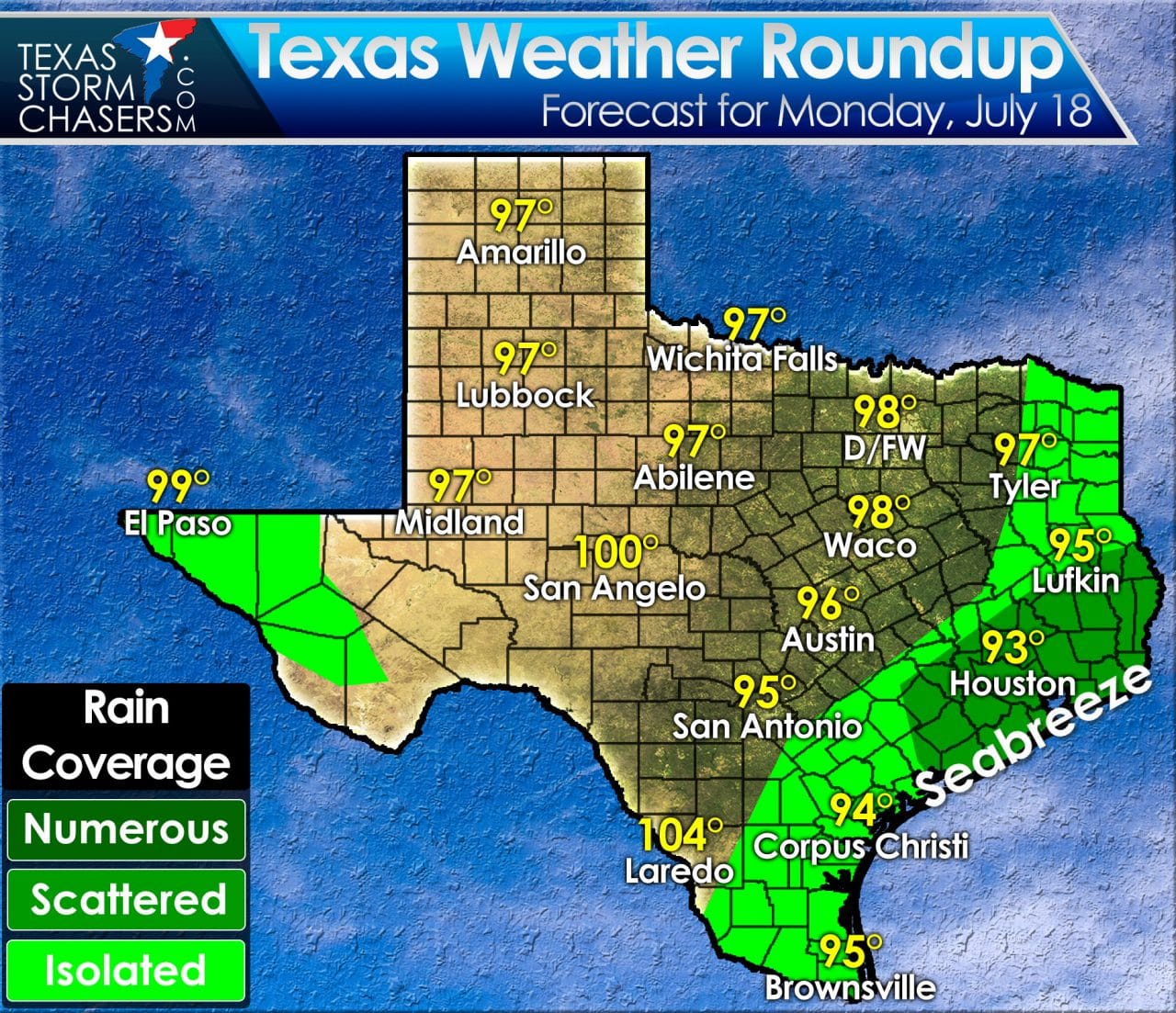
Welcome to twenty ninth work week of 2016. We’ve made it halfway through July without any sort of tropical mischief or unusual summer occurrences. We’ve dealt with a couple thunderstorm events as the occasional heatwave. We are not anticipating any major weather events in Texas over the next week. An upper level ridge of high pressure will dominate our weather pattern. Without any steering currents or storm systems expected most of Texas will remain hot and dry for the foreseeable future. The exception to that will be each afternoon as the sea breeze moves inland from the Gulf of Mexico. The inland movement of the seabreeze each day will vary, but there will be scattered storms in its proximity. The best chance for scattered storms will be in Southeast Texas this afternoon. This includes Victoria, Houston, Lufkin, and Beaumont. Those locations could very well be dealing with hit or miss activity today. The stronger storms may briefly become strong with gusty winds and brief heavy rain. Any storm that develops will produce lightning so please move indoors or to a vehicle if you hear thunder. Otherwise a rouge shower could occur in Far West Texas today as the monsoon struggles to set up shop in the southwest United States. Temperatures this afternoon will peak in the 90s to low 100s. Heat index values of 105 to 108 degrees are forecast in Northeast Texas and East Texas. Little change in the weather is expected this week with high temperatures remaining near or slightly above average for July.


0 Comments