
Good Morning and welcome to Hump Day! Today may be starting off feeling somewhat like january but that’ll change later this morning. Temperatures are going to hit their highest point so far in 2015 today with several locations probably hitting or setting new record high temperatures by this afternoon. The main change in our weather today compared to Tuesday will be increasing southwest winds which will help push the temperature even higher. That’s because southwest winds are often quite dry which dry air will heat more efficiently and quickly. Likewise the temperature/dewpoint spread increases and we also have to deal with low humidity values and increased fire danger.

Afternoon Temperature Forecast
* The Texas Panhandle will top out in the lower 70s
* Low to mid 70s across East and Southeast Texas
* Upper 60s to lower 70s acros Far West Texas and the higher elevations in the Alpine Mountains. Mid to upper 70s in the lower elevations.
* Upper 70s to lower 80s across the Hill Country, North Texas, and Central Texas.
* Low to mid 80s across Northwest Texas
* Low to mid 80s across Deep South Texas and the Rio Grande Valley
Several locations could tie or set new record high temperatures today, especially those who top 80 degrees. Today will feel like an April afternoon versus one in late January.
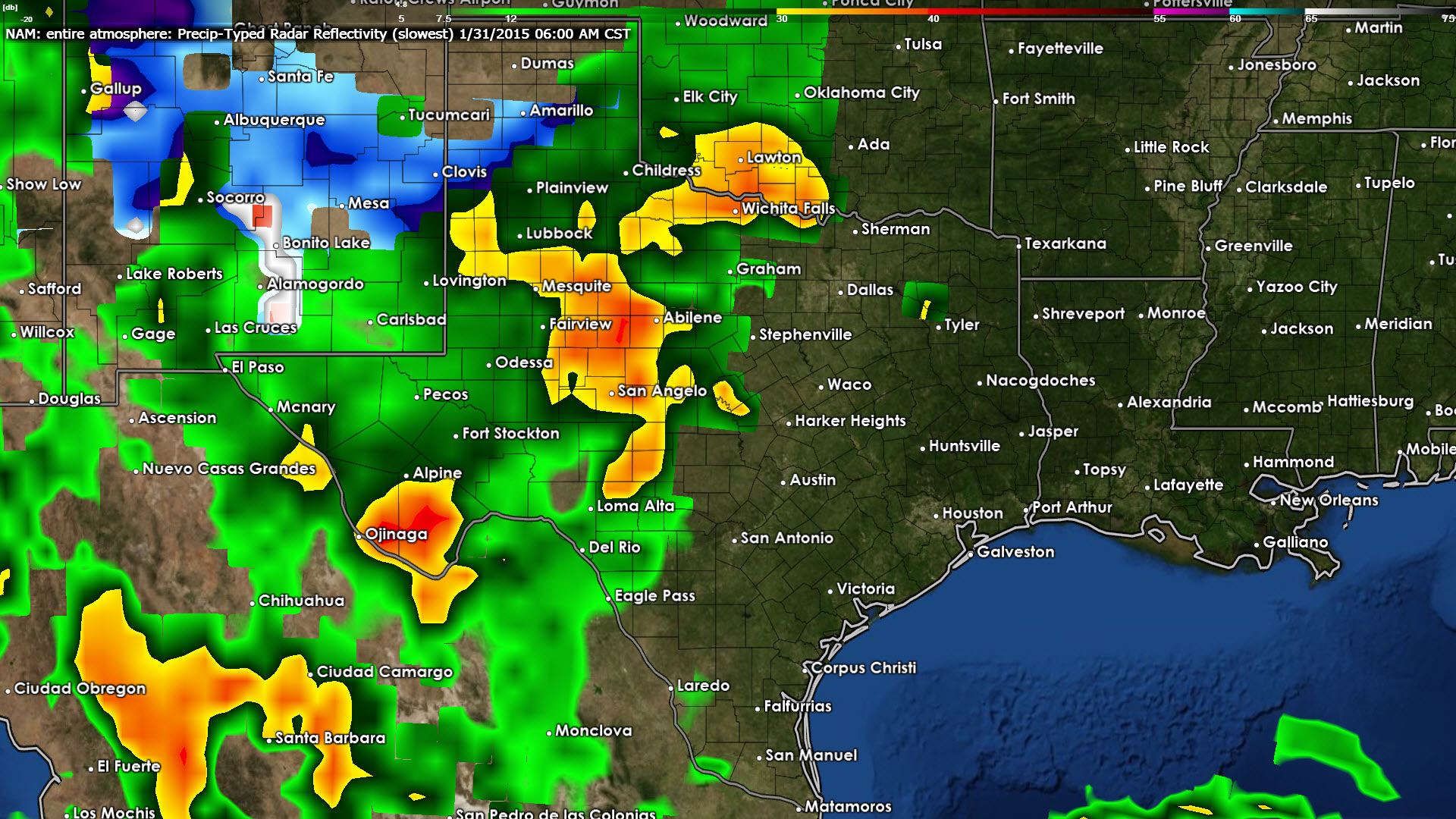
Our weather will change big-time on Friday as a cold front and upper level disturbance drop temperatures back to normal and bring a good chance of rain to Texas. Rain chances will go up during the day on Friday across the Texas Panhandle and West Texas where temperatures should be above freezing and all precipitation in liquid form. The North American Model (NAM) increases rain chances late Friday night into Saturday morning across Northwest Texas, West Texas, the Hill Country, the Permian Basin, and parts of Southwest Texas. Temperatures across the Panhandle may drop low enough during the nighttime hours on Saturday morning to support a winter mix. At this time we’re not anticipating significant accumulations but we’ll keep an eye on data to see if it comes in colder. Rain will increase in coverage during the day on Saturday as it encompasses North and Central Texas continuing into East and Southeast Texas.

The Weather Prediction Center continues to highlight for a widespread rain this weekend from far West Texas eastward into the Hill Country and North and Central Texas. Most spots in this corridor should receive rain totals from 0.75″ all the way up to 1.25″ with isolated totals up to an inch and a half (1.50″). Current data suggests the northern Texas Panhandle, north of Interstate 40, and the Rio Grande Valley will receive the least rain from this upcoming system. We’ll continue to refine the forecast but this looks like a good soaker without the threat of severe weather or substantial winter weather.


0 Comments