
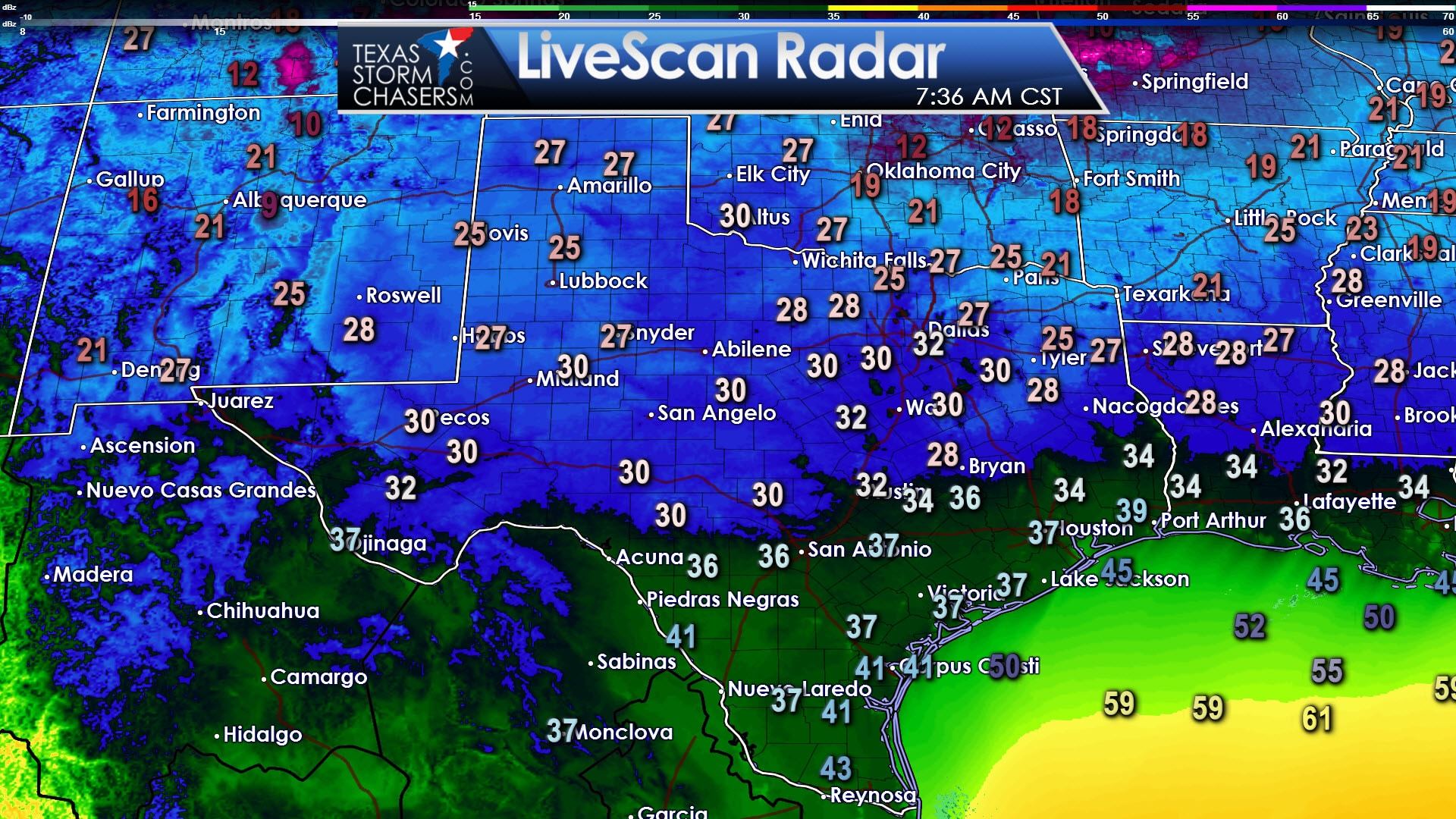
Patchy upper level clouds helped keep temperatures a tad warmer overnight than what we might have seen otherwise. Regardless it was still a chilly night with the freezing line making it south into the Hill Country east into the Brazos Valley and East Texas. Where clouds have rolled in we’ve seen temperatures warm a few degrees this morning.
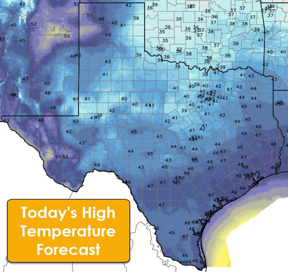
Temperatures will struggle to make much headway against the cold air today, but we will see warmer readings compared to Thursday. Highs will range from the upper 30s in Northwest Texas into the 40s across the rest of Texas. We’ll see a lower 50 degree reading or two in the western Texas Panhandle as southerly winds begin to pick up this afternoon. It’ll be a cold day with wind chill values a couple degrees below the actual air temperature.
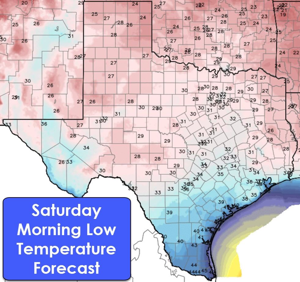
Saturday morning will be chilly once again with temperatures falling into the 20s and 30s across much of Texas. The Rio Grande Valley will be an exception with mid 40s expected. As we like to emphasise during colder weather please make sure you have your outdoor sprinklers deactivated and bring your pets indoors!
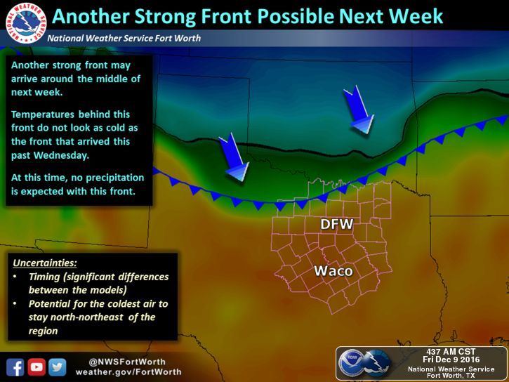
A rapid warm up will commence this weekend as warm air advection, in the form of southerly winds, helps bring temperatures back to and above average for December. Saturday’s high temperatures will range from the upper 40s to the middle 60s. By Sunday high temperatures across Texas should range from the upper 60s to the lower 80s. For comparison the high temperature forecast on Sunday is about 25 to 40 degrees higher than what we experienced yesterday and again today. That is indeed a rapid warm up. A weak cool front on Monday could help knock temperatures down a few degrees in the Texas Panhandle east into Texoma. Another more potent cold front should arrive on Tuesday into Wednesday. At this point there are uncertainties on how strong the airmass behind Tuesday’s front will be. At this time it looks less potent than this week’s front.
Light showers are possible Saturday Night through Sunday and early Monday along and east of Interstate 35. The best chance for scattered showers will be on Sunday in Northeast Texas, East Texas, into parts of Southeast Texas. Coverage should remain below 50 percent and rain amounts will be light. A spot or two could pick up a quarter inch of rain, but this will be a light precipitation event. Not everyone will see rain nor are we expecting anything remotely intense.


0 Comments