
We’re a state divided by a cold front this Thursday morning. Those north of the cold front are experiencing chilly temperatures and likely a rather cold rain. Those south of the front is muggy and warm, but not for much longer. The cold front extends from near Alpine to Junction to College Station to Jasper. As the day goes on, the cold front will continue to push south. We’ll see the southward movement accelerate by tonight. The cold front will be pushing off the Texas Coast and south of the Rio Grande by Thursday morning.
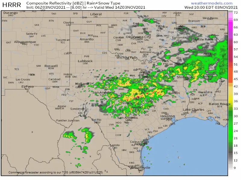
Simulated weather model radar this morning through Thursday afternoon.
Showers and thunderstorms are likely today across the southeastern half of Texas. Some rain may be heavy at times. Severe thunderstorms are not expected but don’t be surprised if storms produce pea size hail. Activity will continue tonight as a cold front continues to push south. Rain chances will increase across South Texas, Coastal Plains, and Southeast Texas through Thursday morning. We’ll shut off rain chances by tomorrow afternoon – with several days of dry weather to follow.
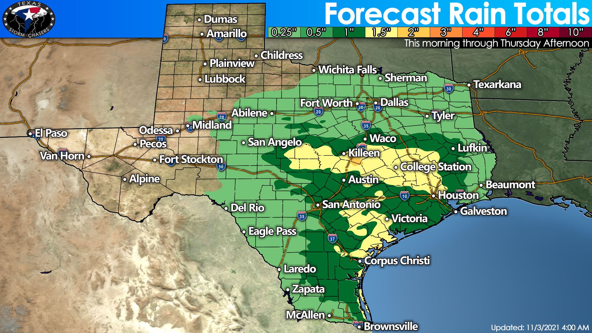
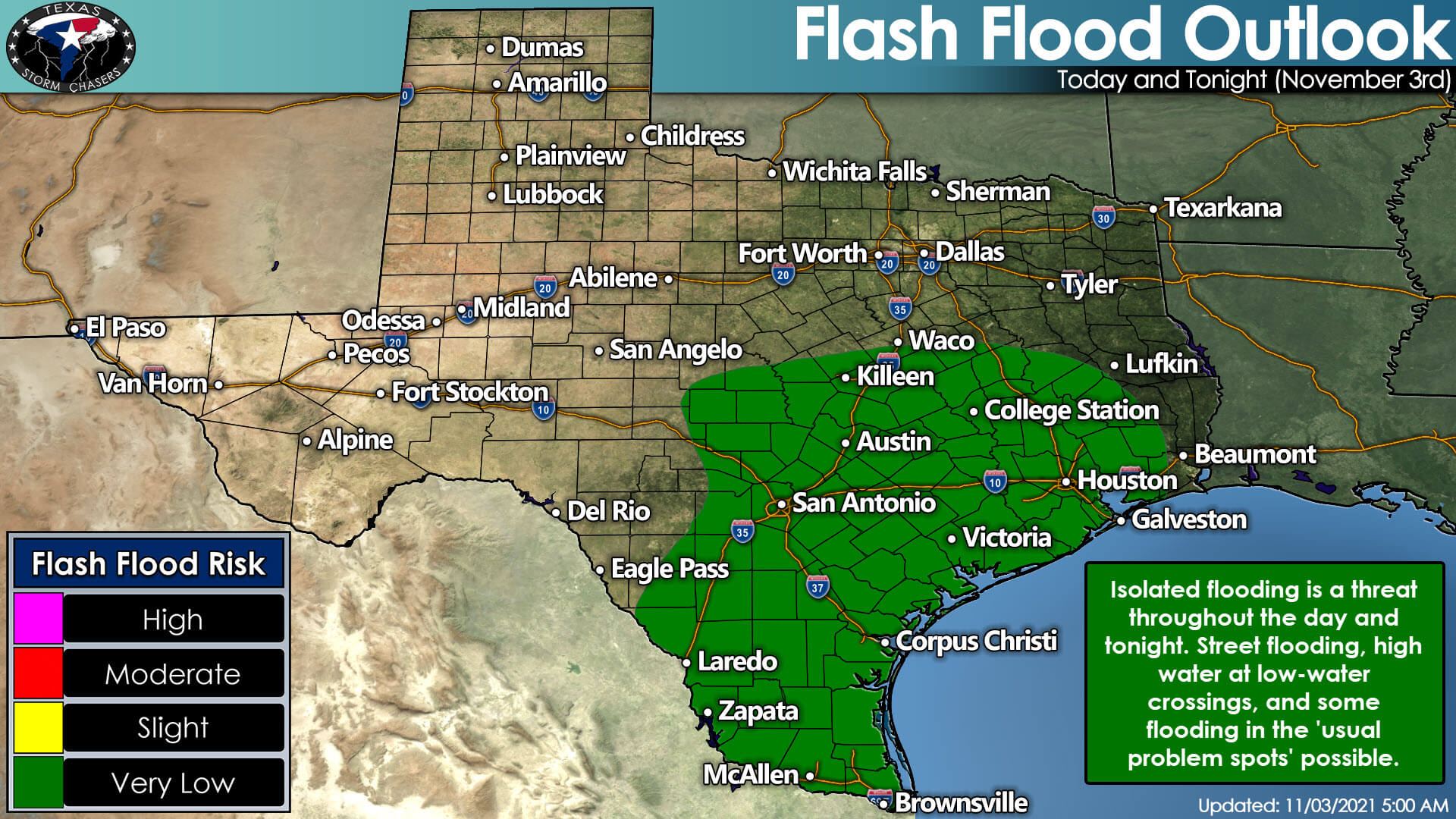
Isolated flooding is possible through Thursday morning across Central Texas, the Hill Country, South Texas, the Brazos Valley, Southeast Texas, and the Rio Grande Valley. We’re not talking about major, widespread flooding. The typical low-water crossing troublespots, construction zones on roadways, and some creeks may experience high water. One to two inches of rain is forecast to fall from the Hill Country and Central Texas south to Corpus Christi and Galveston. Folks across the northwestern half of Texas will not see much more rainfall in the bucket from this event.
Chilly overnight temperatures, but a picture-perfect weekend is ahead
Click the animation for a larger version.
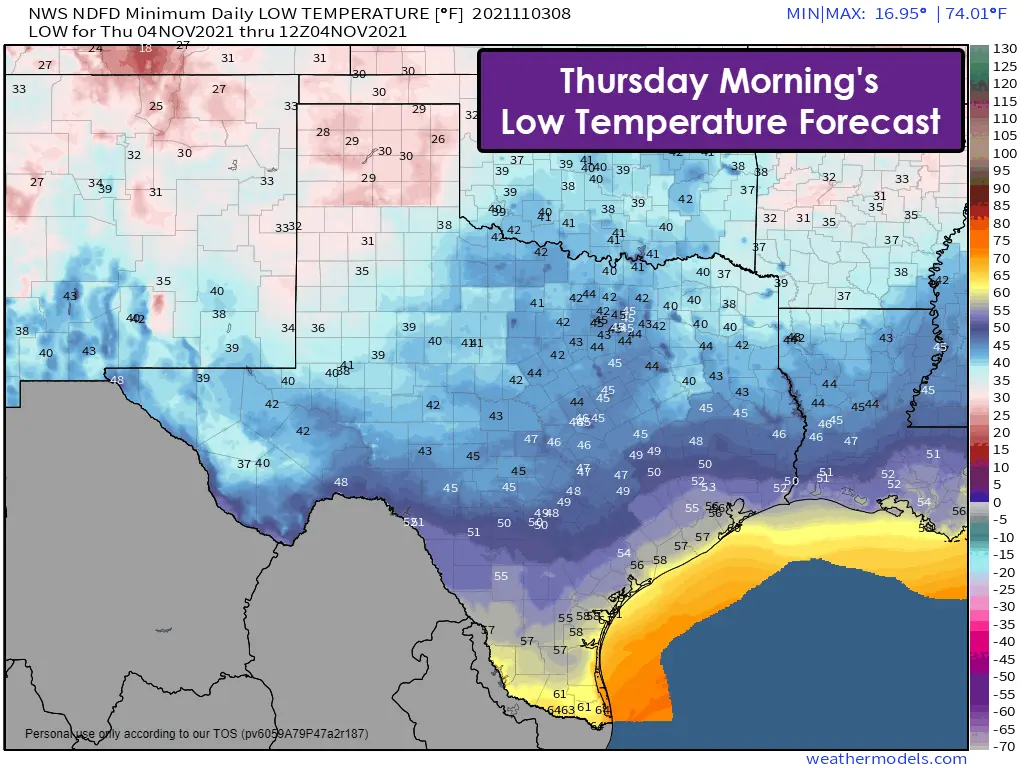
Much cooler air will filter in behind a cold front today and tonight. By Thursday, the front will have pushed through the entire state of Texas. Northerly winds and a dry airmass will also envelop the state. For most folks, overnight low temperatures will fall into the 30s and 40s (on the coldest nights). The Texas Panhandle will see temperatures down into the 20s, while the Rio Grande Valley may struggle to fall below 60 degrees.
Sunny skies, low humidity, and downright beautiful weather are forecast across Texas this weekend. We’ll see temperatures back up to average – and above it for daytime high temperatures. Frankly, this weekend is prime-time weather for outdoor events and plans. I am jealous I don’t have plans to spend this weekend at one of many of our State Parks. The beautiful weather will make up for the ongoing dreariness.


0 Comments