
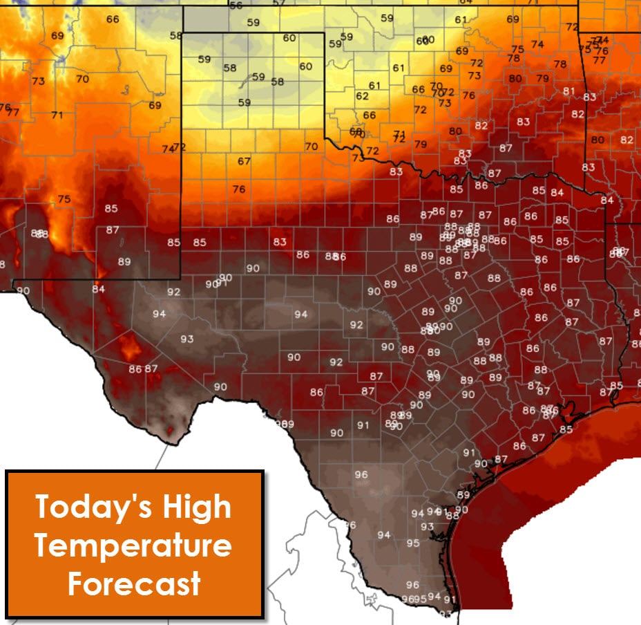
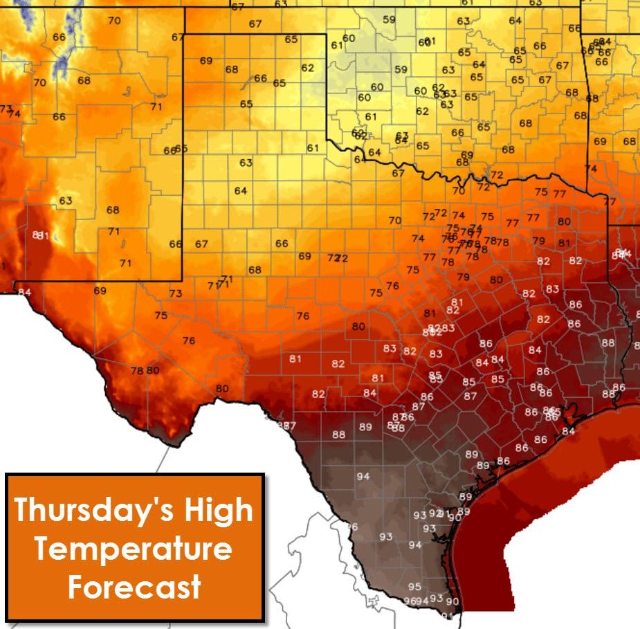
A cool front will sag south into parts of Texas today. This front will slow by tonight and become stationary. The cool front should be able to make it into the Permian Basin, Big Country, and North Texas before becoming stationary. Temperatures today will be comparatively cooler north of the front today compared to the last few days. The Panhandle will not get out of the upper 50s. As the front sags south this afternoon we may see high temperatures occur during the morning hours in parts of West Texas and Northwest Texas. Once the front passes a given location winds will become northerly and temperatures will drop off into the 60s and 70s. Conditions south of the front will be warm to downright hot for mid-October with middle 80s and middle 90s. Deep South Texas and the Rio Grande Valley look to top out in the middle to upper 90s.
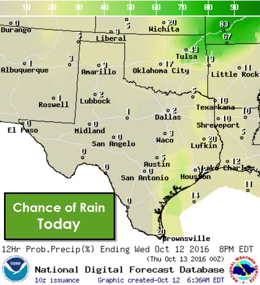
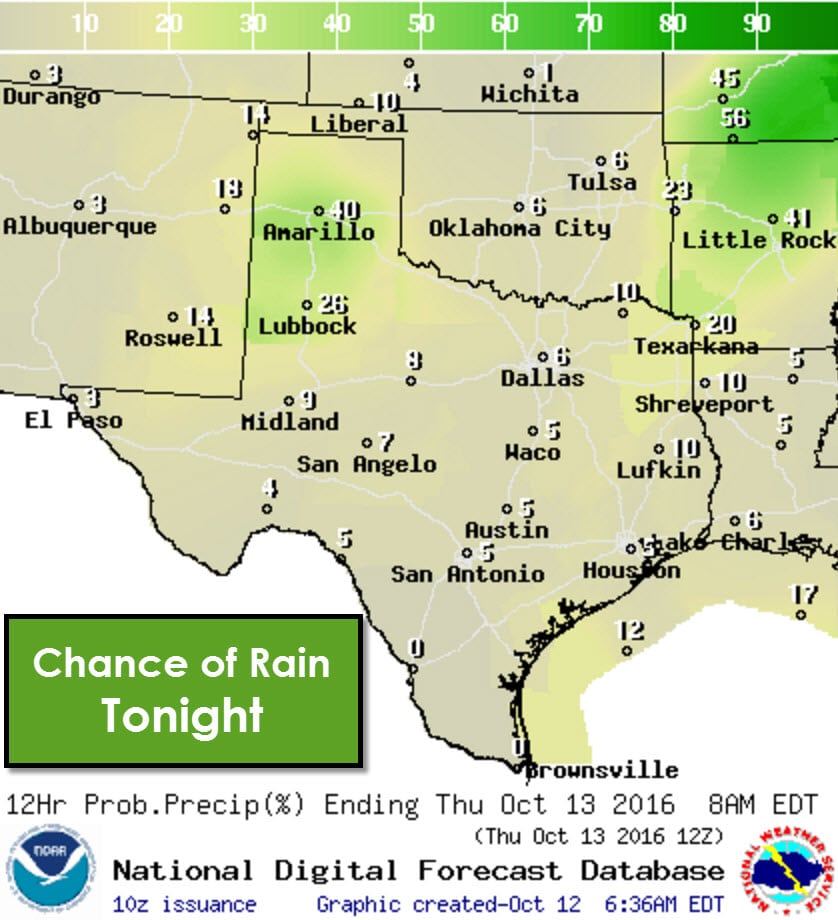
Isolated showers are expected during the day along the Middle Texas Coast inland into Southeast Texas and East Texas. Overall coverage of convection should remain low today. Isolated to scattered showers should develop tonight across the Texas Panhandle and West Texas. Atmospheric instablity amounts will be meager – so only isolated thunder is expected. With surface temperatures falling into the upper 30s in the Panhandle tonight it is worth mentioning that winter weather precipitation (sleet/snow) is not expected.
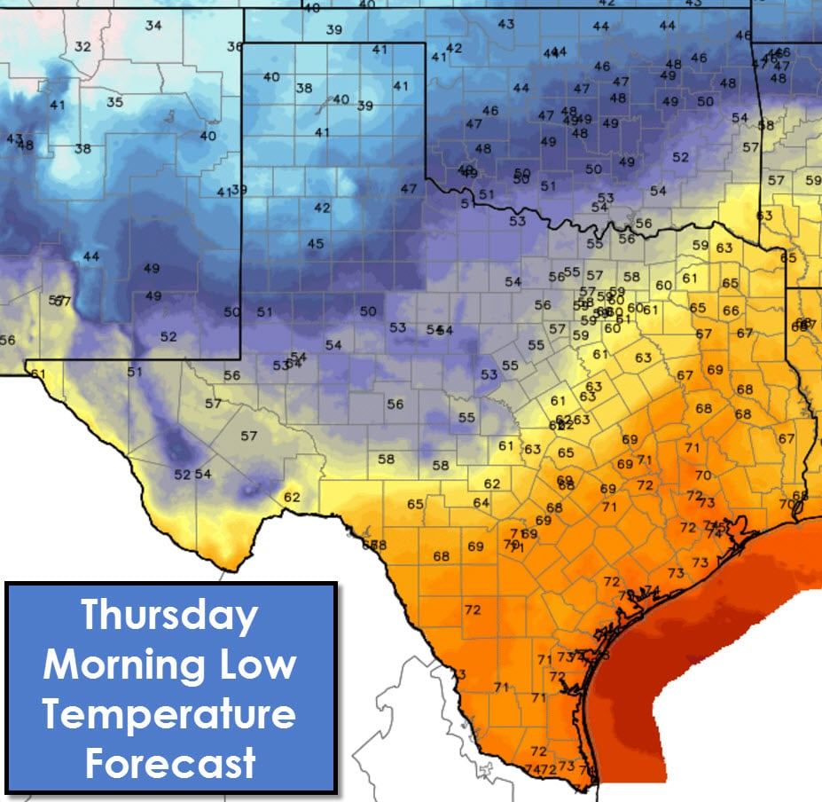
Temperatures tonight and by sunrise Thursday will be quite pleasant across the northwest half of Texas. The cool front will be nearly stationary by Thursday morning across the Big Country into North Texas. Temperatures north of the front will drop into the 40s and 50s. Parts of the Panhandle will likely fall into the upper 30s tonight. The southeast half of Texas will remain in the warm and humid airmass. Fog is a good bet in some locations Thursday morning with lows only in the upper 60s to mid 70s.
Rain chances increase on Thursday into Friday from the Texas Panhandle and West Texas east into Northwest Texas, North Texas, the Big Country, Northeast Texas, into East Texas. The highest rain chances will be in proximity of the Red River where a warm front will be moving north into Oklahoma. Some folks along and within 50 miles of the Red River in Texoma and Northeast Texas could pick up an inch to inch and a half of rain through Friday. Severe weather is not expected and rain amounts are low enough to prevent flooding issues.
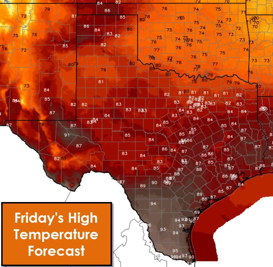
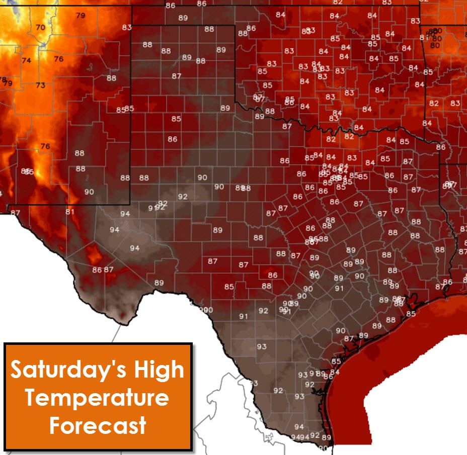
The cool front moving south today will become stationary on Thursday. That stationary front will begin to move north as a warm front on Friday. By Saturday all of Texas will be back in above-average temperatures. Warm weather looks to continue into the weekend and next week. Temperatures will likely top out in the 80s and 90s during the afternoons. Several days of southerly winds will bring in humid conditions. Fans of the warmer weather will be happy with the upcoming forecast. Hopefully we can get a strong cold front down our way in the 7-10 day timeframe.

0 Comments