
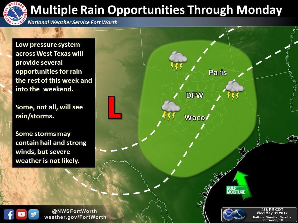
Chances for widespread pop-up showers and thunderstorms will continue for Thursday as a slow moving upper level system continues to spin over the desert southwest. This pattern is pretty typical for what we see in early summer when our upper level winds become more tame and we begin to see storms pop up each afternoon primarily as the result of daytime heating and increasing moisture. Lift from the upper level low moving into western Texas tomorrow will be minimal over the next couple of days, but it may be enough to spark a few stronger storms tomorrow. Not everyone will see storms and we’re not expecting a widespread swath of rain across the area, but any storms that develop will be slow moving and have the potential to dump quite a bit of rain in a relatively short amount of time. Best target area for marginally severe storms tomorrow will be across the northern half of the state along a stalled frontal boundary, and these storms will carry the threat for isolated downburst winds and small hail. Lightning is also a danger with these afternoon pop-ups as they can be so random and develop quite rapidly. With so many out of school and enjoying various camps and other outdoor activities, it’s a good time to remind everyone that whenever you hear thunder, it’s time to head indoors and seek shelter.
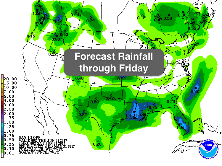
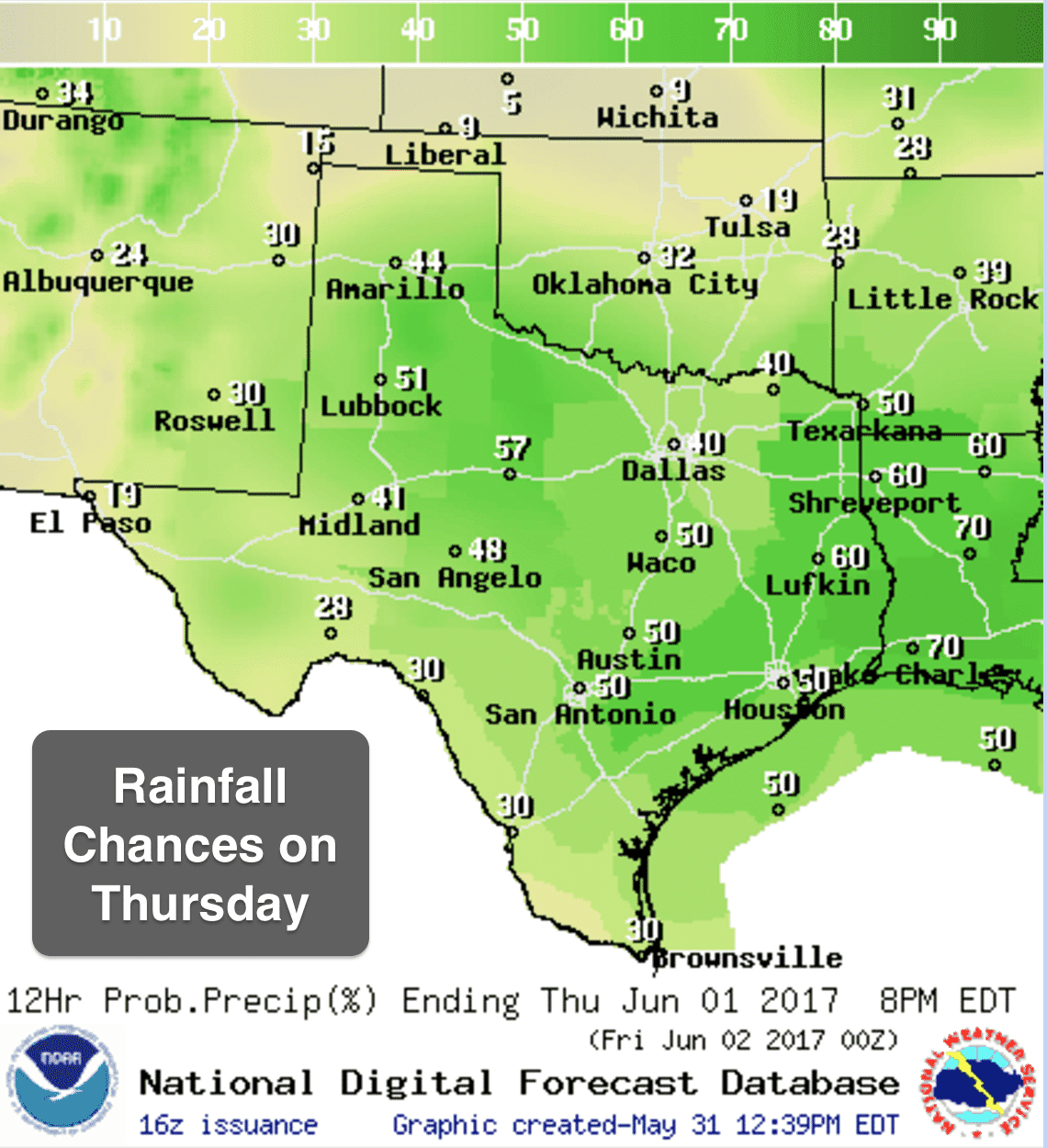
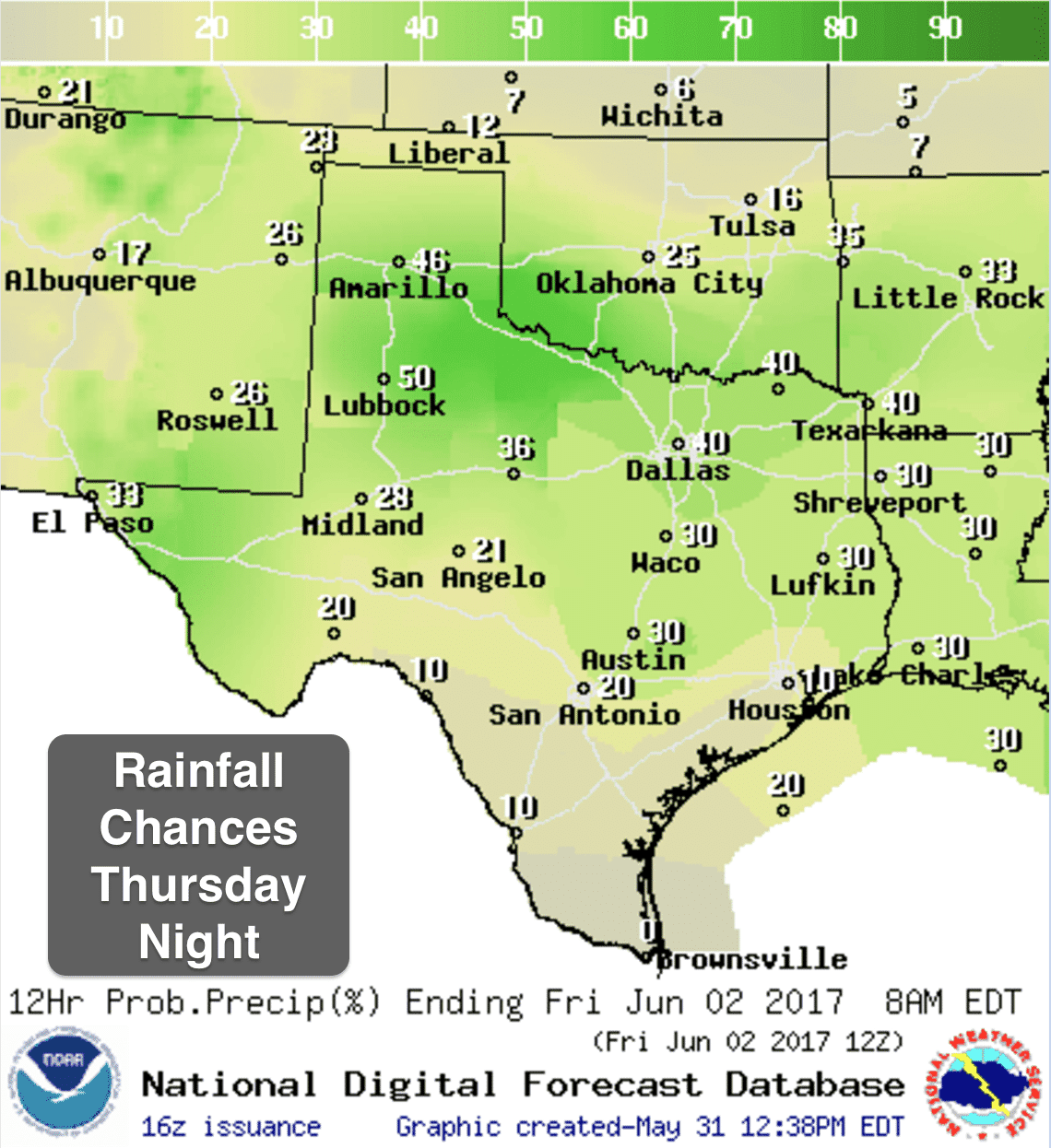
Here’s a look at the currently forecasted chances for precipitation Thursday and Thursday night. Keep in mind these graphics probably makes it look like everyone will get some rain, but that’s not going to happen. Storms will be scattered across all of the state and will be very hit or miss when it comes to a good dousing of rain. If Mother Nature decides to water your lawn or garden tomorrow, count yourself lucky! Most favored locations for greater precipitation totals tomorrow and Friday looks to be across portions of western north Texas, Northwest Texas, southern panhandle/rolling plains, the Permian Basin/Trans Pecos regions…and across portions of southeast Texas. That boils down to folks north of the DFW metroplex, Wichita Falls, Childress and over to Lubbock down to the Midland/Odessa, Ft. Stockton and then over into the Houston/Beaumont region receiving the more abundant rainfall over the next couple of days. While most of the state is not technically under drought conditions, it has been a pretty dry May for Texas overall, and we will need whatever rainfall we can get now to help sustain us through the hot dry summer months ahead.


0 Comments