
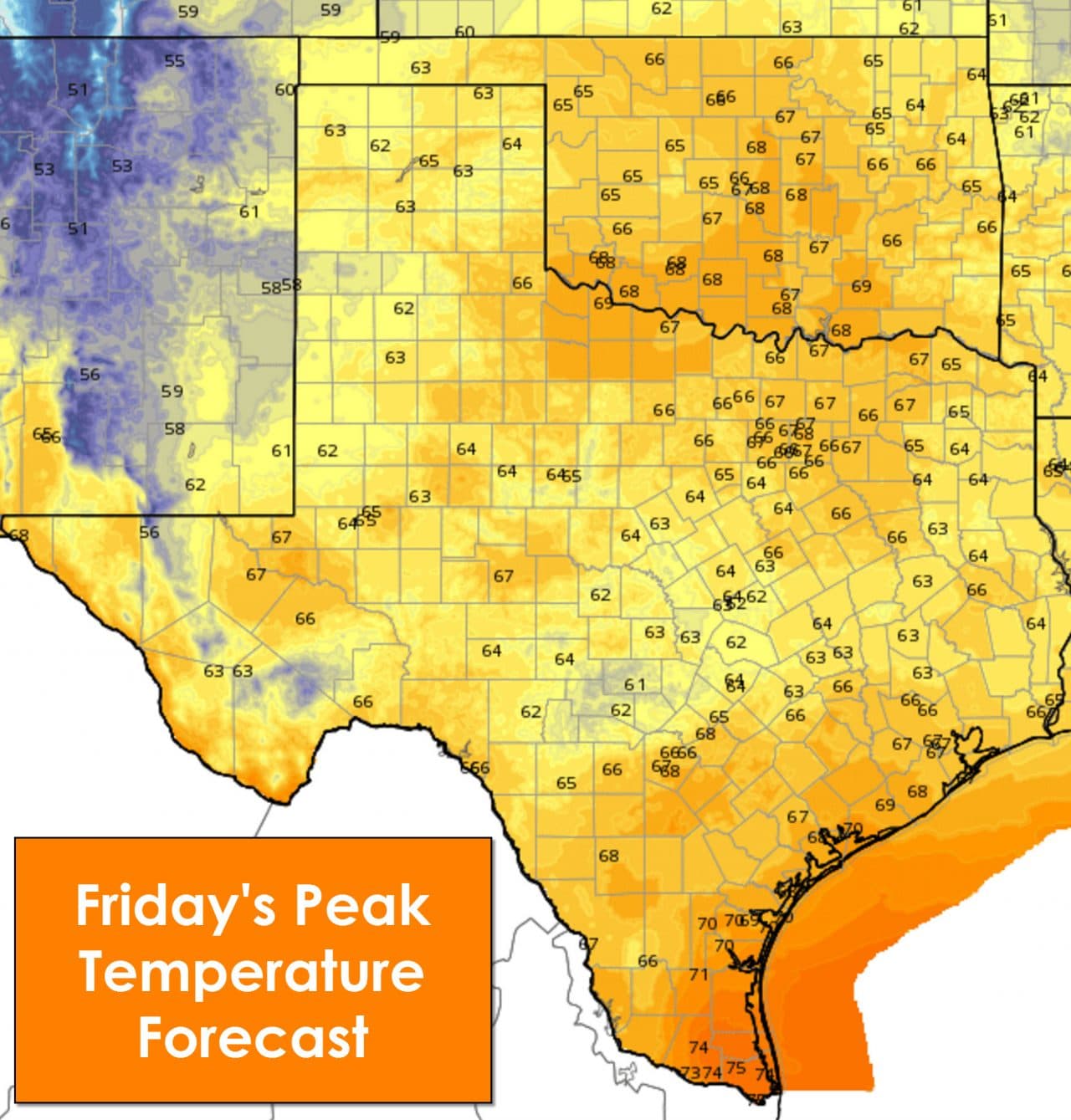
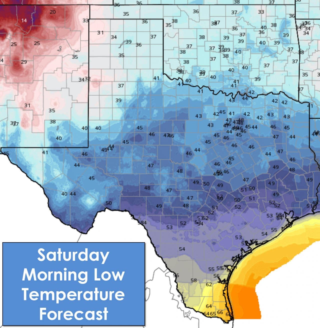
Seasonal temperatures are forecast today and into the weekend across Texas. Things will be a tad on the cool side especially in areas that have more clouds this weekend. We’re not expecting anything unusual temperature-wise through Sunday for November. Increasing moisture will create warm/humid conditions Sunday Night into Monday.
Today and tonight will be dry across Texas. Most of Saturday will be dry as well but changes will be on the horizon. A few light sprinkles or showers could occur during the late afternoon hours on Saturday across the Concho Valley and Rio Grande Valley. Moisture content in the atmosphere will be modest so any rain that develops should be light. The same limited moisture will continue Saturday Night but we could see a few light showers spread into more of Texas including the Interstate 35 corridor. Light showers will expand in coverage across the western two-thirds of Texas during the day Sunday. Again most rain amounts will remain light during the day but we’ll probably see more showers. Finally by Sunday Night scattered to numerous showers and thunderstorms are expected across the Concho Valley, Big Country, North Texas, and Northeast Texas. Its by Sunday Night we should see increasing moisture and the chance for a few heavier storms. Storm chances and the potential for heavy rain really ramp up later on Monday, Monday Night, and Tuesday during which a busy weather period is expected.
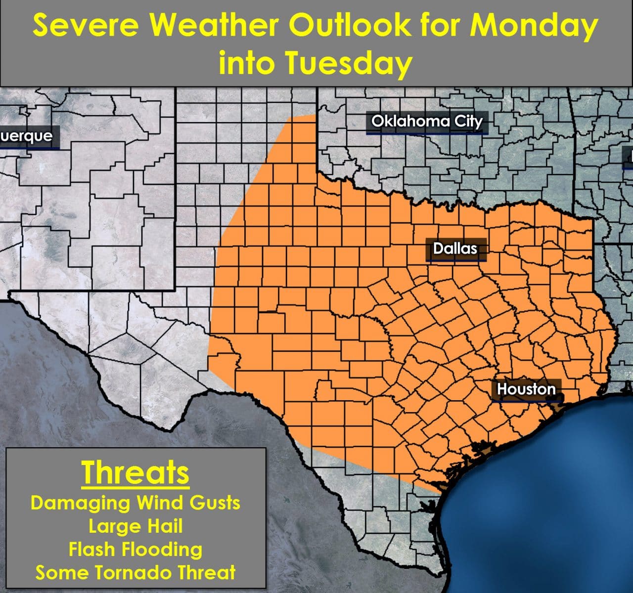
A potent upper level storm system will bring a variety of impacts to Texas beginning Monday. Those impacts will continue Monday Night into Tuesday. We won’t have any cold front to impede moisture return through that period. I expect quite a bit of moisture to be in place ahead of the potent system on Monday. The result will be a moisture-rich atmosphere which will support heavy rain and severe thunderstorms. We’re still several days out but models are indicating very strong wind shear in combination with an unstable airmass. Severe thunderstorms are a distinct threat with large hail, damaging winds, and perhaps a tornado threat on Monday, Monday Night, into Tuesday. This period has the potential to be quite active. I encourage you to check back for forecast updates on this potential severe weather event. 2 to 5 inches of rain will be possible across Northeast Texas and East Texas with some flooding potential. Some light snow is also possible across the Texas Panhandle on Tuesday into early Wednesday. This forecast depends on where the low pressure tracks with any north/south shift resulting in forecast changes. We’ll keep you updated as we approach this active weather period.


0 Comments