
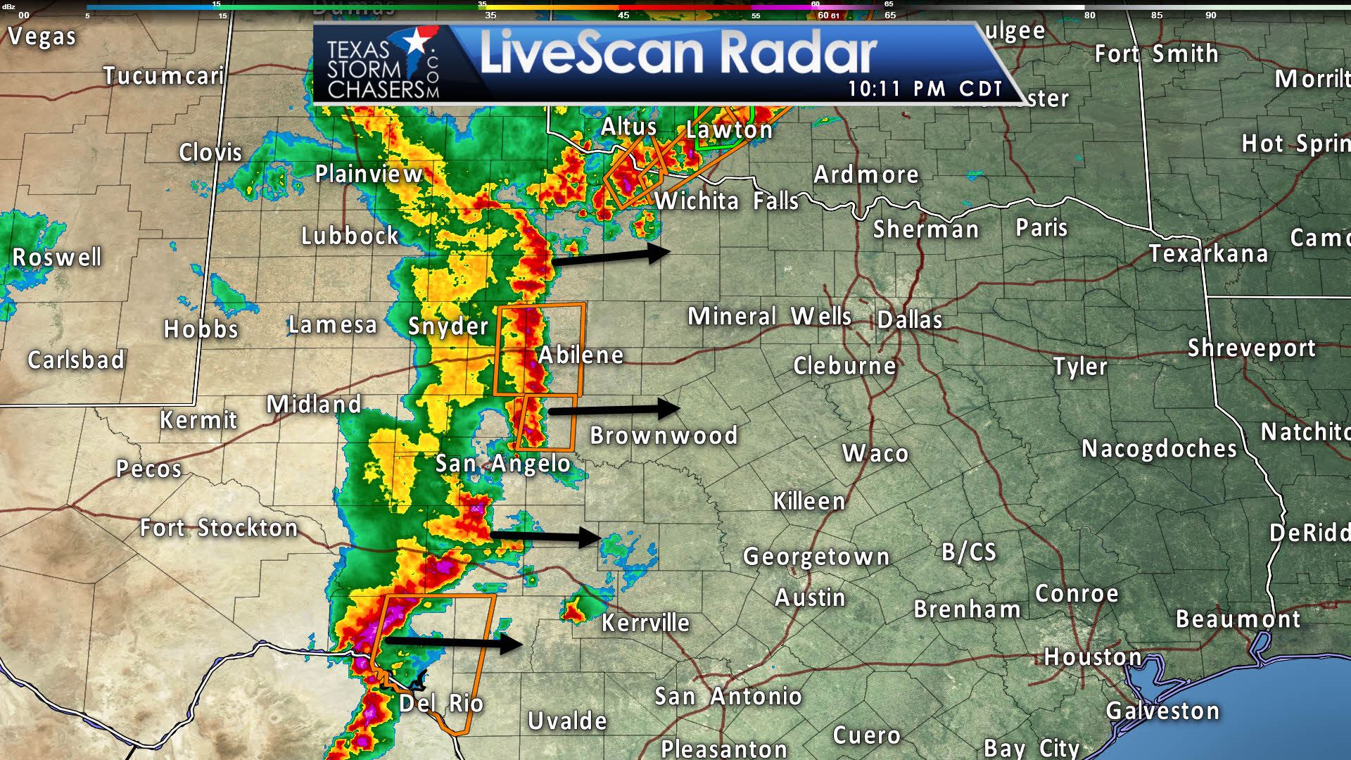
We now have a nearly solid line of thunderstorms extending from Vernon south to Abilene to Sonora to west of Del Rio. Looks like San Angelo ended up in one of the line’s breaks, so I’ll go ahead and apologize for the lack of rainfall there. The line is moving east at 30 to 45 MPH. Some portions of this line currently severe with damaging straight-line winds over 60 MPH and hail up to the size of ping-pong balls. We expect the eastward progression to continue into the late night hours – along with some risk of severe weather.

We have a severe thunderstorm watch in effect through 4 AM along and west of Interstate 35 from San Antonio north through Dallas up to Sherman. Locations west of that watch line and along and east of the squall line are in the severe watch. This watch did replace the tornado watch previously in effect for this afternoon’s storms. The strongest sections of the squall line could produce damaging straight-line winds up to 70 MPH along with hail up to the size of ping-pong balls. Brief tornadoes and localized flooding are secondary concerns.
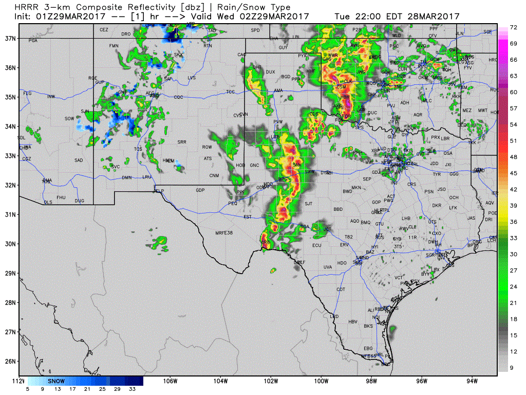
Here’s a simulated radar loop through the night from the High Resolution Rapid Refresh. It has the squall line approaching Interstate 35 from San Antonio to Dallas between 2 AM and 5 AM. Some parts of the line may be producing damaging straight-line winds and some ‘coin’ size hail. A brief tornado can’t be ruled out, but the primary tornado threat was earlier on when storms were discrete. Remember – have a way to receive severe weather warnings overnight. We’ll be here to keep an eye on things.


0 Comments