
December 2021 will easily go down as the hottest December on record for Texas. Winter has been a no-show so far. All that will change this weekend for Texas, although the cold snap will be short-lived. Temperatures will remain thirty to fifty degrees above those experienced this past February.
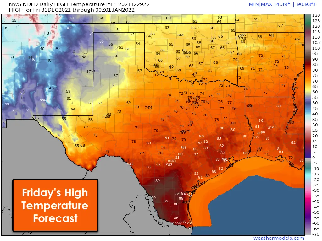
New Years Eve Weather Forecast
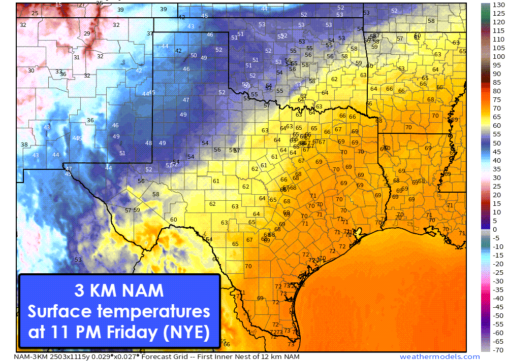
A warm New Years’ Eve is forecast for most of Texas. Temperatures around 11 PM Friday are expected to be in the 60s and 70s across the southeastern two-thirds of Texas. Temperatures across West Texas and in the Panhandle will be cooler, with temperatures in the 40s and 50s. Light rain may put a damper on outdoor plans across Western Texas, Texoma, North Texas, and Northeast Texas. There is the possibility of thunderstorms in North Texas and Northeast Texas late Friday evening and Saturday morning.
Severe Storm Chances New Years Eve Night into New Years Day
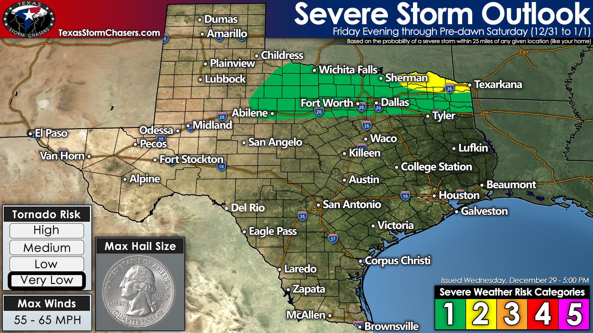
Isolated severe thunderstorms are possible late Friday night and Saturday morning across Texoma, North Texas, and Northeast Texas. Timing differences amongst weather-model data is making the thunderstorm forecast more difficult. Localized damaging wind gusts and small hail appear to be the primary hazards with stronger storms. A brief tornado can’t be ruled out, especially in Northeast Texas Saturday morning.
Uncertainties revolve around the timing of an upper-level storm system. Even though we’re within three days of the threat, we still see a timing difference of six to eight hours. Earlier solutions would have the chance of storms in North/Northeast Texas around 10 PM Friday. The later solutions would hold off until 5 AM Saturday or even a bit later.
Hopefully, this evening’s upper-air data and weather models can come together on a solution. We’ll be able to get far more specific on timing and threats tomorrow.
Snow possibilities on Saturday
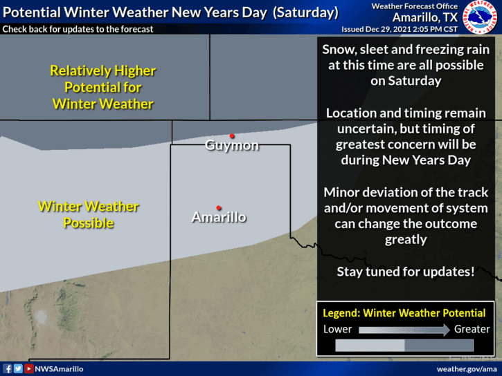
Light winter precipitation is possible on Saturday in the Texas Panhandle. A significant winter storm is possible in Southwest Kansas, extending northeast through Kansas City and Chicago on Saturday and Sunday. If the system were to shift south, we’d see a higher chance of accumulating winter precipitation in the Texas Panhandle on Saturday. As it stands now, perhaps a dusting of snow in places like Amarillo with one to two inches of wet snow in Dalhart east to Perryton. That will change over the next three days, so don’t take it to the bank.
Weekend Temperature Forecast
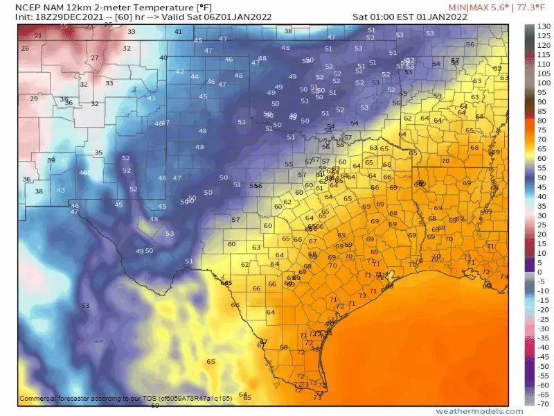
Crashy the cold front will bring a quick end to above-average temperatures in Texas on Saturday. The front will quickly progress south throughout the day. Temperatures will quickly drop twenty to thirty degrees within an hour of the frontal passage at your location. High temperatures will be shortly before the front arrives at your location, whether at 4 AM or 1 PM Saturday.
Gusty north winds will result in wind chills falling into the ‘heavy coat’ category in a hurry. The colder temperatures’ impact on animals and humans will be exacerbated by the record warm December.
Temperatures Saturday night will fall into the teens and twenties across the northern half of Texas. Single-digit temperatures with wind chills in the negative single digits are likely in the Texas Panhandle. Single-digit wind chills are likely into the Permian Basin, Big Country, and North Texas.
Temperatures will climb into the 30s, 40s, and 50s on Sunday – not too abnormal for a typical winter cooldown, but a significant change from our otherwise toasty December. We’ll see a freeze across all of Texas by Monday morning, except for the Rio Grande Valley. We’ll quickly climb the temperature rollercoaster starting Monday and Tuesday – with above-average temperatures back in place by mid-week. Another strong cold front may visit our little corner of the world late next week.


0 Comments