
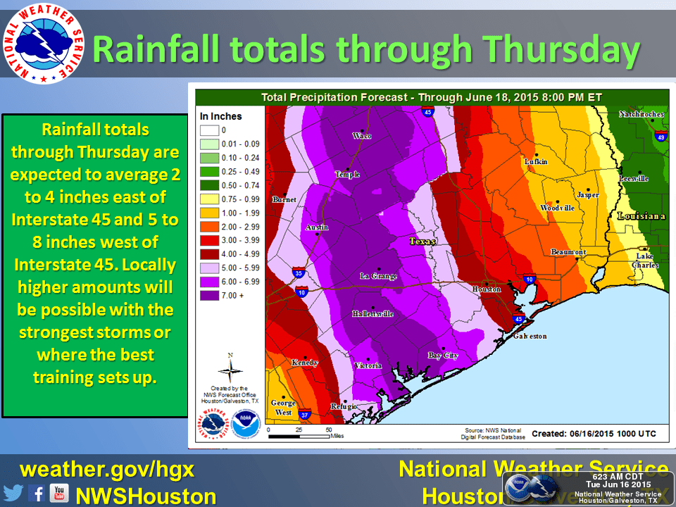
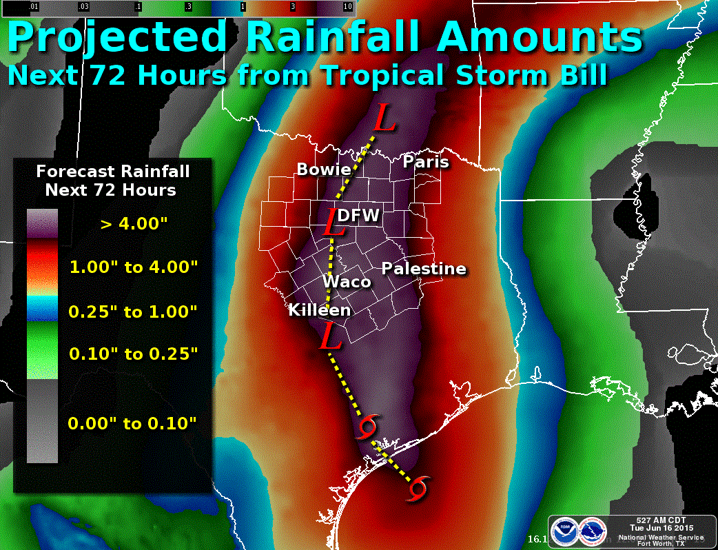
Tropical Storm Bill has finally made landfall at 11:45 on Matagorda Island (near the Seadrift area) with maximum sustained winds near 60mph with gusts near 70mph. The remnants of Tropical Storm Bill will continue to move west/northwest at about 9mph before taking a turn more to the north/northeast later today. As we’ve been posting for several days now, very heavy rain and major…possibly historic…flooding is likely with this system as it impacts portions of the state over the next 24 to 48 hours. For residents in coastal and south central Texas mainly west of the I-45 corridor and east of the I-35 corridor, some could see rainfall totals exceeding 8 inches over the next 24 hours. As this system is expected to track along or just west of I-35 today and overnight, residents in central and north central Texas will also need to prepare for very heavy rain and the potential for high-impact flooding. Rainfall totals across central and north Texas are slightly less than what’s forecasted for coastal and inland regions, but still significant as our lakes and rivers remain above capacity from May’s rain events. In addition to flooding, we also have the threat for tropical funnels/tornadoes as we get into the afternoon and evening/overnight hours. Tropical induced tornadoes are typically not as strong or long-lived as the tornadoes that we usually see and are the result of severe thunderstorms (i.e. “supercells”); however, they can still be dangerous and can bring the threat of roof/tree damage along with flying debris and other mayhem. We will continue to monitor the system throughout the day and overnight and keep you up to date on the latest developments!


0 Comments