
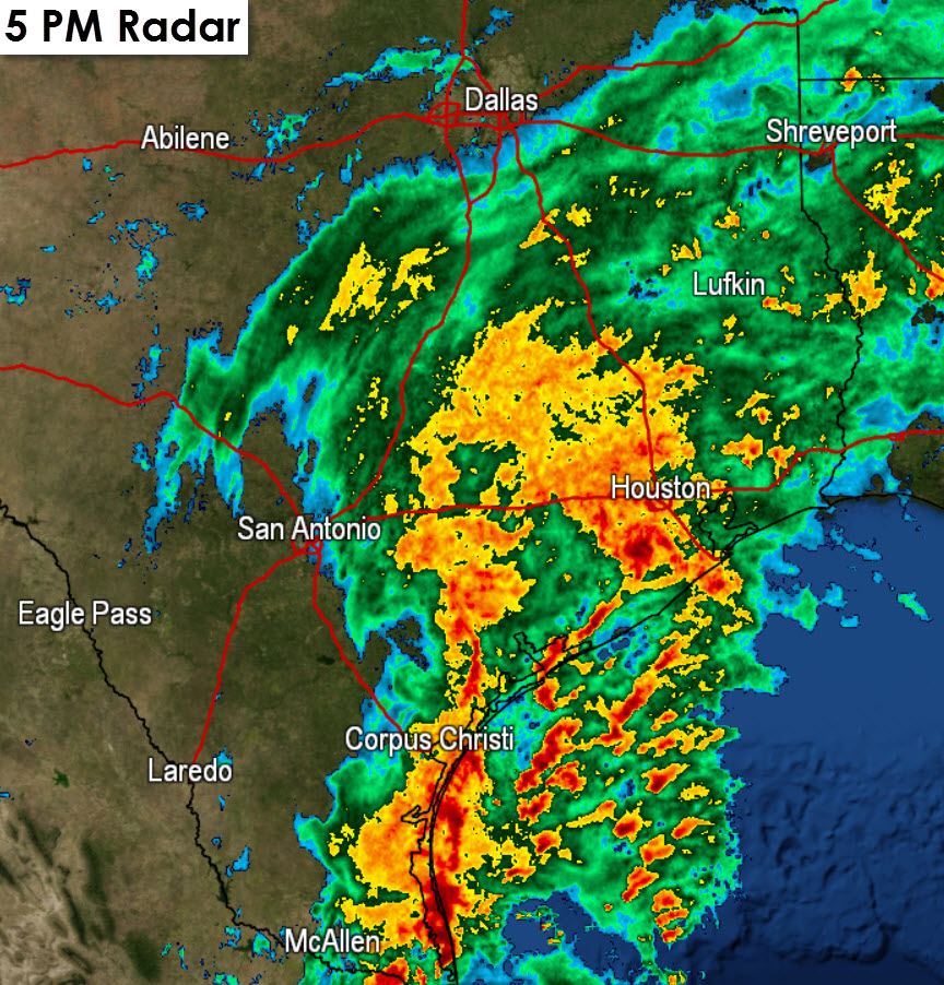
The heavy rain event for most of Deep South Texas and the Rio Grande Valley is in the process of concluding with rain moving offshore. The flooding threat for North Texas and most of Central Texas has concluded although light rain will continue into the evening. Our attention and focus now moves to the Coastal Plains and Southeast Texas where heavy rain and flooding is possible into the overnight hours. In addition isolated tornadoes will remain a threat along the coastline in Southeast Texas and just inland.
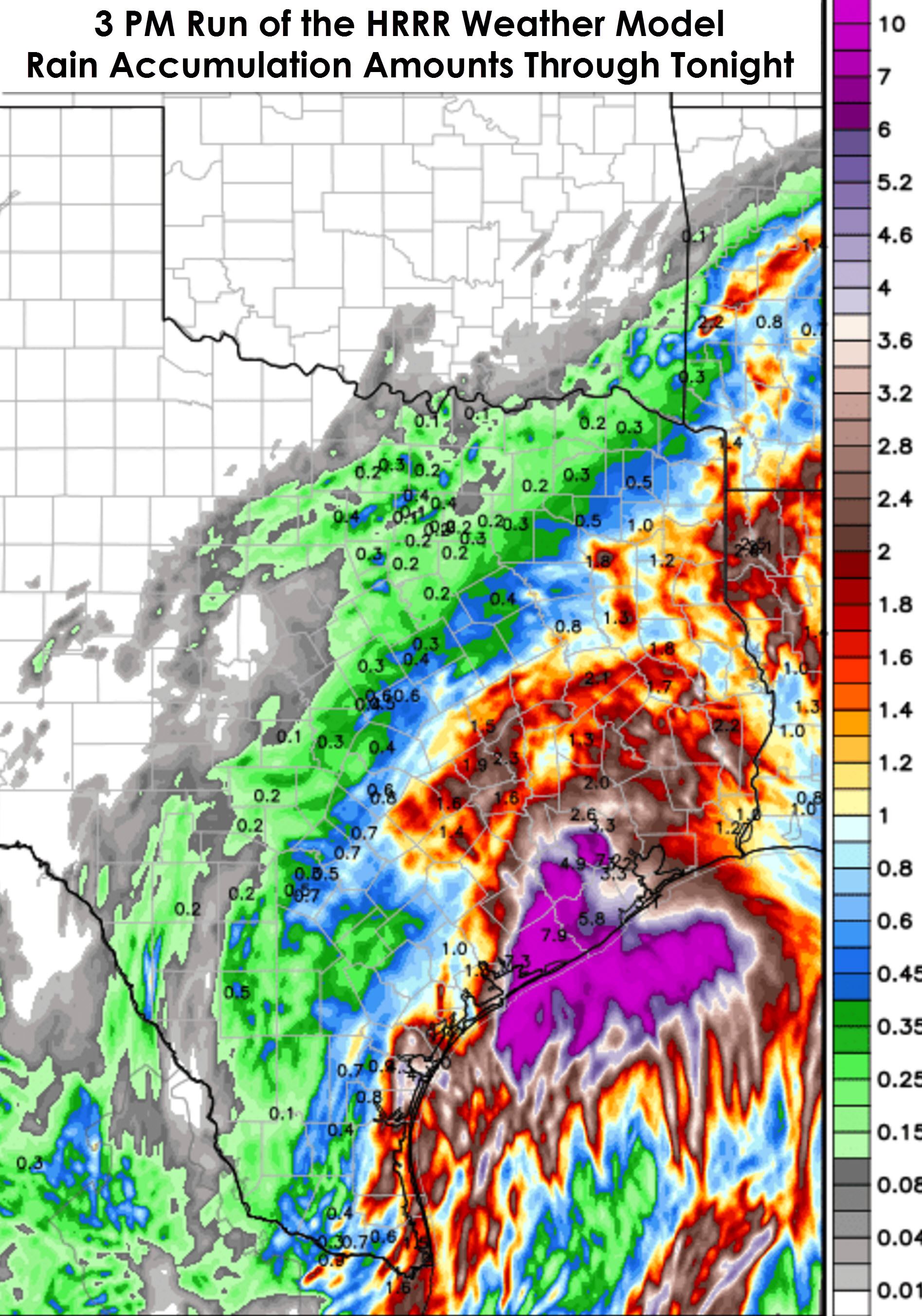
The 3 PM hourly run of the High Resolution Rapid Refresh (HRRR) weather model shows the heaviest rain falling near the coast in Southeast Texas and out in the Gulf of Mexico. The track of the low pressure responsible for all the rain in the southern half of Texas today is key in determining where the heaviest rains set up. The HRRR has the low taking a slightly more offshore path which would keep the heaviest/prolific rains closer to the coast and partially out in the Gulf. We’ll see where the low sets up shop and how far inland the ridiculously heavy rains get. I do note this run of the HRRR does have 4 to 8 inches of rain falling across the southern Houston metro to the coast. Should that occur flash flooding will be a real problem this evening and overnight in Houston. The model shows widespread 1 to 2 inch rain totals across most of Southeast Texas with heavier rain producing 3 to 10 inches of rain closer to the coast and out in the Gulf.
Heavy rain will begin to move east of Southeast Texas on Sunday morning. Pockets of rain will continue into the afternoon hours on Sunday across parts of East and Southeast Texas.


0 Comments