
Texas is one day away from experiencing a generational event – a total solar eclipse. After tomorrow, we won’t have another one in our part of the United States until 2044 and 2078. For most of Texas, cloud cover will prevent direct event viewing. However, there have been some encouraging trends regarding cloud cover for portions of North and Northeast Texas.
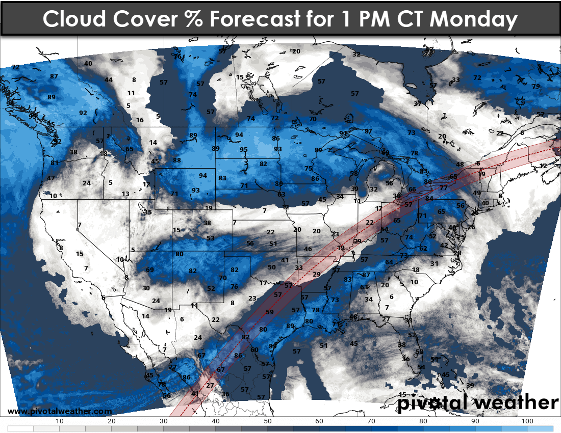
We’re in the range of high-resolution weather model data. Some of that data suggests we may have a window of opportunity around the time of the total eclipse in proximity to Interstate 30 in the D/FW Metroplex into portions of Northeast Texas. Unfortunately, those from the Edwards Plateau, Hill Country, Central Texas, and North Texas south of Interstate 20 look to be socked in with low-level clouds.
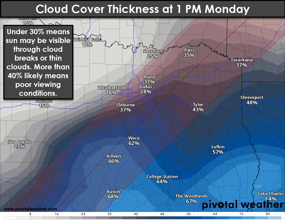
For the Interstate 30 corridor, if we can time things just right, we may be able to break up some of the morning cloud cover to give us a few glances at the sun. There is not enough skill in weather-model data to pinpoint where the breaks in the clouds may be during tomorrow’s four minutes of totality. However, we’re a little more hopeful than yesterday—and hopefully, that trend will continue with today’s weather model guidance.
We’ll have an afternoon video update with new information by 5 PM today. Those with plans to travel to Arkansas, Missouri, Illinois, or areas farther away should still keep them. We’re talking about a ‘last hope’ situation in Texas versus a better chance of clear skies further northeast.
Extreme Wildfire Danger Continues in Western Texas
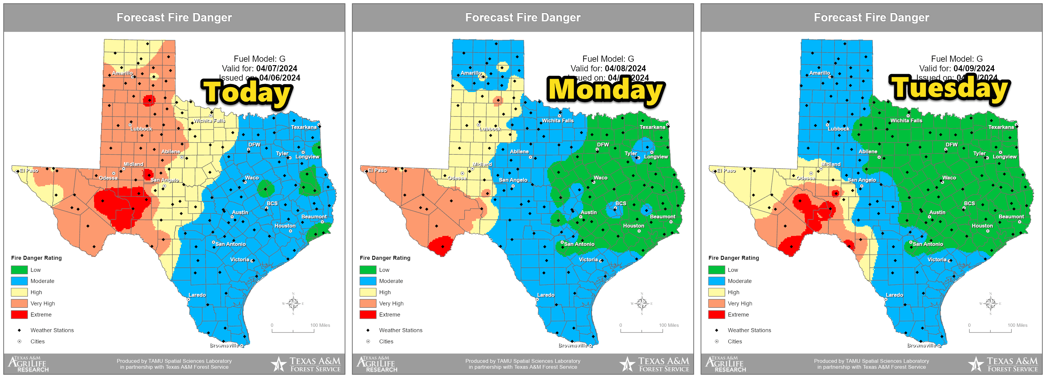
A pacific front has brought a slightly cooler, but significantly drier airmass to the western two-thirds of Texas today. Wind gusts will be less impressive than yesterday, but the airmass will be just as dry. Critical to extreme wildfire danger will continue today for the western half of Texas.
Severe Storms Expected Shortly After Eclipse

Significant weather concerns will start shortly after the eclipse tomorrow afternoon. Scattered severe thunderstorms will begin developing after 3 PM in parts of Central Texas, the Brazos Valley, and East Texas. These storms will generally move northeast. The most intense storms could become supercellular, posing a threat of all modes of severe weather. We’re talking about baseball-sized hail, damaging wind gusts over 70 MPH, and the potential for a few tornadoes with the most intense storms.
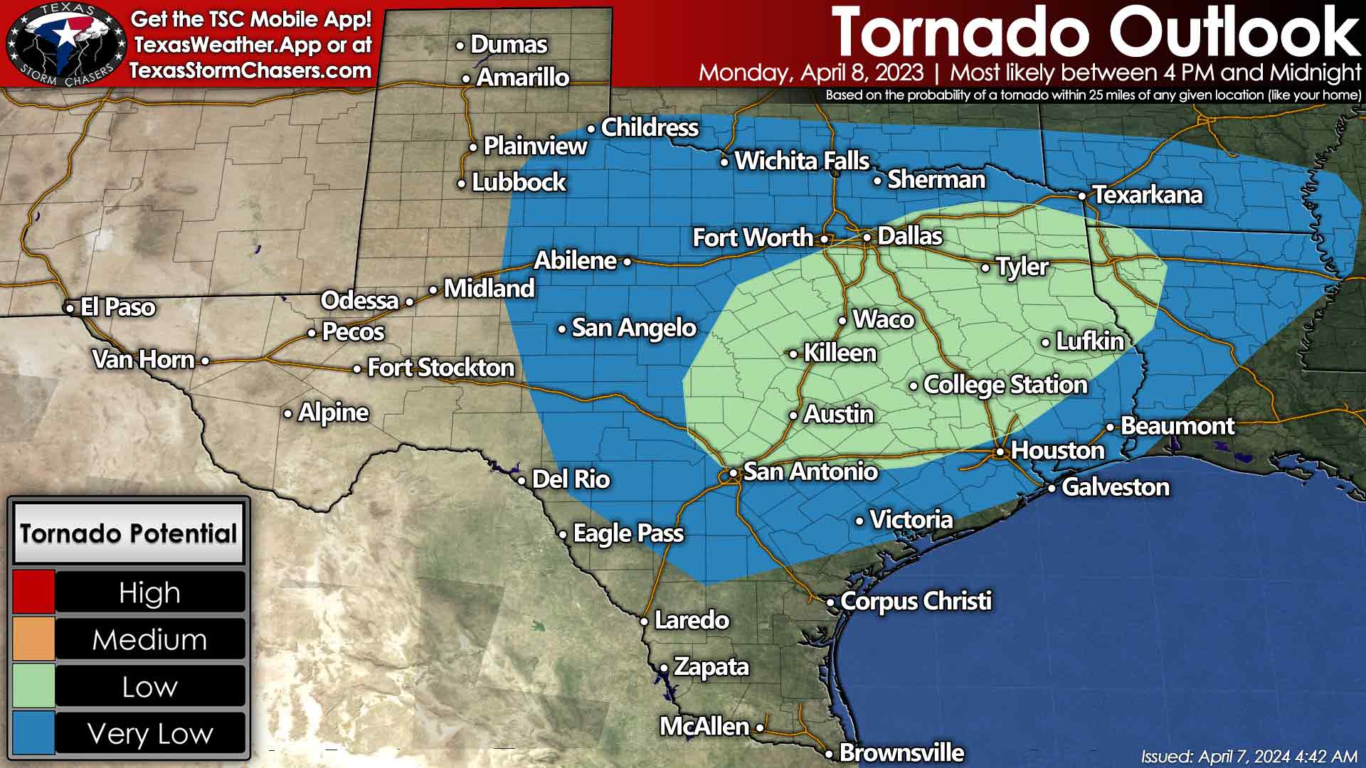
As we move closer to dinner time and into Monday evening, scattered severe storms are also expected to develop and move into Northwest Texas, Texoma, and North Texas. The primary concern with the most intense storms is baseball-size hail, although damaging winds and tornadoes are also possible. Storms will continue into the late-night hours on Monday – with severe weather remaining a threat.
Numerous Storms Again on Tuesday with Severe Weather Threat
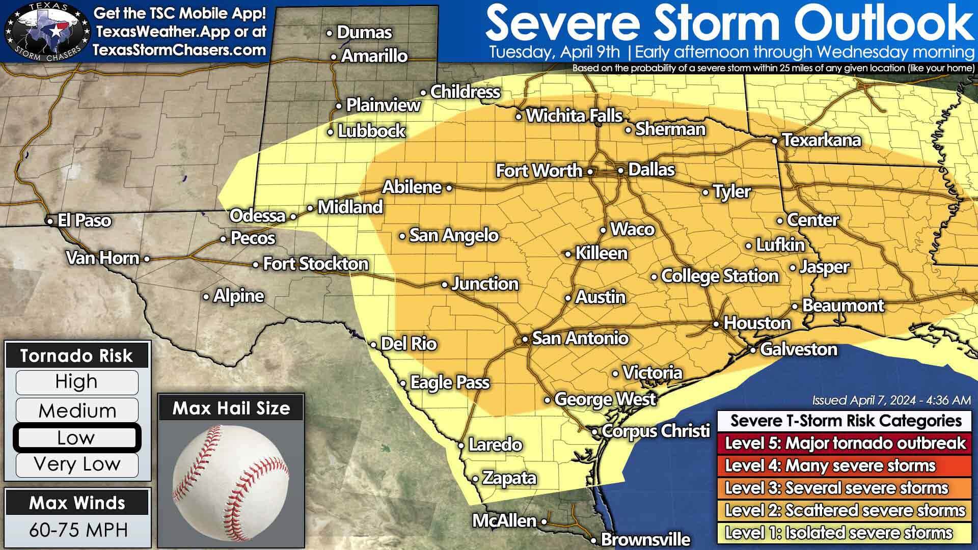
We could see a bit of a lull Tuesday morning before yet another busy severe weather day sets up across Northwest Texas, West-Central Texas, the Permian Basin, Big Country, Concho Valley, Hill Country, Central Texas, North Texas, Texoma, Northeast Texas (Ark-La-Tex), East Texas, and Southeast Texas. Multiple waves of thunderstorms, potentially clusters of storms, are expected to move from west to east across the regions mentioned above. With the most intense storms, large hail, damaging winds, and a tornado threat could exist. We’ll provide more specific information on the threats on Tuesday once we get into tomorrow.
Significant Rainmaker and Flash Flooding Risk
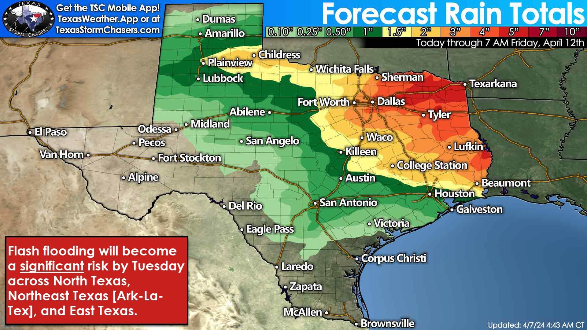
Multiple waves of heavy storms will result in excessive rainfall across portions of Texoma, North Texas, Northeast Texas, the Brazos Valley, East Texas, and Southeast Texas through Wednesday. Three to seven inches of rain are expected in those areas, with locally higher amounts of rain possible. Significant flash flooding concerns could materialize by Tuesday, in addition to the threats of hail/wind/spinny-spinny doom doom. Severe thunderstorm chances will exit Texas to the east Wednesday morning, but rain chances may continue through the day until our upper-level storm system finally departs. As we head into the weekend across Texas, several days of dry weather are expected.
Helpful Links
My FREE & AWESOME weather app for radar/alerts/more: https://texasweather.app/
My website, also with radar: https://texasstormchasers.com/radar
The 24/7 Texas weather tracker & music: https://www.youtube.com/watch?v=lNZuPEWS5AI&t=0s
Storm chaser videos: https://www.youtube.com/texasstormchasers
Facebook: https://www.facebook.com/TxStormChasers
TikTok: https://www.tiktok.com/@texasstormchasers
X (Twitter): https://twitter.com/TxStormChasers

0 Comments