It’s Thursday, and it also happens to be the final day of September. It’ll be going out with the kind of weather we didn’t see for most of September – and that is rain! An incoming cool front, plenty of tropical moisture, and a few modest upper-level storm systems will bring rain chances to Texas over the next several days. It won’t constantly be raining every day, nor are we expecting significant severe weather or widespread flooding. We’ve been entering a flash drought; we will take it with open arms if we can get a good soaking over a large area.
Here comes the rain, Texas!
The latest rain total forecast from the Weather Prediction Center is a sight for sore eyes. Nearly everyone in Texas should see some rain over the next several days, though there will be winners and losers. On average, we’re expecting between one-half inch and one inch of rain across Texas through Sunday.
Heavier rain totals, resulting from multiple rounds of precipitation over the next several days, could bring rain totals up above two to locally three inches from the Edwards Plateau north into North Texas.
We’ll also see some heavier rains along with the Middle and Upper Texas Coast. Widespread flooding is unlikely, given mostly dry soils. However, localized flooding (streets, small streams, and creeks) is possible where we see heavier rains over a short period, or heavy rain falls in areas that already received rain earlier this week.
Fall severe weather season has begun.
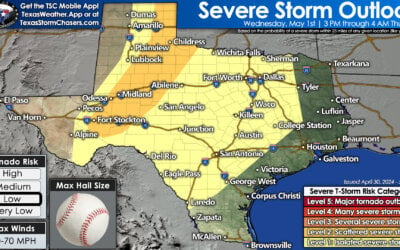
How about the chance for scattered severe thunderstorms? We haven’t had to talk about that too often since this past spring. The Storm Prediction Center has highlighted their standard level two out of five risk for severe storms in Far Southwest Texas north into the Permian Basin.
A level one out of five risk for isolated severe storms includes the Edwards Plateau, Big Country, and West-Central Texas. Stronger storms may drop large hail up to the size of goofballs and wind gusts over 60 miles per hour.
The risk of a brief tornado is very low. Like yesterday, the most likely timeframe for more rowdy storms will be this afternoon and this evening. While storms will continue late into the night, the risk for more rowdy storms will slowly decrease after 9 PM.
Today’s storm timing
Storms will likely be underway by late morning along the Texas coastline, possibly with the highest concentrations on the Upper Texas Coast and Southeast Texas. New thunderstorms are expected to erupt this afternoon across Far Southwest Texas, the Permian Basin, and eastern New Mexico.
Some storms may be strong to severe this afternoon and evening. Any storm that develops will produce dangerous cloud to ground lightning, so if thunder roars – get your behind indoors.
Storms will likely grow upscale those evening into a couple of thunderstorm complexes from the Texas Panhandle south into West Texas, the Permian Basin, Concho Valley, and Edwards Plateau.
Overall, thunderstorms will progress to the east tonight into Northwest Texas, the Big Country, North Texas, and the Hill Country by Friday morning. More scattered storms may continue along the Texas coast tonight.
Rain chances remain high into the weekend.
Thunderstorm chances will remain on the high side tomorrow through the weekend. We’ll see multiple rounds of rain versus a constant multi-day neverending downpour. Those specific timings will likely depend on residual outflow boundaries from previous storms. Still, the highest rain chances this weekend should be during the daylight hours.
That being said, plenty of folks are likely to get a soaking over the next several days. It won’t be a bad idea to make it an ‘indoor weekend’ if you make plans. Besides keeping a flash drought from developing, the increased rain chances will also help keep temperatures in check.
Rain chances look to decrease from west to east Sunday evening. A period of dry weather will then take hold for the first whole week of October.


0 Comments