
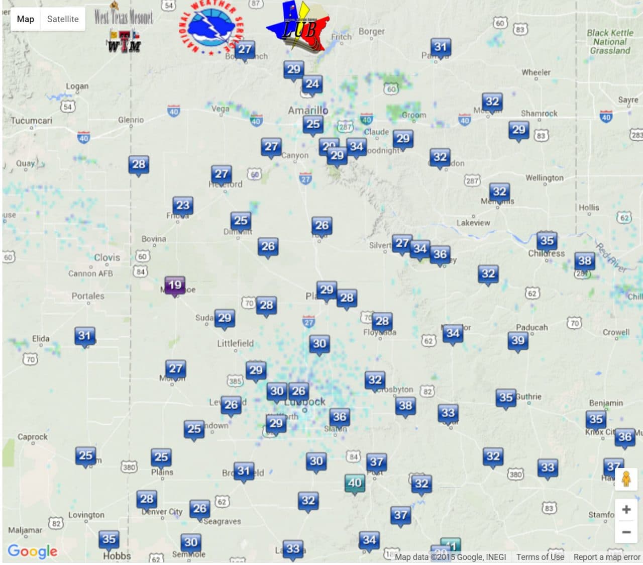
Low temperatures as of 6:20 AM CT from the West Texas Mesonet
What a difference a day can make with much calmer weather in progress this morning. Most of the Texas Panhandle and South Plains are experiencing their first freeze of the fall. Muleshoe made it down to 18.6 degrees according to their West Texas Mesonet Station. Most other sites in the region are in the 20s to low 30s. We may see temperatures fall another degree but they’ll quickly start climbing after sunrise.

A pleasant fall day is in store for Texas with high temperatures climbing into the 60s to 70s. The northwest Texas Panhandle will be the relative coolest with upper 50s. The Rio Grande Valley the relative warmest with around 80 degrees this afternoon. Mostly sunny skies are expected with noticeably less wind compared to yesterday.

The same clear skies that help warm temperatures up this afternoon will likewise work to quickly cool them off tonight. Another chilly night is forecast with low temperatures falling back into the 20s to mid 30s across the Texas Panhandle and South Plains. Northwest Texas, the Big Country, and Texoma should see upper 30s tonight. The Concho Valley, North Texas, Northeast Texas, and Central Texas will have low to mid 40s by Friday morning. Southeast Texas, East Texas, and South-Central Texas will have 40s to tonight. As usual folks in the Rio Grande Valley will be the relative warmest with low temperatures in the low 60s by sunrise Friday.
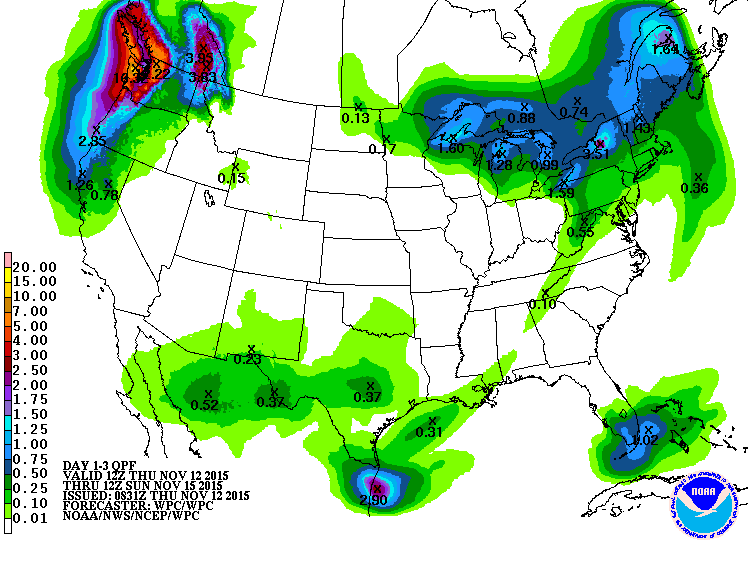
Rain accumulation forecast Saturday through Sunday morning
Rain chances return by Saturday and Saturday Night as a weak storm system traverses Southwest Texas and Central Texas. Rain amounts will be light with overall rain accumulations remaining around or below a quarter of an inch through Sunday morning.
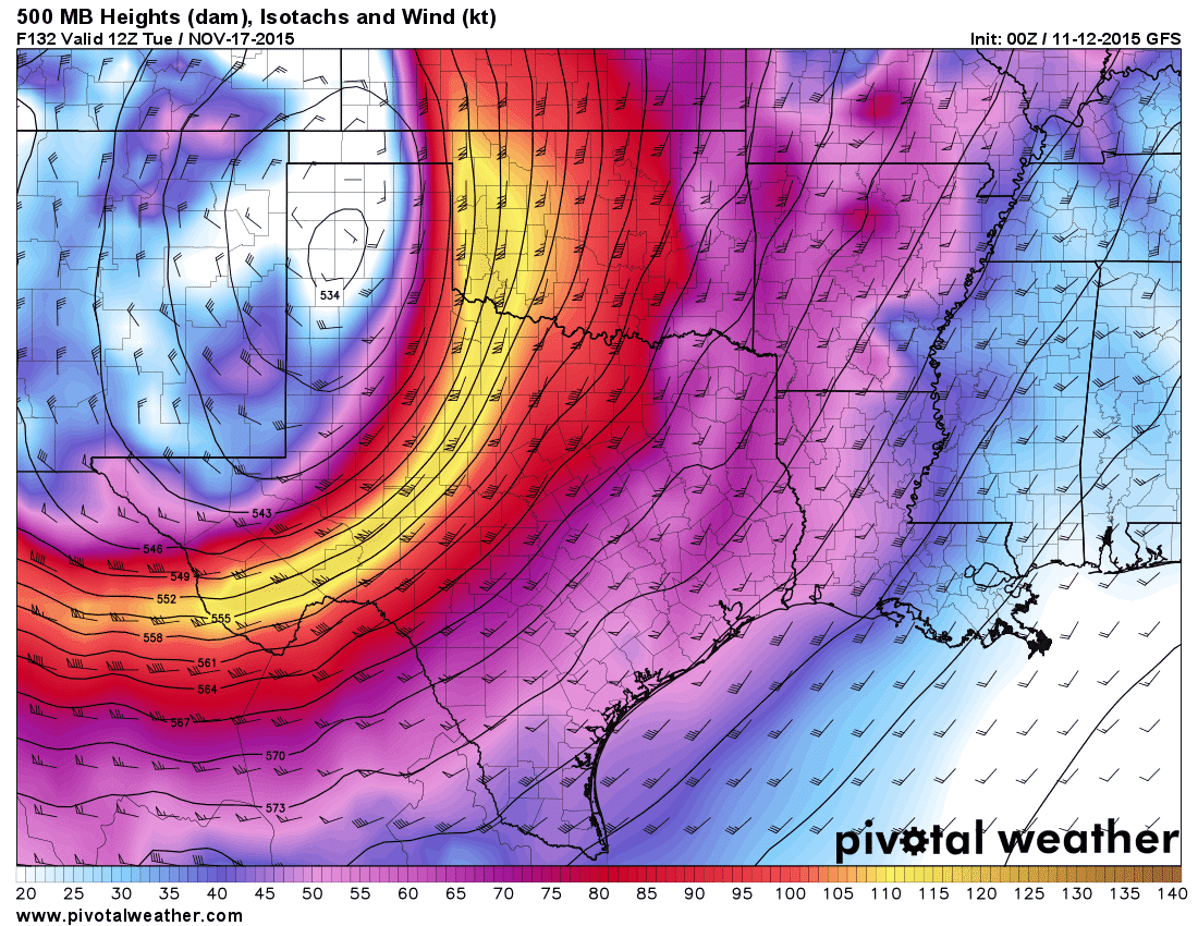
A much more significant storm system will impact Texas beginning on Monday and continuing into Tuesday Night. There is the potential for a verity of impacts including severe thunderstorms and heavy rain. The Texas Panhandle looks to see their first snow of the season. This period could be very active and I encourage you to check back for forecast updates as we continue into the weekend.


0 Comments