
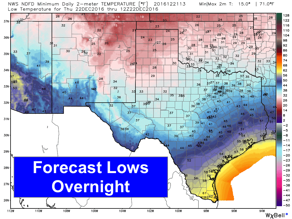
Very mild conditions are expected across the state today with highs in the 60s and 70s across a majority of the state. Quite a relief from the arctic blast we experienced last weekend, and in typical Texas weather style, we go from parkas to t-shirts again! Another cold front will arrive later this afternoon, pushing into the Texas panhandle region this afternoon and across north and into central Texas overnight, but this next front will not bring frigid arctic air with it, and will likely not have much of an impact across the southern half of the state. Temperatures behind the front will be chilly, but pretty close to where we should be at around this time of the year, and the cold will not stick around too long as we begin to warm back up by the weekend.
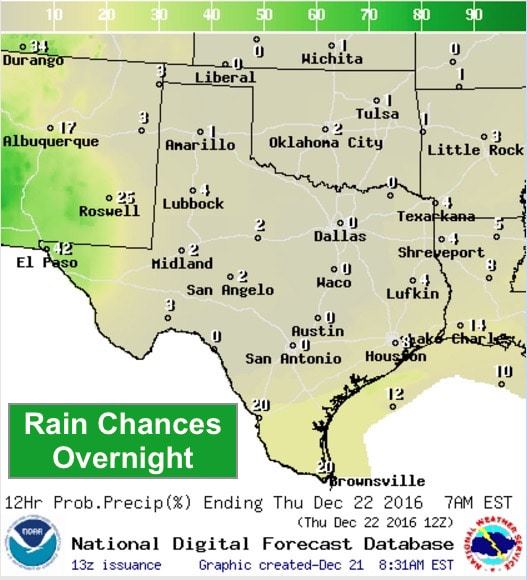
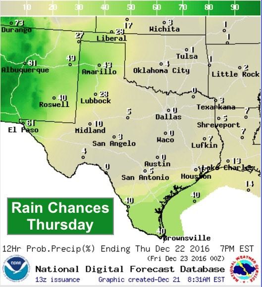
We’ll remain rain-free today, but chances for rain will slowly increase over the next several days, with a chance for thunderstorms this weekend, especially on Christmas Day as a strong upper level system arrives. Overnight, chances for rain are expected across deep south Texas and across far western Texas. Chances for rain expand into the panhandle region for Thursday. By Friday, we’ll see chances for scattered showers and light rain expand across north, central and southeast Texas.
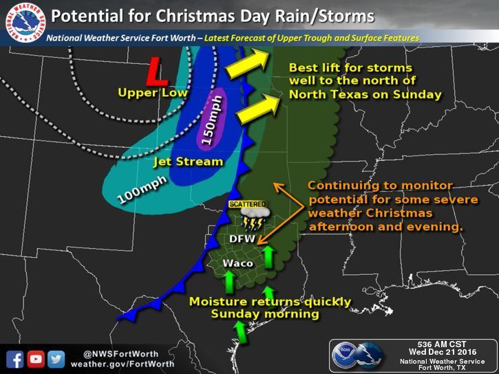
As for the Christmas Day storm chances, we continue to monitor the risk for a few strong to severe storms by Sunday afternoon as a strong upper level low approaches from the west. We know that many will be concerned about a repeat of the severe weather and tornado event we had last year on December 26th across north central Texas, but there are a number of differences between this system and the one we had last year leaving forecasters pretty confident that we’ll not have another tornado outbreak situation. For one…atmospheric instability is not expected to be nearly as significant with this next system as extensive cloud cover across the region is expected to severely limit surface heating. Second…the upper level disturbance is expected to be positioned much further north than what we saw last year which means the best lift generated by the system will be to our north across Oklahoma and perhaps southern Kansas. Third…we’re expecting the atmosphere to remain capped for most of the day with only a small window of opportunity Sunday afternoon where the cap may erode and allow for a couple of strong to possibly severe storms to develop mainly east of the I-45 corridor. At any rate, we’ll continue to keep an eye on things and provide more detailed information as the forecast for Sunday continues to develop.
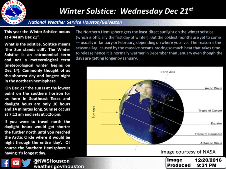
Lastly…today is the Winter Solstice…the first day of astronomical Winter and shortest daylight of the season. From here on out, our daylight hours become longer and our nighttime hours become shorter!


0 Comments