
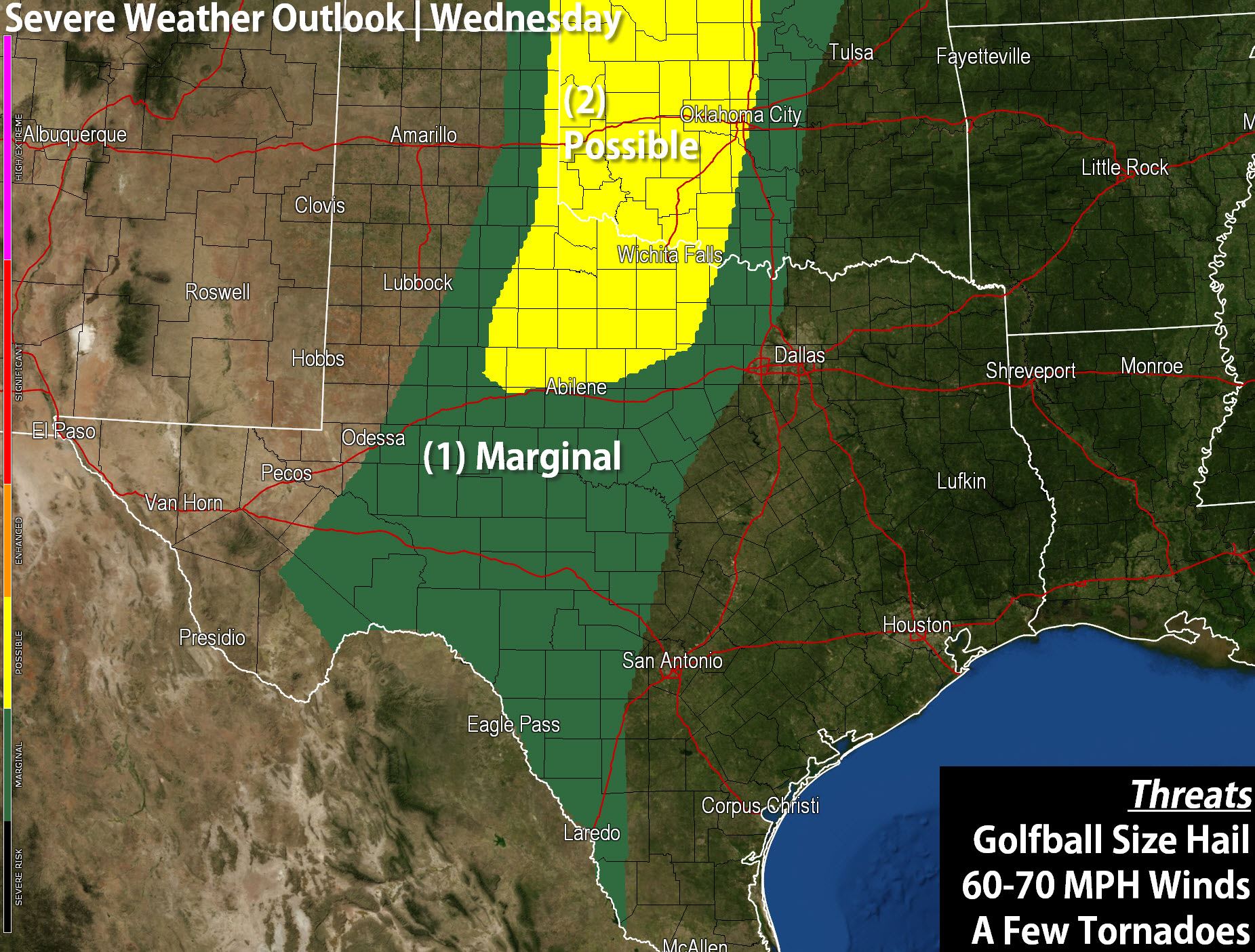
A level 2 possible risk for severe weather is in effect for Northwest Texas and the Big Country this afternoon just east of the dryline. A level 1 marginal risk runs from Deep South Texas north through the Concho Valley and western North Texas. Unlike yesterday where we had a fairly messy storm setup today should be a bit more typical for the Southern Plains. A weak cap will allow for the chance of thunderstorms to develop by early afternoon across Northwest Texas into Southwest Oklahoma. These storms would be in an environment supportive of severe weather including the possibility of a tornado. By the evening hours storms may tend to congeal into a cluster with a threat for hail and damaging winds. Isolated severe storms will be possible further south in the Marginal risk zone. While coverage of storms will be more isolated they could be just as intense in the Concho Valley with large hail and gusty winds. Remember we run a five level severe weather risk system – one the lowest and five the highest.
High temperatures will range from the upper 70s to lower 80s today. Remember you can keep up with the storms using our free interactive weather radar. We’ll be out chasing in the Red River Valley today.


0 Comments