
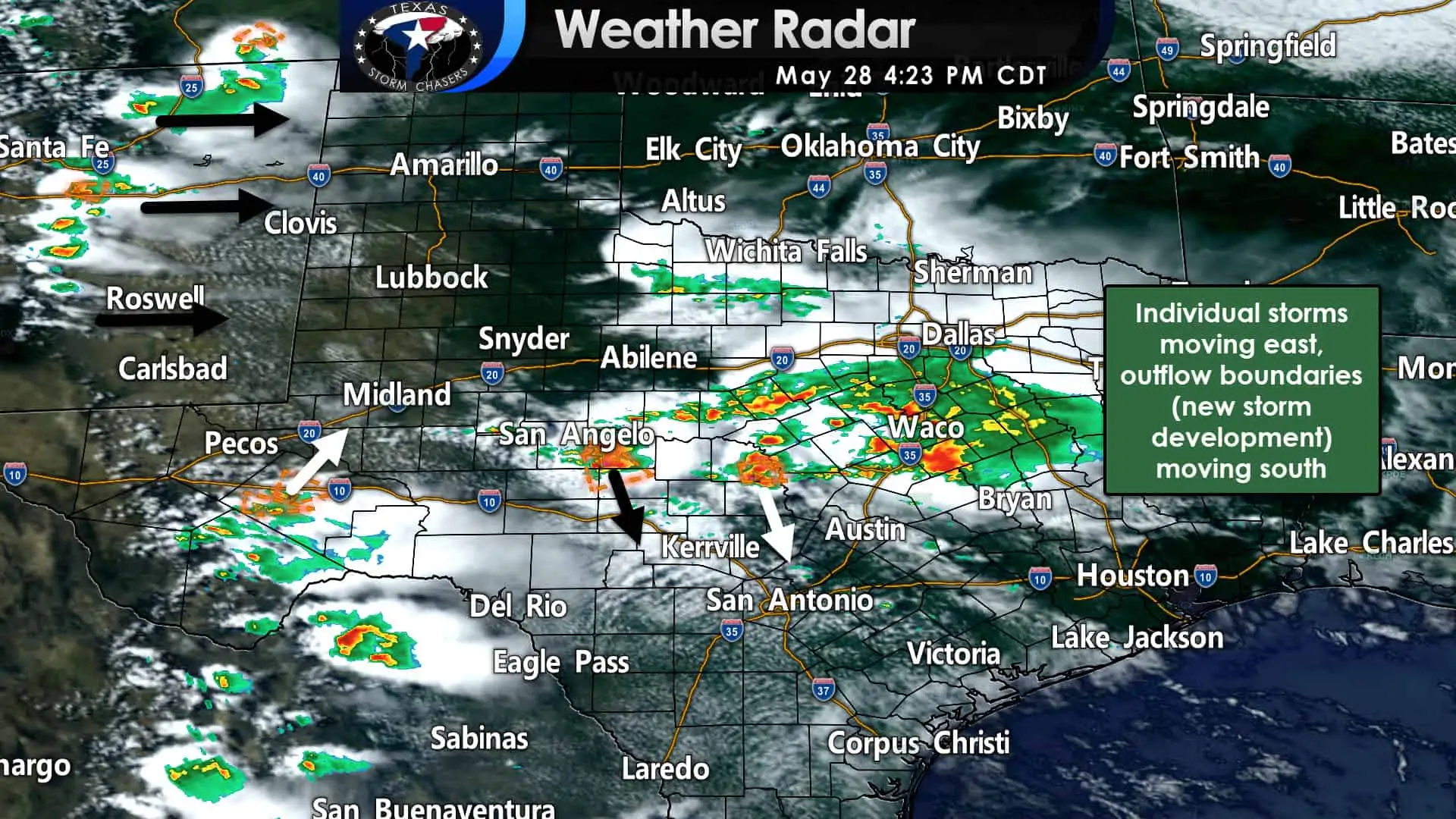
Showers and thunderstorms continue this afternoon across the eastern Concho Valley into southern North Texas. Flash flooding is ongoing around Waco as heavy rain continues to fall. Storms are generally moving to the southeast, albeit slowly. Earlier severe storms in southern North Texas have weakened in the hail/wind department.
New storms, particularly a nasty supercell southeast of San Angelo and to the west of Eden, can produce damaging hail, strong winds, and a tornado cannot be ruled out. That specific supercell is moving toward Menard and Junction. Other strong to severe storms have developed in the higher terrain south of Interstate 10 in the Big Bend. Those storms may impact Alpine, Fort Stockton, and Sanderson through the early evening.
More areas of potential storm development over northern Mexico and eastern New Mexico could move into Texas this evening.
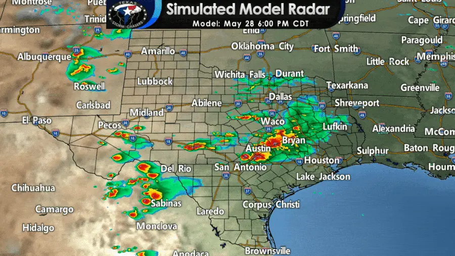
Thunderstorms ongoing across the eastern Concho Valley and southern North Texas will continue through dinner-time. Individual storms are moving to the east, but an outflow boundary and new storm development will continue pushing south. Eventually, we may see precipitation progress into Georgetown and Austin. If the outflow boundary keeps firing off new storms as it moves south, we may even see some rain in San Antonio this evening.
Scattered thunderstorms will develop this evening in eastern New Mexico. Upscale growth into a squall line or thunderstorm cluster is expected by 8 PM. Those storms will move east into the Texas Panhandle, West Texas, and western Permian Basin tonight. Damaging straight-line winds, hail, and heavy rain are probable with more intense storms (not all storms in the squall line will be severe).
Any storm today will be capable of producing a quick one to two inches of rain. If multiple storms move over the same location, we could see multi-inch rain totals pile up in a hurry. Localized flash flooding is a threat this evening.


0 Comments