
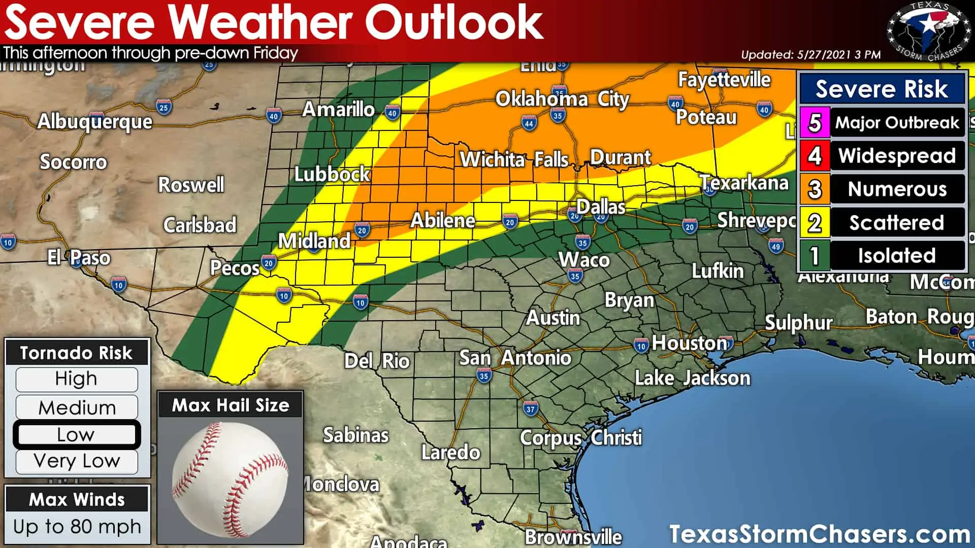
It’s another late May day in Texas with a chance of afternoon and night-time thunderstorms. Today’s severe weather threat is concentrated over portions of the Permian Basin, West-Central Texas, Big Country, Northwest Texas, and Texoma. The Storm Prediction Center has highlighted a coverage level 3 (out of 5) for severe storms near Colorado City and Sweetwater northeast through Childress, Wichita Falls, Gainesville, and Sherman. A level two risk of severe weather includes Sanderson, Midland, Mineral Wells, Dallas, and New Boston. A level one risk includes Amarillo, Hillsboro, and Tyler. Severe weather risks are based on the probability (or coverage) of severe storms. A severe storm in a level one risk could produce similar hazards to a severe storm in a higher risk level
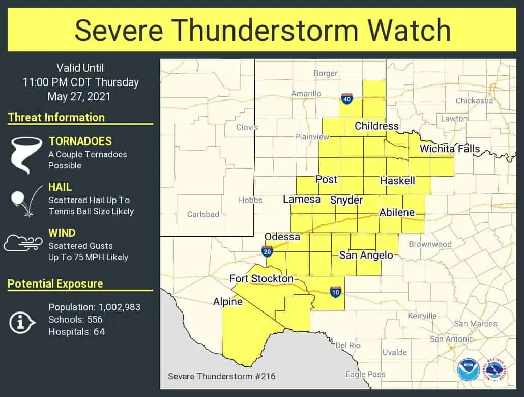
Isolated to scattered thunderstorms will begin developing over the next few hours east of the dryline across Northwest Texas southward into the eastern Permian Basin. It won’t take long for storms to get riled up, given a volatile air mass and increasing upper-level winds. Our most intense storms later this afternoon are expected to be supercelluar. Very large hail up to the size of baseballs and localized wind gusts up to 75 MPH are possible out of the most intense supercells. A couple of tornadoes are also possible through the early evening across Northwest Texas and the Big Country.
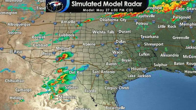
Simulated weather model radar this evening through Friday morning
As we push toward sunset and thereafter, we should see storms start growing upscale into one or more thunderstorm clusters. Those clusters will propagate to the east/southeast with an increasing chance for damaging straight-line winds along with hail. Storms across Northwest Texas, the Big Country, and the eastern Permian Basin should weaken after 10-11 PM as they start moving east toward the Hill Country and North Texas.
However, north of the Red River, our friends up in Southern Oklahoma will be dealing with their own squall line this evening. That squall line is expected to progress south/southeast tonight and approach the Red River around midnight. Damaging straight-line winds, heavy rain, and perhaps some ‘change’ size hail are possible early Friday morning in North Texas and Northeast Texas. The highest chance for stronger storms will be from Interstate 35/Interstate 35W and points east late tonight and Wednesday morning.
The threat for damaging winds and hail will decrease as storms move south of Interstate 20. Localized flash flooding is also a concern given saturated soils and rain over the last few weeks in East Texas. We’ll be back to our usual tradition of severe weather coverage later this evening. You’ll be able to watch that on our digital media platforms and here on our website. Remember, our interactive weather radar is a great tool to keep an eye on storms in your area.


0 Comments