
Happy Independence Day, Y’all! Remember, the reason for the season may apply more for Christmas, but it sure applies today as well. While we’re all out enjoying barbeque, friends, and fireworks, let us not forget the reason why we’re able to enjoy those festivities. Thank you to our troops, emergency responders (including dispatchers), and all those who put their life on the line and help us all remain free.
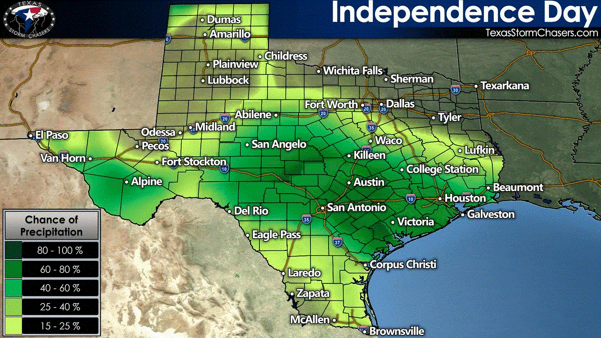
A relatively active weather pattern for the summer months continues this Independence Day. Isolated to scattered thunderstorms are likely to begin developing late this morning through the late afternoon across the southern two-thirds of Texas, generally south of Interstate 20.
As with all summer thunderstorms, dangerous cloud to ground lightning will be a hazard. Stronger storms will also likely produce localized winds (microbursts) with 40-60 MPH winds and very heavy rainfall. Given the outdoor nature of today’s festivities, we remind folks that when thunder roars – get your family indoors. Go check out YouTube for ‘lightning strikes tree’ to determine why sheltering under trees in a thunderstorm is a bad idea.
Thunderstorms are expected to decrease as we head toward dinner-time and start losing peak heating. I’m hopeful we will see most thunderstorms dissipating by 8-8:30 PM – resulting in little to no interruptions for this evening’s scheduled firework shows. There will be an exception to that timing which I will discuss next.
Severe storms possible tonight in the Texas Panhandle
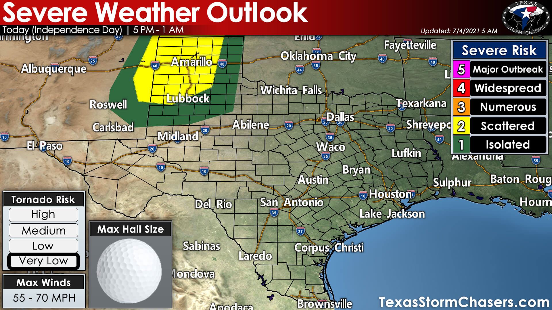
Organized thunderstorm development is possible this evening across the Texas and Oklahoma Panhandles. The strongest storms may initially produce large hail up to the size of golf balls and wind up to 70 miles per hour.
By mid-evening through early Monday, the primary hazards should be damaging straight-line winds, heavy rainfall, and dangerous cloud to ground lightning. Not everyone in the Panhandles will get ‘rained out’ this evening. Storms will tend to be more organized and long-lasting than this afternoon’s ‘popup storms’ further southeast.
Hopefully, we’ll be able to get all the firework shows done without issue, but Mother Nature may put on her own show for some.
Some thunderstorms may continue past midnight across the Texas Panhandle. Storm movement will generally be to the east or southeast. Localized flooding may occur where we see heavy rainfall rates.
More storms on Monday
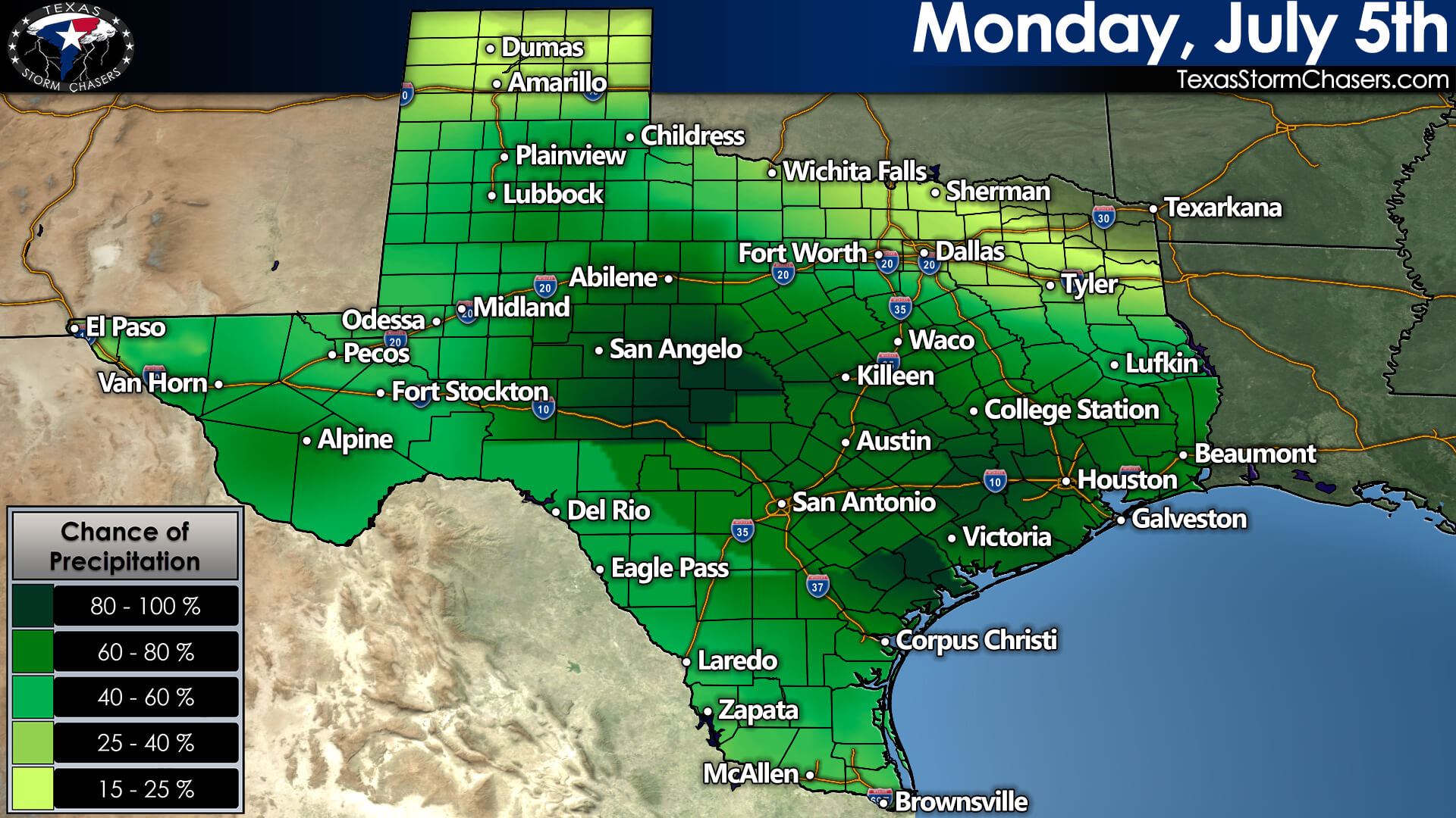
Another round of ‘popup thunderstorms’ will likely occur on Monday across Texas. Like today, the highest coverage of storms will be from the late morning through late afternoon hours. They’ll start decreasing in coverage by dinner-time and should mostly be gone by 10 PM. All thunderstorms produce dangerous cloud-to-ground lightning. Summer storms are known for producing microbursts and a quick one to two inches of rain.
You can keep an eye on the sky with the Texas Storm Chasers Interactive Weather Radar here on our website – or by downloading our free mobile app. Please have an enjoyable and safe 4th!


0 Comments