
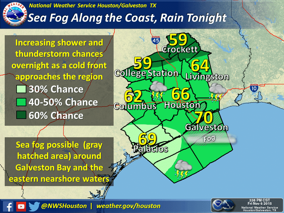
Moisture from the Pacific Ocean along with some influence from the cold front will allow rain chances to increase this evening and overnight. The overall highest rain chances are expected to be south of Interstate 20. Southwest Texas, the Concho Valley, Central Texas, and East Texas have the best chance for scattered to numerous showers and thunderstorms tonight. Severe thunderstorms are not expected as the atmosphere is much more stable than on Thursday.
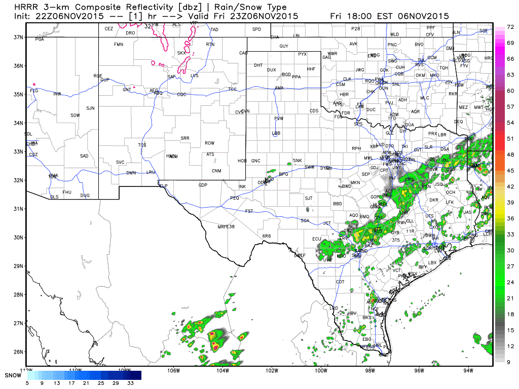
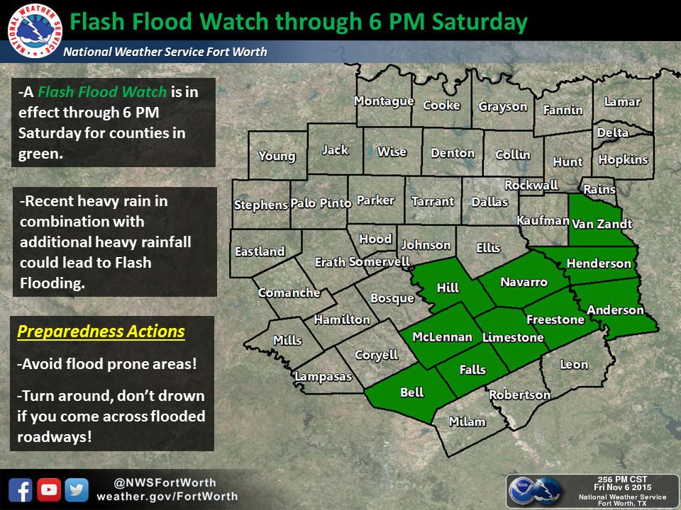
The High Resolution Rapid Refresh run from 4 PM shows an increase in rain coverage after midnight across Central Texas, South-CEntral Texas, and the Brazos Valley. The heaviest areas of rain may produce up to an inch of rain an hour. In areas that have received significant rains over the past two weeks it won’t take much rain to cause flash flooding. A small flash flood watch has been issued from Temple, Waco, and Hillsboro east to Corsicana, Fairfield, Canton, Athens, and Palestine. These locations are where flash flooding is an increased possibility – especially around Corsicana and Navarro County.
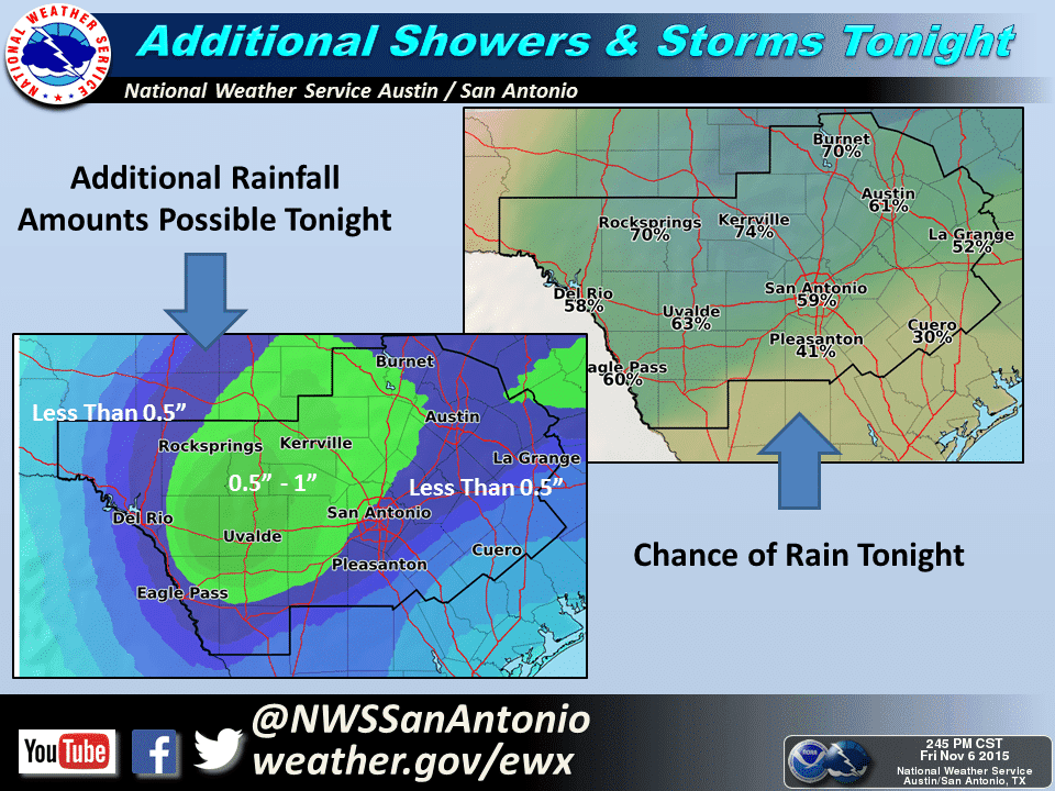
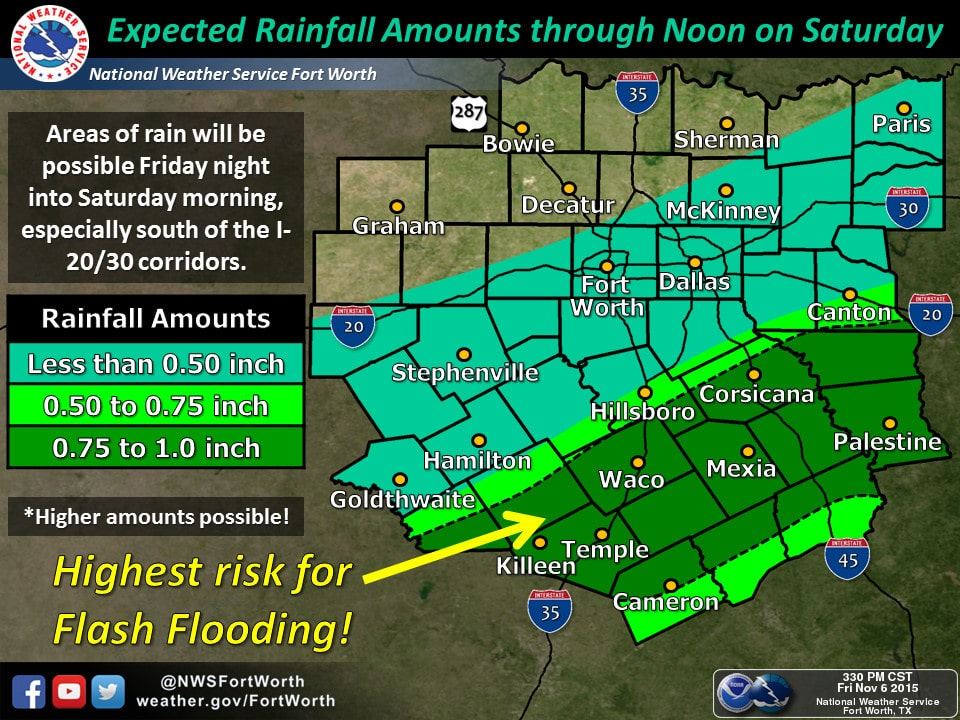
Rain accumulations tonight through the day on Saturday could approach 1.5 inches in Southwest TExas and in parts of Central and Southeast Texas. Most locations will receive lighter rain amounts of half an inch up to one inch. Unfortunately in areas that received 10+ inches of rain over the past two weeks anything over an inch could indeed cause problems. Games on Saturday are going to be wet in some locations but I’m hopeful we can keep lightning issues out of play.


0 Comments