
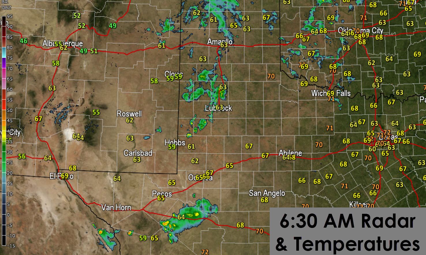
Scattered showers are moving across the Texas Panhandle and South Plains this morning. This activity is not producing lightning and is mainly just enough rain to wet the roads. Overall rain accumulations should remain below a quarter of an inch and that’s the high end. An area of low pressure is located in the northwestern Texas Panhandle. That is causing showers across the northern Panhandle to move north and almost northwest. Showers in the South Plains are making progress to the east into Plainview and Lubbock. This activity should begin to diminish by the early afternoon.
A couple of thunderstorms are underway between Fort Davis and Fort Stockton. These storms are in a slightly more unstable airmass than the Panhandle and South Plains. These storms are moving southeast with cloud to ground lightning and locally heavy rain. The strongest storm may produce small hail this morning.
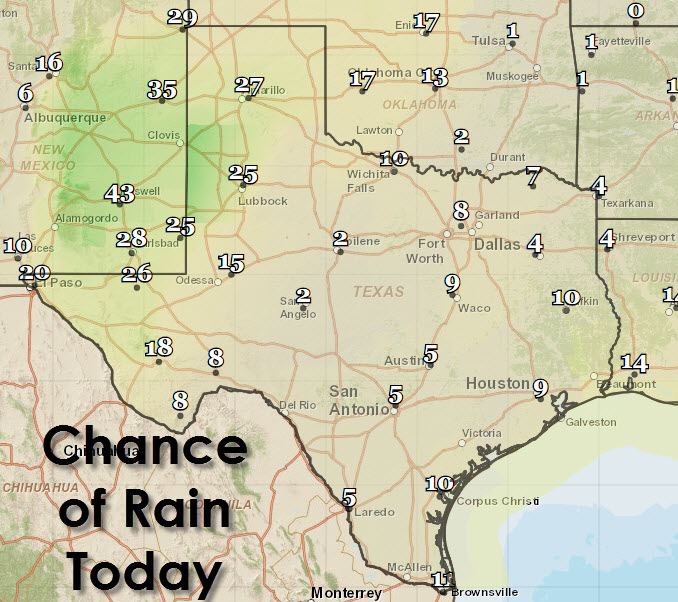
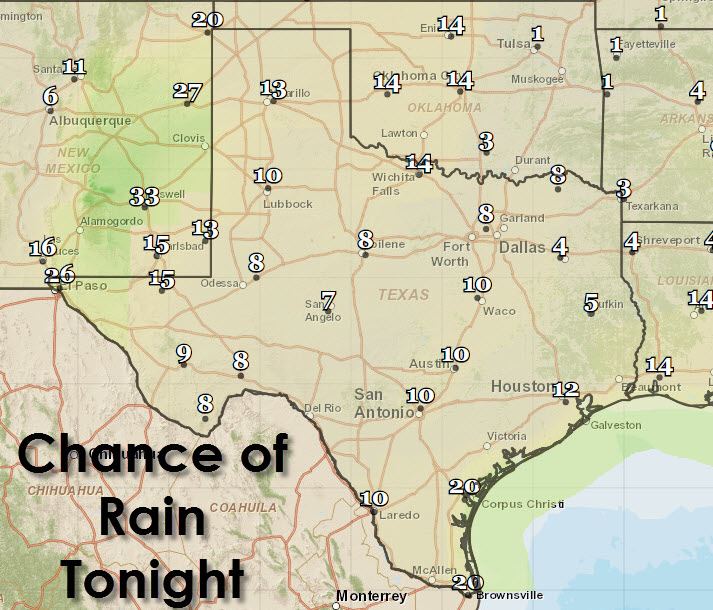
The rain forecast from the National Weather Service doesn’t believe the ongoing rain will make much more progress to the east today. I can’t rule the rain making a push towards the Permian Basin and east of Interstate 27 but it’ll be in a weakening state like Wednesday’s activity. By tonight precipitation chances will diminish across the Panhandle and West Texas. Isolated thunderstorms are possible tonight across Far West Texas and along the coast.
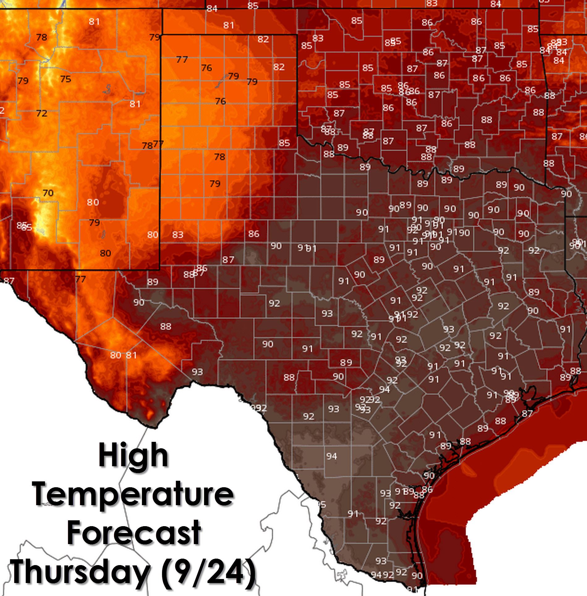
This morning’s rain and ongoing cloud cover across the Texas Panhandle and South Plains will result in fall like temperatures. Temperatures will remain in the 70s which should feel pretty good. High temperatures along the coast will be in the upper 80s. Those in the Hill Country, Big Country, Concho Valley, Northwest Texas, North Texas, Northeast Texas, East Texas, and Southeast Texas can expect high temperatures in the 88 to 92 degree range. Those located from San Antonio south along Interstate 35 to Del Rio/Laredo will be the warmest today with 93 to 95 peak temperatures this afternoon.
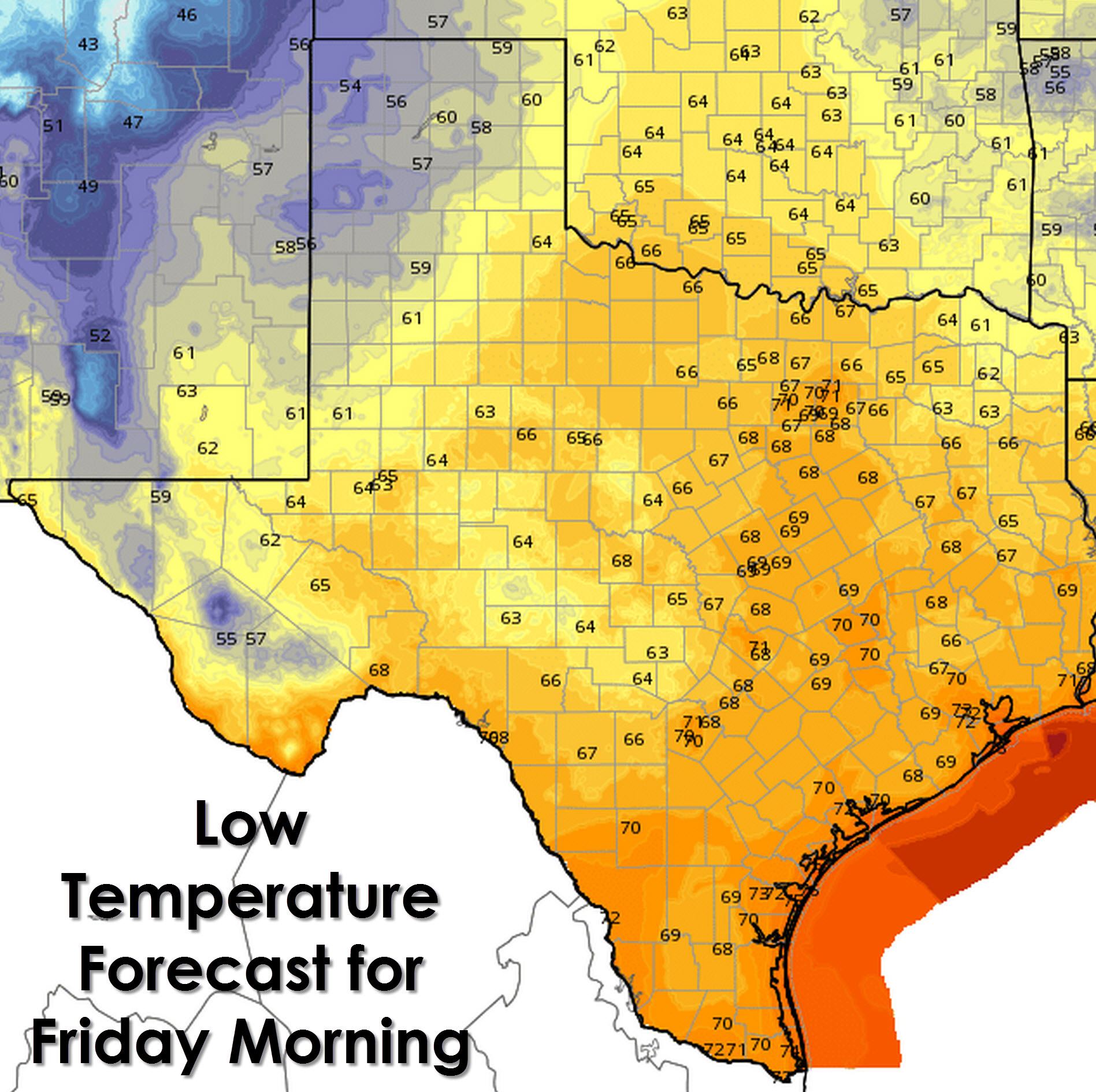
The warmest temperatures tonight will be located along the coast and in South Texas with 70 to 72 degrees. Houston, San Antonio, Austin, and Dallas will drop to 71-72 degrees. Those Central Texas, East Texas, Northeast Texas, West-Central Texas, Northwest Texas, the Big Country, and the Concho Valley will drop into the 60s. Finally the Texas Panhandle and West Texas will cool off into the 50s tonight.
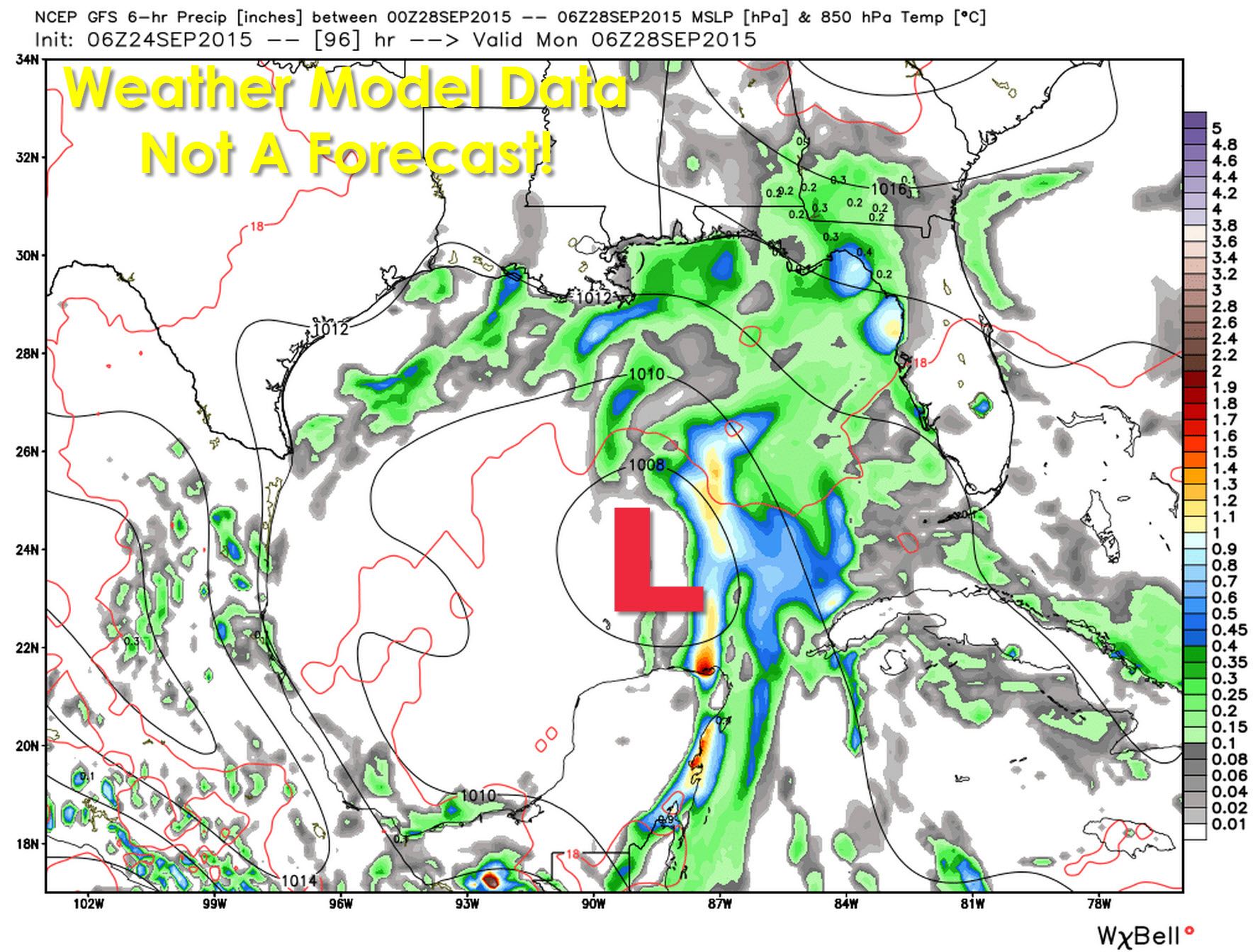
Lets take a trip out into the Gulf of Mexico where things could get interesting by the weekend. Various weather models develop an area of low pressure towards Sunday and Monday in the west-central Gulf of Mexico. Sea surface temperatures are warm and would definitely support the development of a tropical system. The good news is wind shear will only be marginally supportive of a tropical depression or tropical storm by early next week. Steering currents aloft will keep any storm system (tropical or not) east of Texas into the Central/Eastern Gulf of Mexico. We’ll keep tabs on this system even though we don’t expect it to impact our weather this weekend or early next week.


0 Comments