
Bottom Line
- A historic winter storm will impact all 254 counties in Texas today, tonight, and on Monday.
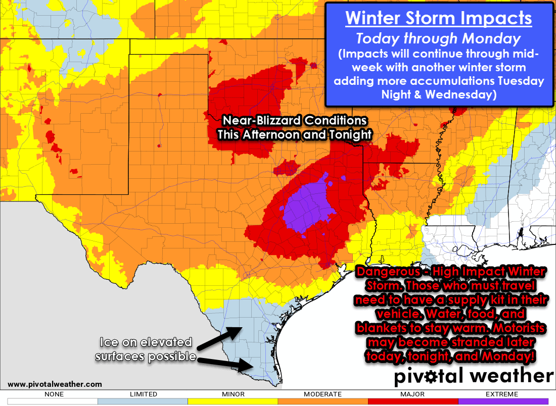
- Do not travel unless necessary. Those who travel risk becoming stranded in near-blizzard conditions or worse.
- Travel will be greatly disrupted across Texas and the Southern United States for days.
- Temperatures will drop near or below zero tonight across the northern half of Texas. Wind chill readings will approach 35 degrees below zero in some spots.
- Brutally cold weather is forecast tonight and on Monday across all of Texas. Increasing stress to infrastructure from the extreme cold may result in power disruptions and water lines breaching.
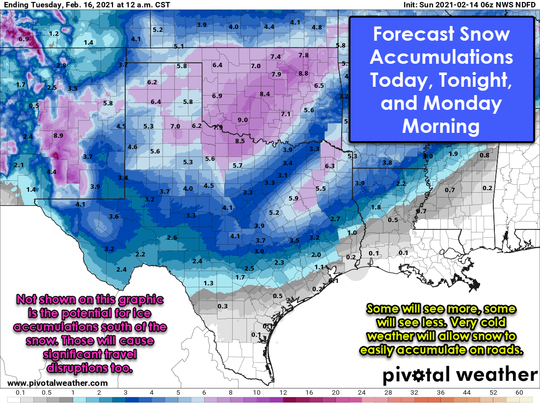
- Another high-impact winter storm is becoming likely Tuesday Afternoon through Wednesday across the northern half of Texas – with accumulations falling on top of what falls today and tonight.
- You can get our latest weather updates by downloading our free Texas Storm Chasers app (click here).
Ongoing Weather
Snow, sleet, and freezing rain are ongoing this morning across Texoma, North Texas, and the Brazos Valley. This first round of precipitation is moving east/northeast into East Texas and Northeast Texas. Those below freezing could see freezing rain cause ice accumulations on elevated objects. Snow and sleet are accumulating on all surfaces. Abnormal for us in Texas, but typical up north is snow collecting most efficiently on the pavement versus grassy surfaces. Road conditions are problematic, with bridges being the first to go downhill. Please check road conditions at https://drivetexas.org/. Temperatures will not rise today and will likely slowly fall instead. We may see a break in precipitation for a few hours before the heavier winter weather arrives from the west.
Significant Winter Storm Today, Tonight, and Monday

Simulated weather model radar for Texas through tonight. Whites/blues are snow, pink is freezing rain or sleet, while green is rain.
Our second round of precipitation, associated with a far more impactful winter storm, is ongoing across the Texas Panhandle and West Texas. Moderate to heavy snow has been reported, with several inches of snow already on the ground. We’ll see that precipitation move eastward this morning while expanding southward all the way to Mexico. This second storm system will bring widespread, high-impact winter weather to all of Texas today, tonight, and on Monday. Let me be blunt – those risking travel once heavy winter precipitation has begun may become stranded. We’ve seen major winter storms in the 2000s, and early 2010s result in folks being stranded on interstates for more than a day. This winter storm has a unique ingredient – lethal cold to those without a way to stay warm. If you must travel and understand some folks have no choice, you need to take a supply kit with you – food, water, and blankets. Near blizzard conditions are likely this afternoon and this evening across the northern two-thirds of Texas.
Extreme Cold Alert Tonight and Tomorrow for Texas
This is not a typical Texas winter storm where it snows and clears up the next day. Temperatures will remain drop below zero tonight across the northern half of Texas. Temperatures well below freezing are forecast across the northern two-thirds of Texas tomorrow. Wind chill temperatures may approach thirty-five below zero in the Texas Panhandle, with below-zero wind chills south of Interstate 10 a good bet tonight. Near blizzard conditions are likely this afternoon and this evening across the northern two-thirds of Texas. Dangerous winter weather will impact the southern third of Texas too. Those in Deep South Texas and the Rio Grande Valley could see ice form on elevated objects such as bridges and overpasses late tonight.
We’re now entering the ‘nowcast’ portion of this event. We’ll be covering the winter storm extensively on social media throughout the day. We also plan to post regular forecast updates on our weather blog and provide video updates throughout the event.


0 Comments