
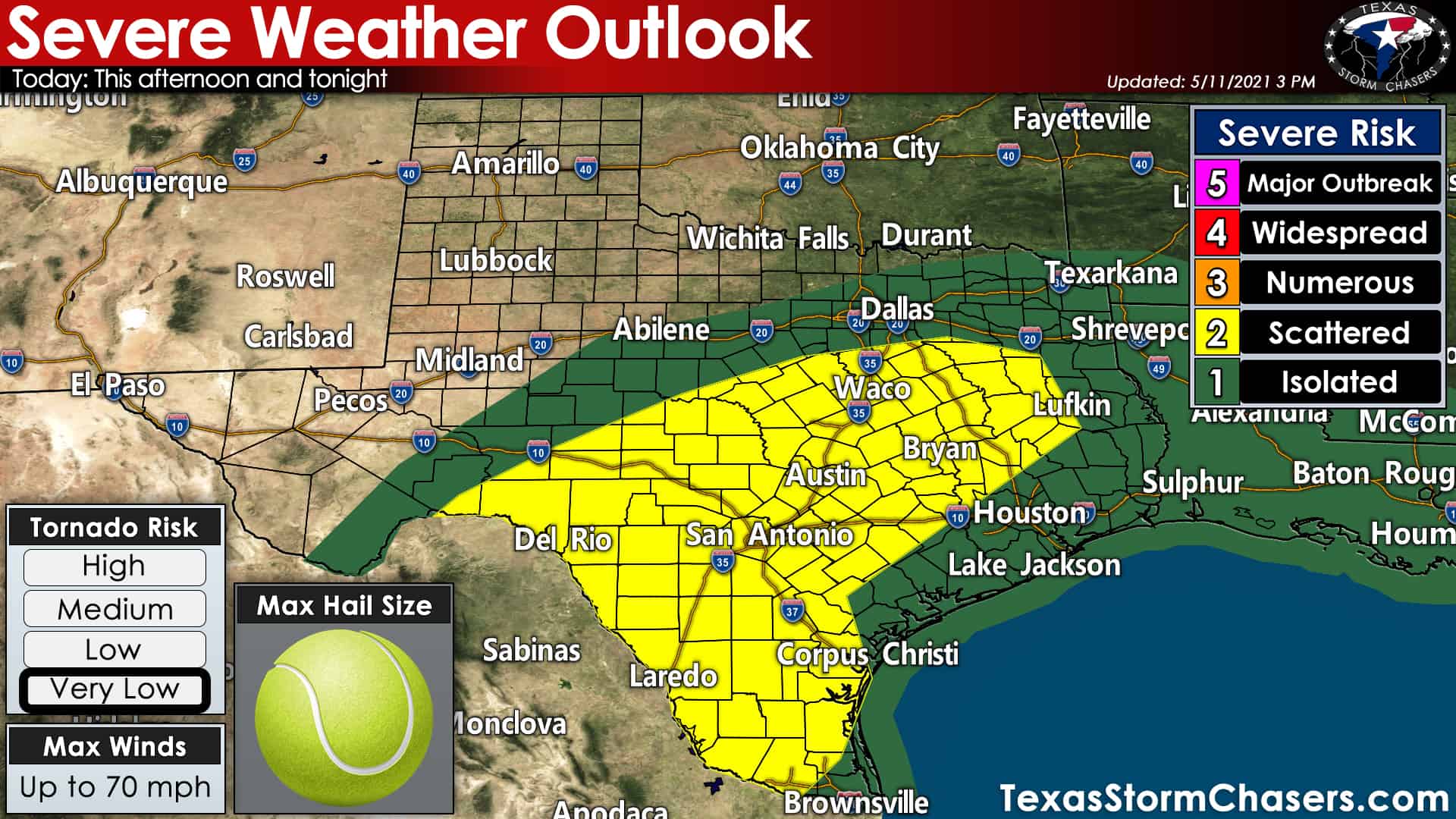
Unsettled weather continues across several regions of Texas this afternoon. In the short term, a few severe storms remain possible across East Texas and the Brazos Valley. The strongest storms may produce localized damaging wind gusts, nickel to ping-pong ball size hail, and perhaps a brief tornado. There have been a few tornado warnings already, but we are not expecting a significant tornado issue today. That being said, take any weather warning seriously since even a brief/weak tornado can still cause plenty of problems.
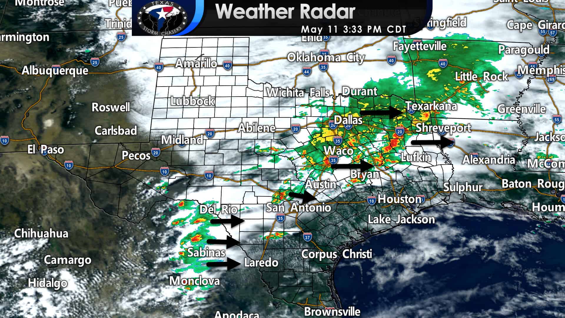
Across North Texas, storms have been loud but are not severe. We should see North Texas dry out tonight as rain exists to the east/south.
Farther southwest, we’re monitoring thunderstorms developing over the higher terrain in Coahuila. Those storms are making slow progress to the east toward the Rio Grande. Additional scattered storms may also develop in the Edwards Plateau and South-Central Texas by early evening. Some of these storms could become severe with large hail and damaging straight-line winds.
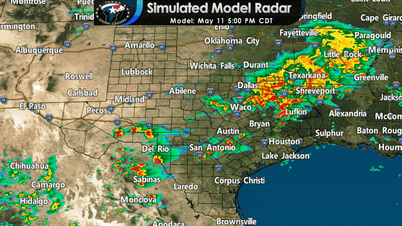
The High-Resolution Rapid Refresh (HRRR) model suggests a squall line/thunderstorm complex may develop. If a thunderstorm complex materializes, those storms will move south/southeast into South Texas and the Rio Grande Valley tonight. Damaging straight-line winds, some hail, and heavy rainfall would be likely. Storms are also expected to continue tonight in Southeast Texas. Localized flooding may occur, especially where heavier storms drop two to four inches of rain over a couple of hours.
You can keep tabs on ongoing storms with our Texas interactive weather radar.


0 Comments