
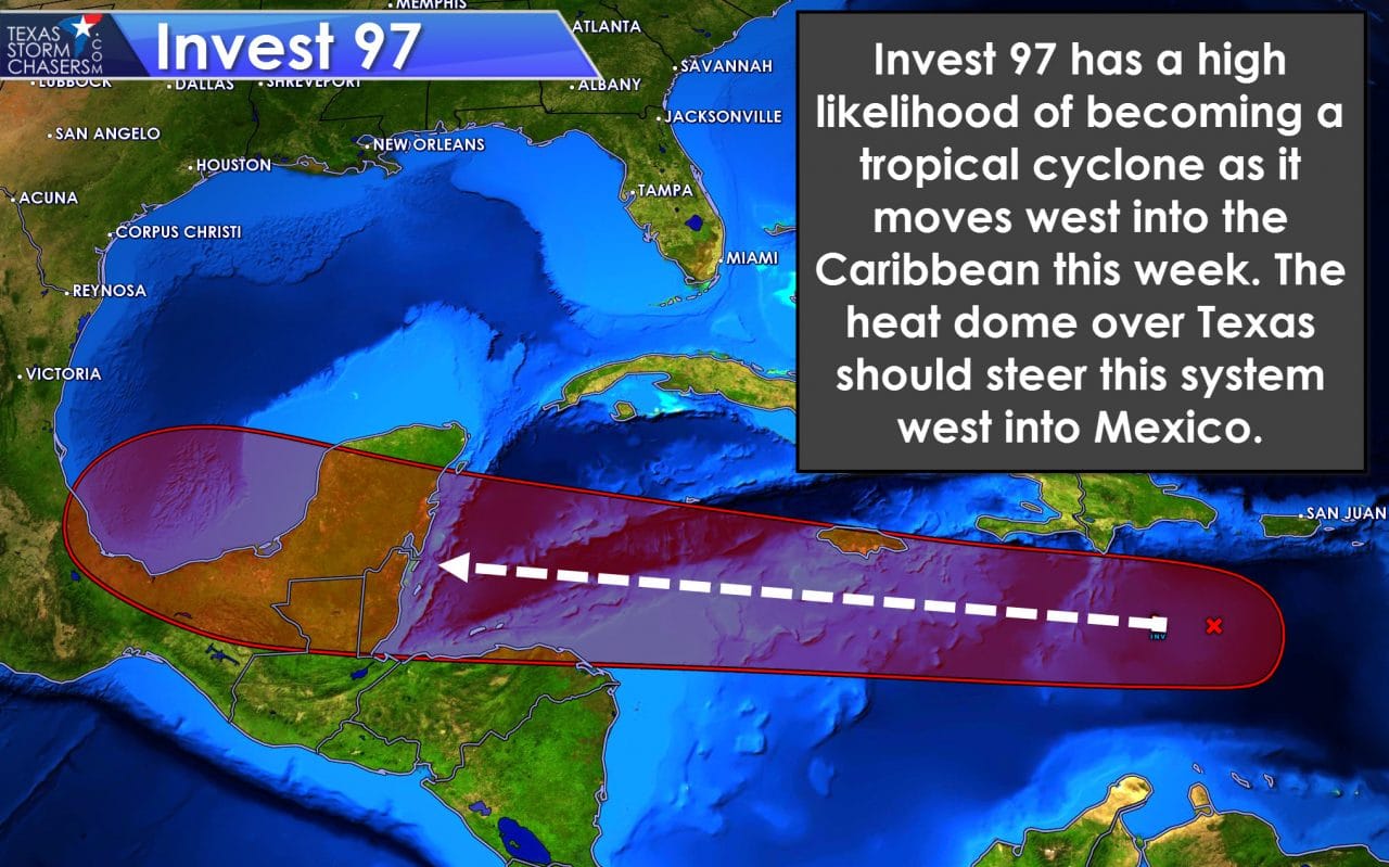
Welcome to August and the hottest month of the year for Texas. We experienced above-average temperatures for July and we’ll likely see the same for the first half of August (at least). We’ll also be watching the tropics as the Atlantic Basin wakes up. Invest 97 has a high probability of becoming Tropical Storm Earl this week in the Caribbean. The high pressure aloft Texas is expected to push Earl west into Mexico later this week. We’ll still keep an eye on the system but in all likelihood the only impacts we’ll see is an increased rip current threat on the coast. Otherwise the only other discussion point today will be the heat ridge that will bake us this week.
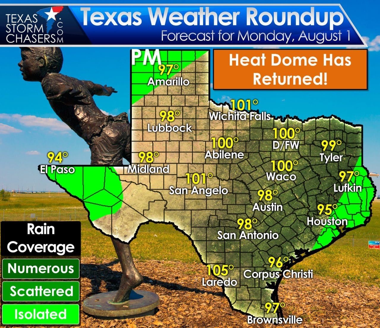
High temperatures this week will remain in the middle 90s to middle 100s. Unlike last week our daily afternoon rain chances will be much lower this week. Since the high pressure aloft has built back in we’re in for multiple sunny and hot days. Temperatures will remain warm at night, although that isn’t atypical for August. Humidity values will tend to stay on the lower-end of the spectrum through Wednesday, but may start to creep up inland as we get towards the end of the week. Those increased humidity values will lead to higher heat index values and more miserable afternoon conditions. Again, this heat is nothing unusual for August. Those of y’all who were here in 2011 know this summer has nothing compared to the heat we dealt with back then.


0 Comments