
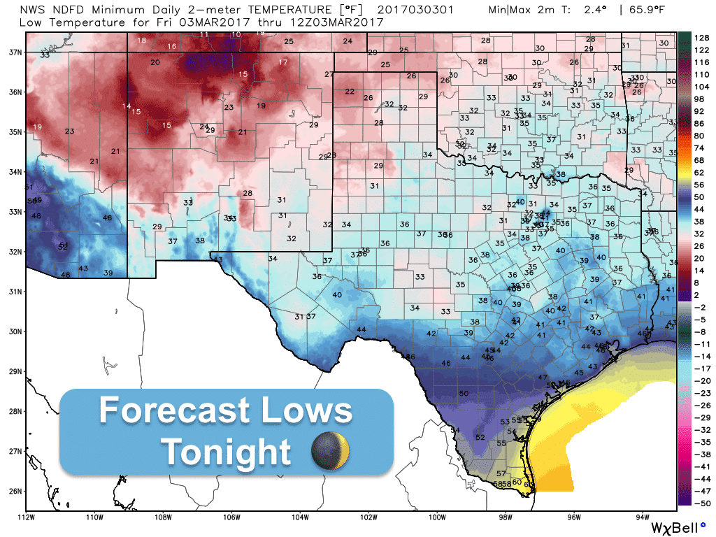
We have a gorgeous early March day on tap for tomorrow with highs right about where they should be for this time of the year. We’ll start off chilly once again tomorrow morning with lows dropping down into the 20s and 30s across the northern half of the state. Areas south of I-10 will be chilly as well with lows dipping into the 40s for all except deep south Texas which will see lows only drop down into the upper 50s. Skies will remain mostly clear tonight, but we’ll see cloud cover returning tomorrow across the southern half of the state as a weak upper level disturbance over northern Mexico moves east into south Texas.
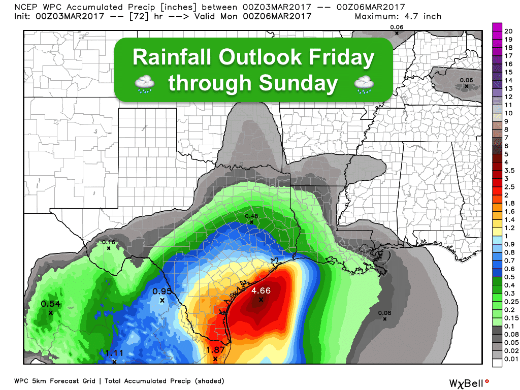
Rain chances return on Friday and Friday night across south Texas as the aforementioned upper level disturbance approaches. Most of the rain will be in the form of scattered light to moderate showers which will increase during the overnight hours on Friday and spread further north into south central, central and southeast Texas on Saturday. The heaviest rainfall is expected across deep south Texas where some areas could pick up a good 2 inches or more. Definitely a weekend to enjoy indoor activities or catch the latest movies. Central Texas may should see rainfall totals just under and inch, and the northern half of the state will see even less…mainly 1/4 to 1/2 inches. Thankfully, no severe weather is expected and most of the rain should be gone by Sunday evening.
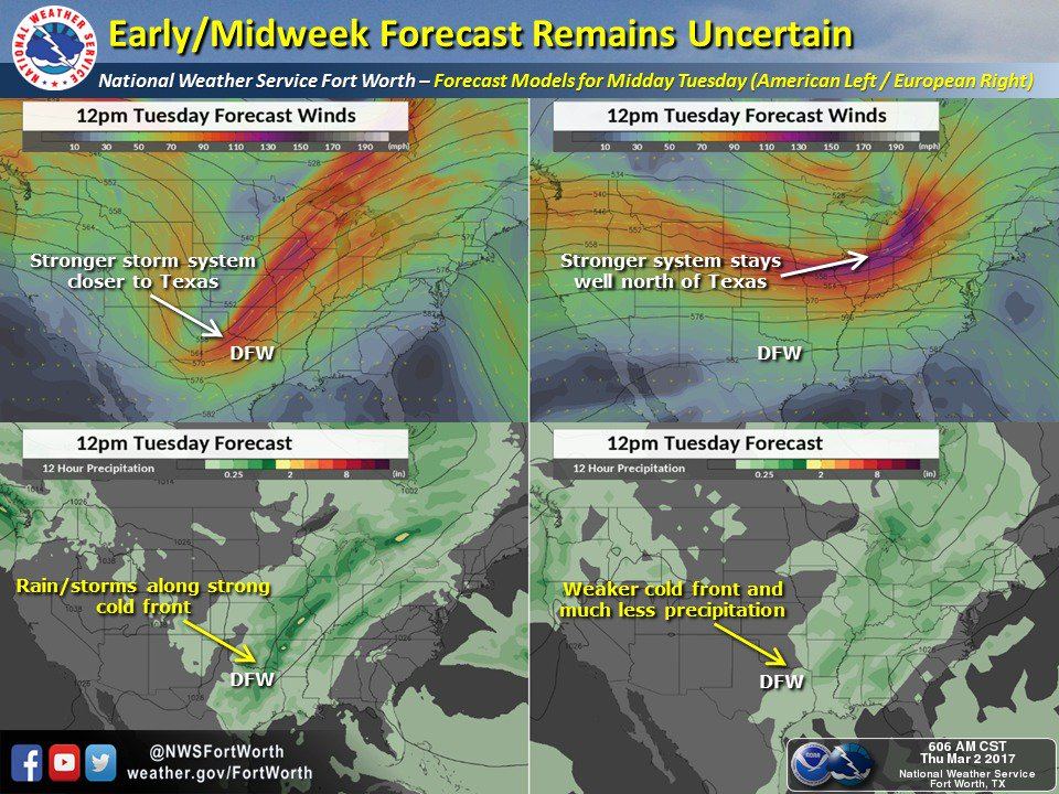
The forecast for next week is still up in the air (pun intended) as the longer range models are still struggling with the evolution of our next potential rainmaker and cold front. The model graphics below on the left depict what the GFS (Global Forecast System) model thinks will happen with regard to an upper level disturbance expected to arrive late Monday into Tuesday. On the right, the graphics depict what the current European (Euro) model output thinks will happen. Usually we end up settling somewhere in between, but the overall trend at this point appears to keep most of the rainfall early next week across the central and southern parts of the state. It’s too early to talk about the potential for strong storms, but if the GFS solution pans out, we could see a line of strong storms develop as a cold front advances through the state. We’ll be monitoring that through the weekend and have updates out as the forecast becomes clearer!


0 Comments