
Good morning and happy Thursday! A cold front is making progress through the state this morning. As of this typing, it has moved through the panhandle, northwest Texas and is currently pushing through the DFW metro area. Winds will pick up behind the front and become gusty at 15 to 25mph, but temperatures won’t be all that quick to drop behind the front. The front should be across central Texas by around noon, the upper coast by this evening and deep south Texas overnight. Clouds will be on the increase today as our next upper level system draws closer. We’ve got some dense fog this morning along the coastal plains with Dense Fog Advisories in effect through mid-morning.
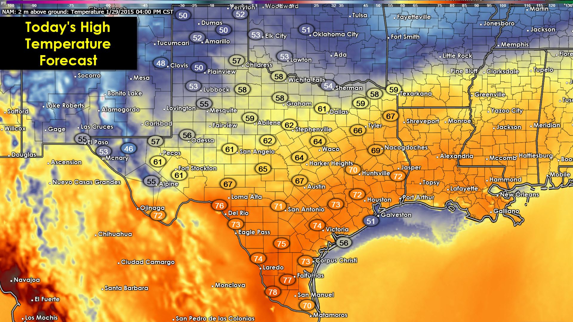
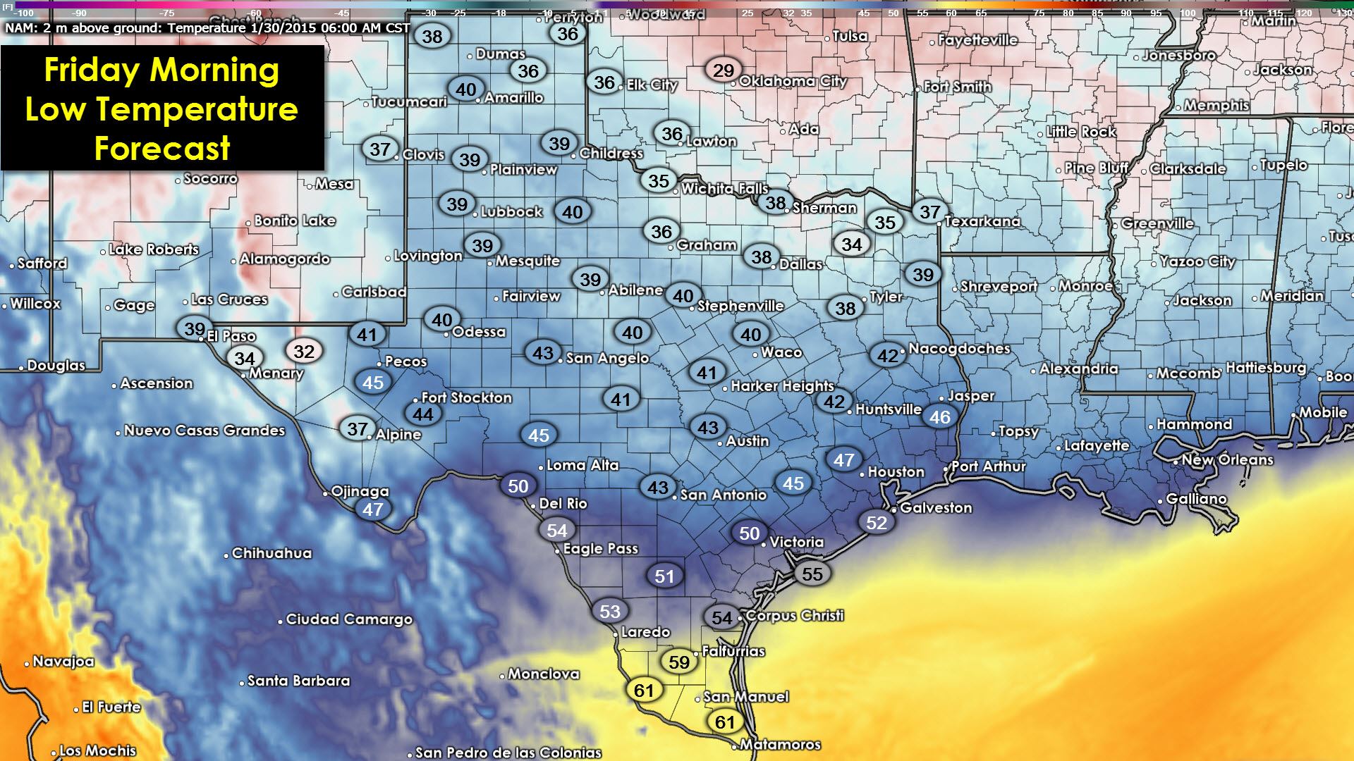
Highs today across the northern 1/2 of the state will be reached early on in the day then begin to gradually decrease as we head into the afternoon hours. Lows tonight will end up being fairly close to seasonal normals.
Rain will begin to arrive tonight across far west Texas and New Mexico and slowly work its way east on Friday. Some snow is expected across the Guadalupe Mountains Friday night into Saturday, but right now it appears the bulk of the precip that falls across our western portions of the state will be in liquid form. Upwards of 1 inch amounts are possible.


0 Comments