
We’ve arrived at hump day in the thirty-eighth week of 2021. It also happens to mark the start of autumn across the northern hemisphere. We’re starting autumn with appropriate temperatures to mark the occasion.
The cool front responsible for our fall preview will be in Deep South Texas and the Rio Grande Valley by the time you read this post. A few thunderstorms will remain possible as the front pushes south into Mexico this morning. Rain chances will conclude by noon as drier air filters in behind the front.
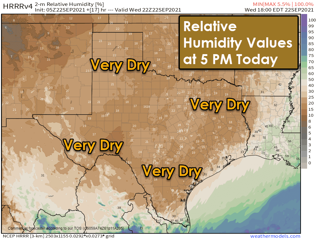

A very dry airmass will be in place across Texas this afternoon and through the next few days. Low humidity values (below 20 percent) along with northerly winds will result in an elevated risk for grass/brush fires today across Texas. Our relatively wet spring and early summer have provided abundant grasses – that have dried out some thanks to the recent hot weather.
If your browser does not display the graphic above, click here to view it.
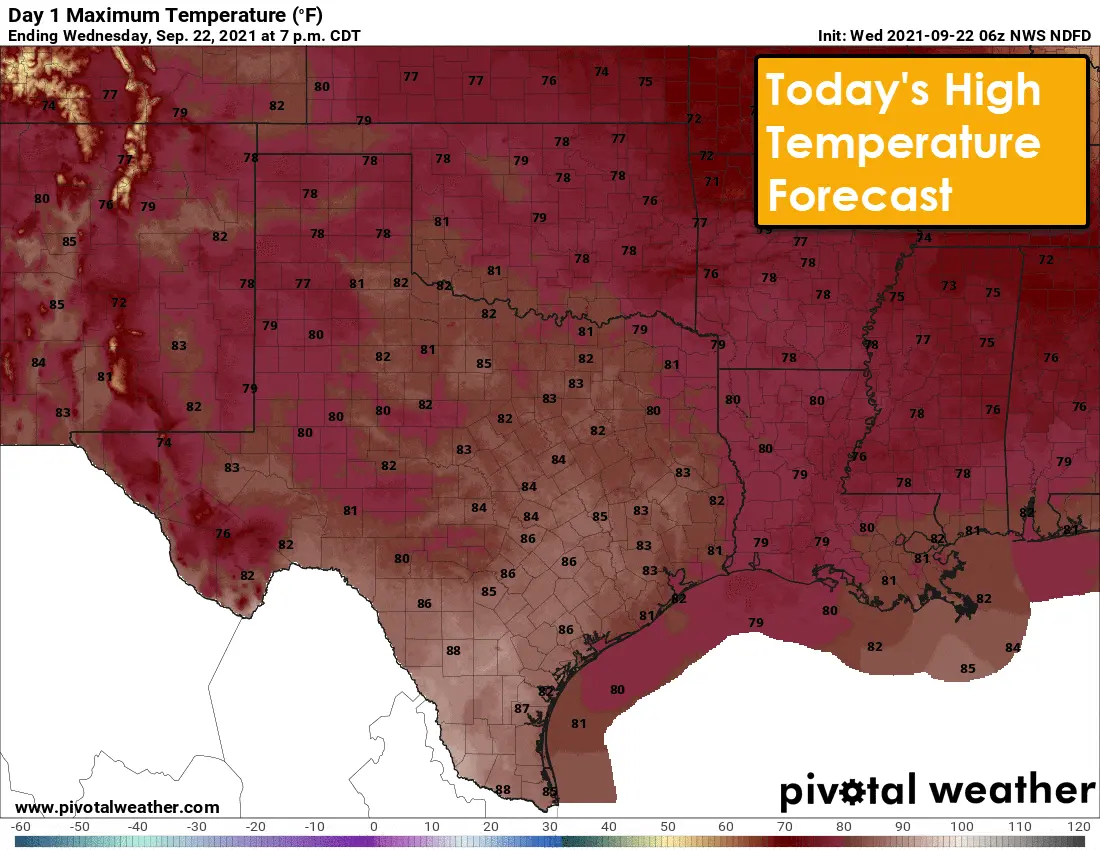
Today will indeed be a fall preview across Texas as high temperatures are a good fifteen to twenty degrees cooler than earlier this week. A very dry airmass and northerly winds will also make for a beautiful day. Clouds may hang in tough across Southwest Texas and South Texas, but rain chances will end this afternoon.
Tonight will be calm across Texas as light winds and a dry airmass promotes a quick cool off after sunset. Temperatures by morning will range from the upper 40s to the middle 60s (coolest in sheltered locations, warmest along the immediate Texas coast, and the heat islands).
Afternoon temperatures will start rebounding up on Thursday and Friday. Still, overnight lows will continue to be comfortable as a dry air mass remains in place. We’ll begin to see moisture levels increase on Sunday and into early next week. Our next upper-level storm system and at least a slight chance for rain look to arrive on Monday or Tuesday.
Have a great Wednesday and enjoy the beautiful weather!


0 Comments