
Record temperatures and continued below average rainfall resulted in a not-so-pretty picture in the hydrology and wildland fire department. The Texas A&M Forest Service and local fire departments have been busy with many wildfires over the last month. After a brief respite from the heat, we’re heading back into a hot/humid pattern for the weekend. Typical summer heat this time, not 114 degree heat of doom.
August 2 Drought Monitor Update
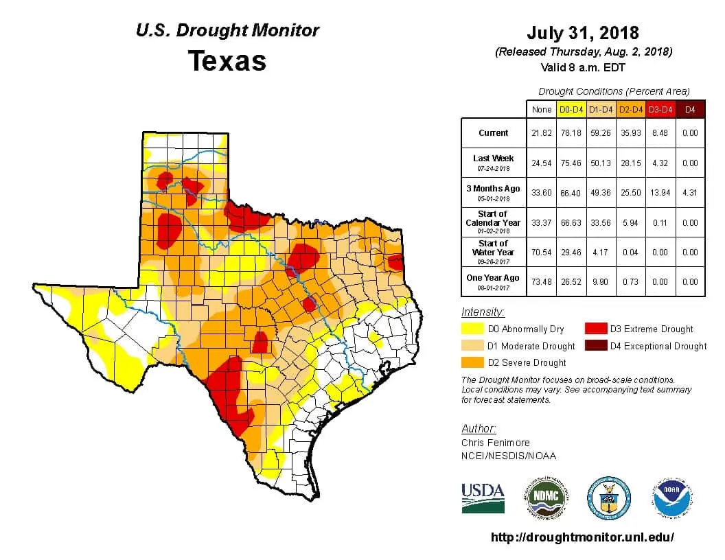
Extreme drought designation has expanded again in this week’s drought monitor. Those splotches are shown in red. They include portions of the Edwards Plateau, Hill Country North Texas, Northwest Texas, into portions of the southern Texas Panhandle and West Texas.
On the opposite side of the spectrum – the northern half of the Texas Panhandle is completely out of drought conditions. That’s a big shift from back in April. The Permian Basin, Rio Grande Valley, Coastal Bend, up into Southeast Texas are also excluded from any drought designation.
Percent of Normal/Average Rains since May 1
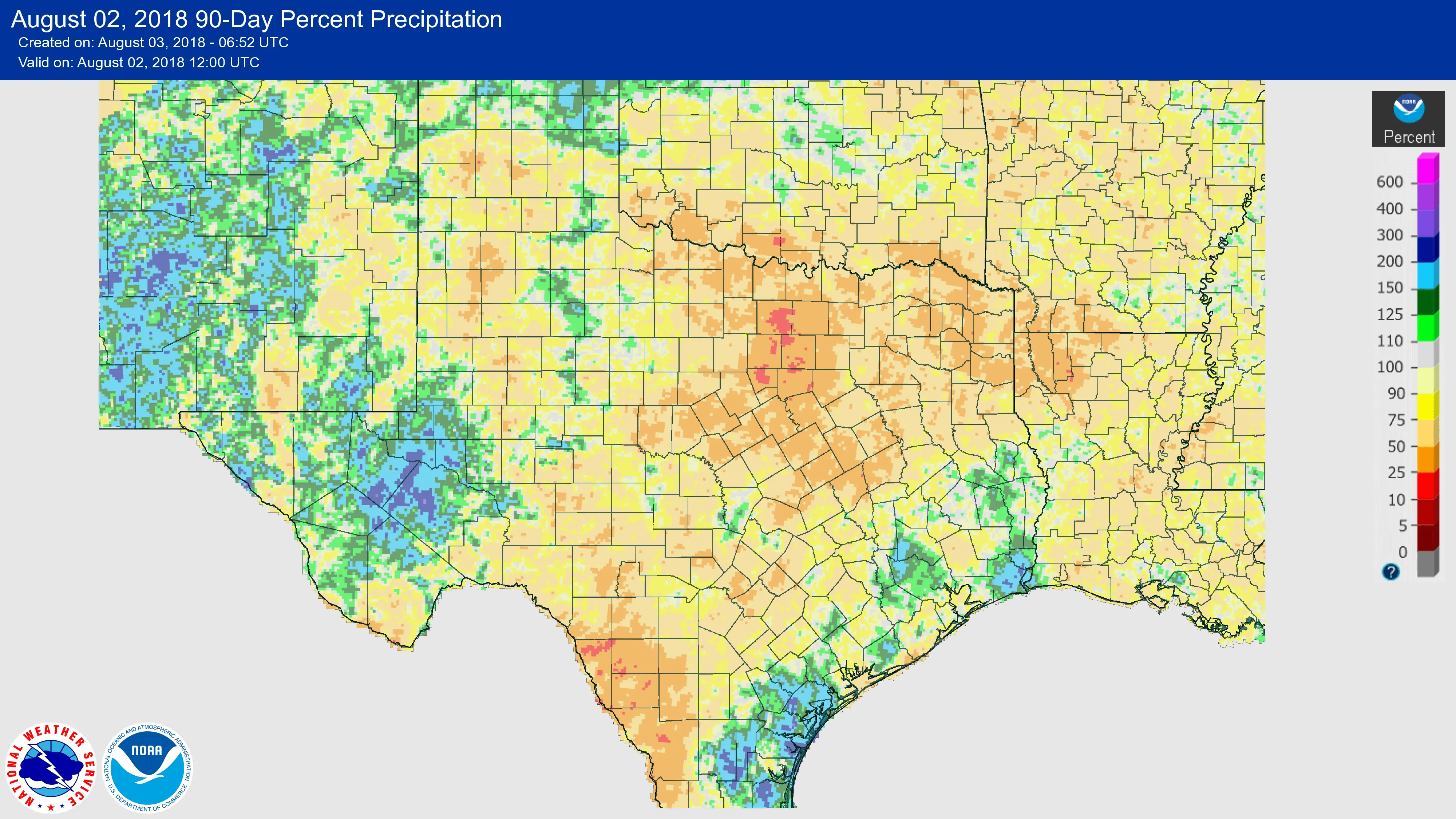
Significant precipitation deficits were observed over the last three months across Texoma and North Texas south toward the Edwards Plateau. These regions have received less than 25% of their usual precipitation since May 1. The worst off are closer to 10 percent of their average three-month rain totals. Above-average temperatures over the last month along with the lack of rain has resulted in an uptick in wildland fires.
Chris Fenimore at NOAA authored this week’s drought monitor update. He notes that
…There was a precipitation surplus in parts of western Oklahoma stretching into north Texas, prompting the further contraction of drought and abnormal dryness there as well as in the central part of Oklahoma. In northeast Oklahoma, abundant precipitation the past 30 days prompted the removal of D3. Drought/dryness continued for much of Texas. Precipitation departures mounted, with precipitation approaching 10 percent of normal at the 30-, 60-, and 90-day time periods in much of south and east Texas. Exceptional drought was added to some locations in the south-central part of the state where the dryness is the worse as well as in north-central Texas along the Oklahoma border.
Hope on the horizon…
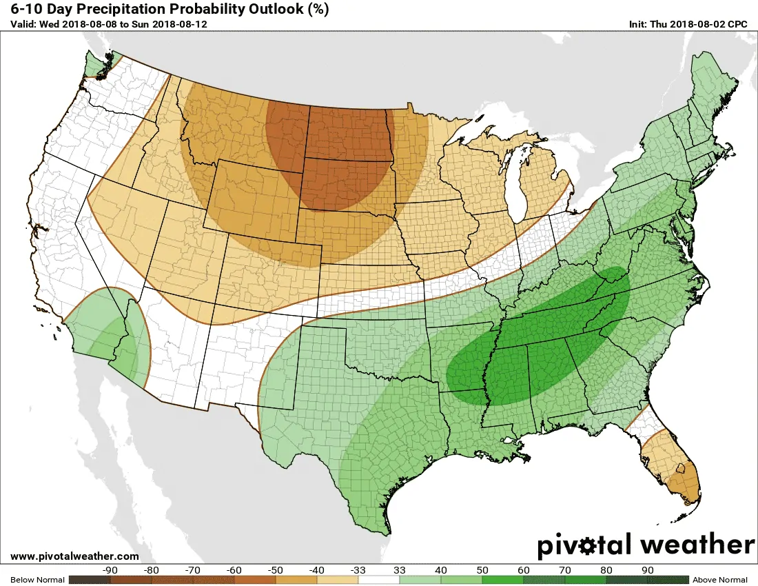
We’re already looking ahead for our next pattern change. This hot/humid pattern we’re back at least has a light at the end of the tunnel. The longer-range weather model data is optimistic in showing the heat ridge shifting back to our west by the second half of next week. That would result in cooler temperatures, increased cloud cover, and an increase in precipitation chances. Who knows – perhaps we’ll even get another rare summer cool front. I won’t speculate on any of that at this range, but the Climate Prediction Center is showing an above-average chance of rain in the six to ten day timeframe.


0 Comments