
Let me start off by saying we’re not expecting any severe weather issues this morning or early this afternoon. The initial severe weather threat will develop across the eastern Texas Panhandle and West Texas by mid-afternoon. Pockets of showers and storms are possible further east into Texas before that point. However they are unlikely to be severe.
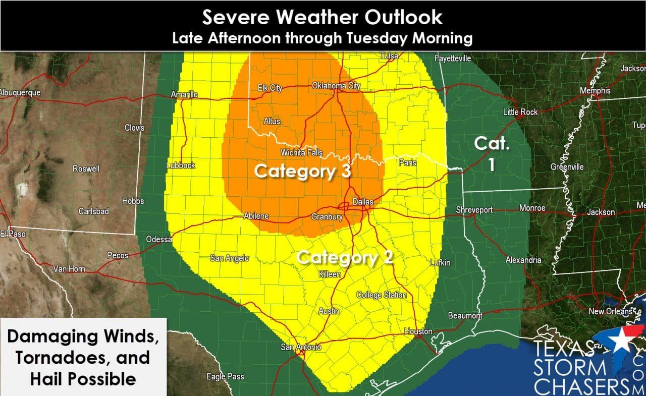
An enhanced severe weather risk will develop by late afternoon across the eastern Texas Panhandle and parts of West Texas. Initial thunderstorm development should take place between 3 and 5 PM. Some of these storms will be supercellular and moving quickly to the northeast around 50 MPH. Very large hail up to the size of baseballs, localized damaging wind gusts over 70 MPH, and tornadoes are all threats with these initial storms. I am somewhat concerned about the tornado threat as ingredients by and after sunset will be quite conducive for tornado development.

Those in the eastern Texas Panhandle and Northwest Texas need to be on their game tonight. Be ready to move to a safe place if a dangerous storm approaches your location. By mid-evening we’ll see a line of severe thunderstorms moving east across Northwest Texas, the Big Country, and the Concho Valley. Damaging straight line winds of 60 to 70 MPH will be possible with the strongest segments in the line. Isolated destructive wind gusts over 80 MPH are possible. Brief embedded tornadoes will also be a threat. Any discrete thunderstorms ahead of the line could have an enhanced tornado threat overnight. We’ll have to closely watch for those cells. The squall line will approach Interstate 35 from the Red River south into Central Texas between 2 and 4 AM Tuesday with a continued severe weather threat. The highest severe weather threat should be across Oklahoma and North Texas where widespread damaging wind gusts will be a significant hazard overnight. Brief tornadoes will also be possible during this timeframe. As the line of storms moves east we’ll continue to deal with a damaging wind threat across Northeast Texas, East Texas, and Southeast Texas into the day on Tuesday.
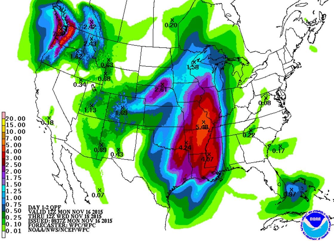
Projected rain accumulations through Tuesday
In addition to the severe weather threat there is the potential for localized flash flooding in Northeast Texas and Far East Texas. A Flash Flood Watch has been issued to account for that possibility. As the line of storms moves east tonight it could drop a quick inch or two of rain. The fast eastward progression of the squall line should prevent a widespread flash flooding threat. Nevertheless minor flooding is possible in typical trouble spots and in construction zones on roadways.
An updated severe weather outlook will be issued by the Storm Prediction Center around 7 AM CT. We’ll share it shortly thereafter if there are any substantial changes.


0 Comments