
Good morning and happy weekend to everyone! For folks that have been on Spring Break this week, I hope everyone has enjoyed the overall pretty decent weather, although we really could use some rain. Our focus for today’s weekend blog will be the ongoing threat for wildfires out west and the return of widespread rain and possibly severe weather on Monday.
Wildfire Threats This Weekend
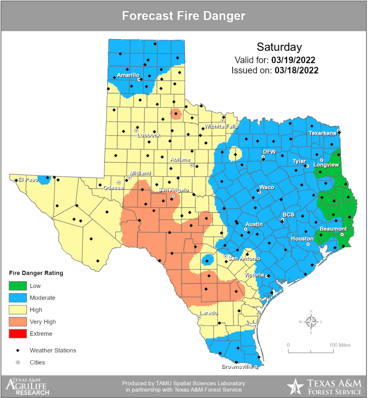

For both today and Sunday, almost the entire expanse of western Texas, including much of the Texas panhandle will remain under a threat of wildfires due to very dry air, low humidity and breezy sustained winds. Stronger sustained winds will arrive on Sunday and pretty much this entire region will therefore be under Fire Weather Watch, and possibly elevated to Red Flag conditions. It goes without saying that residents in this region will need to be extra cautious with any activity that cold cause a spark…burning, welding, idling engines over dry grass, BBQs, backyard fire pits, cigarette butts, etc. Please do not hesitate to report any fire you see to 911 immediately!
Monday’s Severe Weather Threats

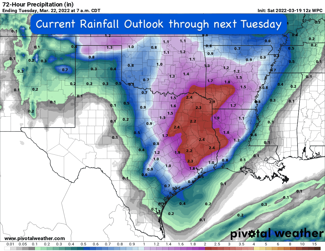
Monday will be a day you want to keep an eye on…especially for residents in Central Texas and Eastern Texas. A strong upper level system will push into the state by early Monday bringing widespread rainfall during the early to middle part of the day on Monday, then increasing chances for severe weather as we head into the afternoon hours as the atmosphere continues to destabilize. At this point in time, the locations in Texas with the greatest threat for seeing severe storms on Monday afternoon will be mainly in the central Texas/Brazos Valley region that lies south of I-20, north of I-10 and between I-35 and I-45. As we get into the evening and overnight hours, this risk location will shift east towards the piney woods and Sabine river, but will remain triangled south of I-20, north of I-10 and along and east of I-45. These locations are where the Storm Prediction Center has placed an Enhanced Risk (Level 3) for Monday. All modes of severe weather will be likely with this system including the threat for flash flooding, large damaging hail up to the size of tennis balls, damaging winds and tornadoes. It’s important that you have your weather radios ready to go for this event. If you use Apps on your smartphone for notifications, make sure you’re phone volume is turned up loud enough for you to hear. Pay attention to your local news media outlet during the day as well for any important updates on the weather conditions in your immediate area. The forecast will continue to refine over the next 48 hours and we will provide several updates including blogs and live video forecasts Sunday and into Monday morning. Our Baldy in Chief, David, will also be handling live storm coverage on Monday, so we’ll have plenty of information out there for folks during this next severe weather event.
Weekend Temperature Outlook


0 Comments