
All images and animations may be viewed full-screen by tapping on the image. That includes our mobile app, where animations will not natively play without being tapped. Feel free to watch our video update at the bottom of this post for a full update.
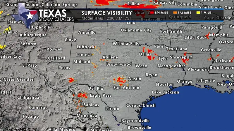
Fog will become dense and widespread across the northwestern half of Texas tonight through Thursday afternoon. Some locations will remain entrenched in fog for much of Thursday. Where temperatures fall below freezing across the Panhandle and West Texas tonight, freezing fog is expected, with ice accumulating on exposed objects. Travel may become impacted.
Fog will become widespread and significantly reduce visibilities Thursday morning across the northwestern half of Texas. Unlike most days, dense fog may continue through the afternoon from the Hill Country northwest into West Texas and the Panhandle. Temperatures will be below freezing in the Panhandle and West Texas, resulting in freezing fog. Ice accumulations are possible with freezing fog, resulting in slippery travel conditions. Elsewhere, temperatures will remain safely above freezing, with ‘just’ fog.
Panhandle Snow
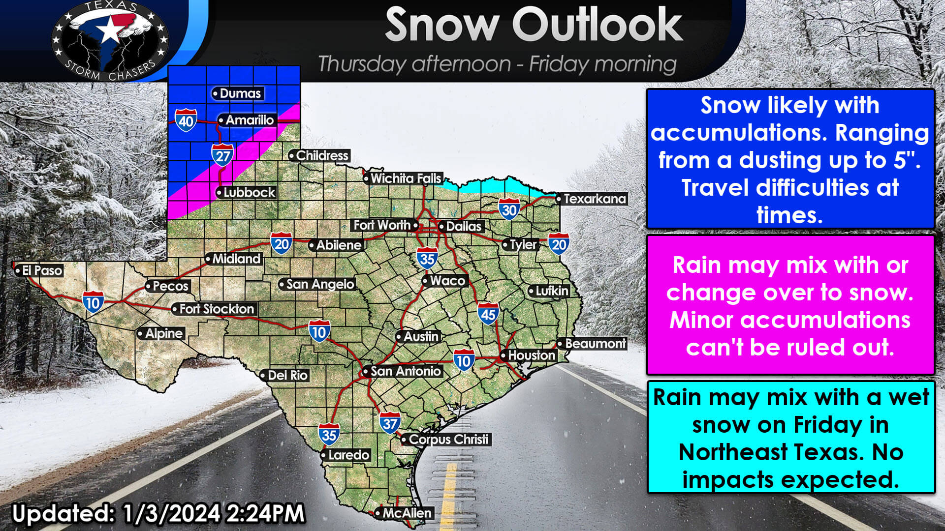
Accumulating snow is expected on Thursday across the Texas Panhandle. A smidgin’ of snow is possible farther south into West Texas. Some slick/snow-packed roads are expected. We may also see rain mix with snow in Northeast Texas Friday afternoon, with no impacts expected there.
Precipitation moves into Far West Texas (El Paso) late tonight with a quick round of rain and a rain/snow mix in the higher elevations. Rain, mixing with or changing over to snow, is likely across the Texas Panhandle down into the South Plains, likely west and north of Lubbock on Thursday. Snow accumulations are possible, and travel may become adversely affected. The highest chance for several inches of snow will be west of a Muleshoe to Canyon to Borger to Perryton line. Snow isn’t out of the question farther southeast toward Morton, Lubbock, Plainview, McLean, and Canadian, but confidence is lower. Temperature trends will need to be monitored. If we end up a degree or two colder, that will result in more snow.
Rain & Storms
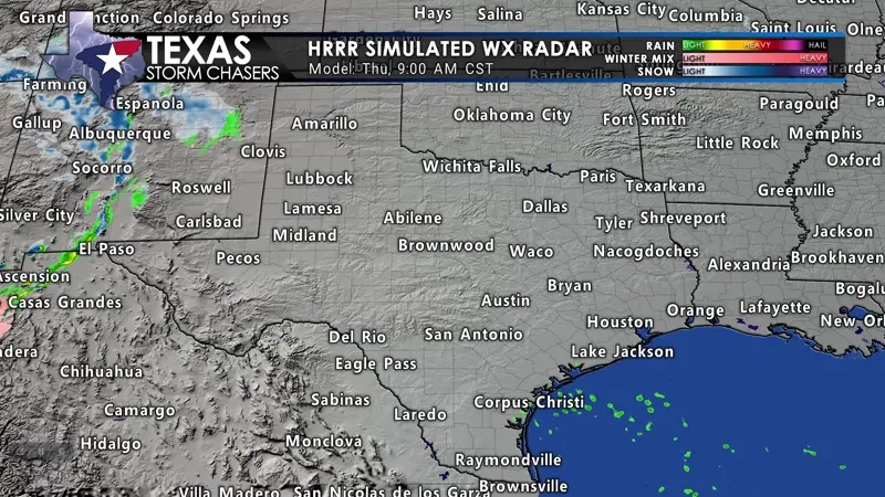
Our second storm system will move from west to east across Texas on Thursday through Friday morning. Rain will mix with or change to snow in the Panhandle and perhaps parts of West Texas. Rain is expected elsewhere. All rain exists in Texas to the east by Friday afternoon.
Showers and thunderstorms are expected across the eastern half, to perhaps the eastern two-thirds of Texas, Thursday afternoon into Friday morning. Some storms may produce small hail and heavy rainfall. We expect another quick-hitting round of rain, just like a few days ago. The fast-moving rain will limit rainfall amounts, but we’ll still likely pick up one-quarter to one inch of rain across the eastern third to the eastern half of Texas. There are no significant flooding or severe thunderstorm concerns with this system. Rain may mix with a bit of snow in Northeast Texas as precipitation ends Friday afternoon. No impacts are expected.
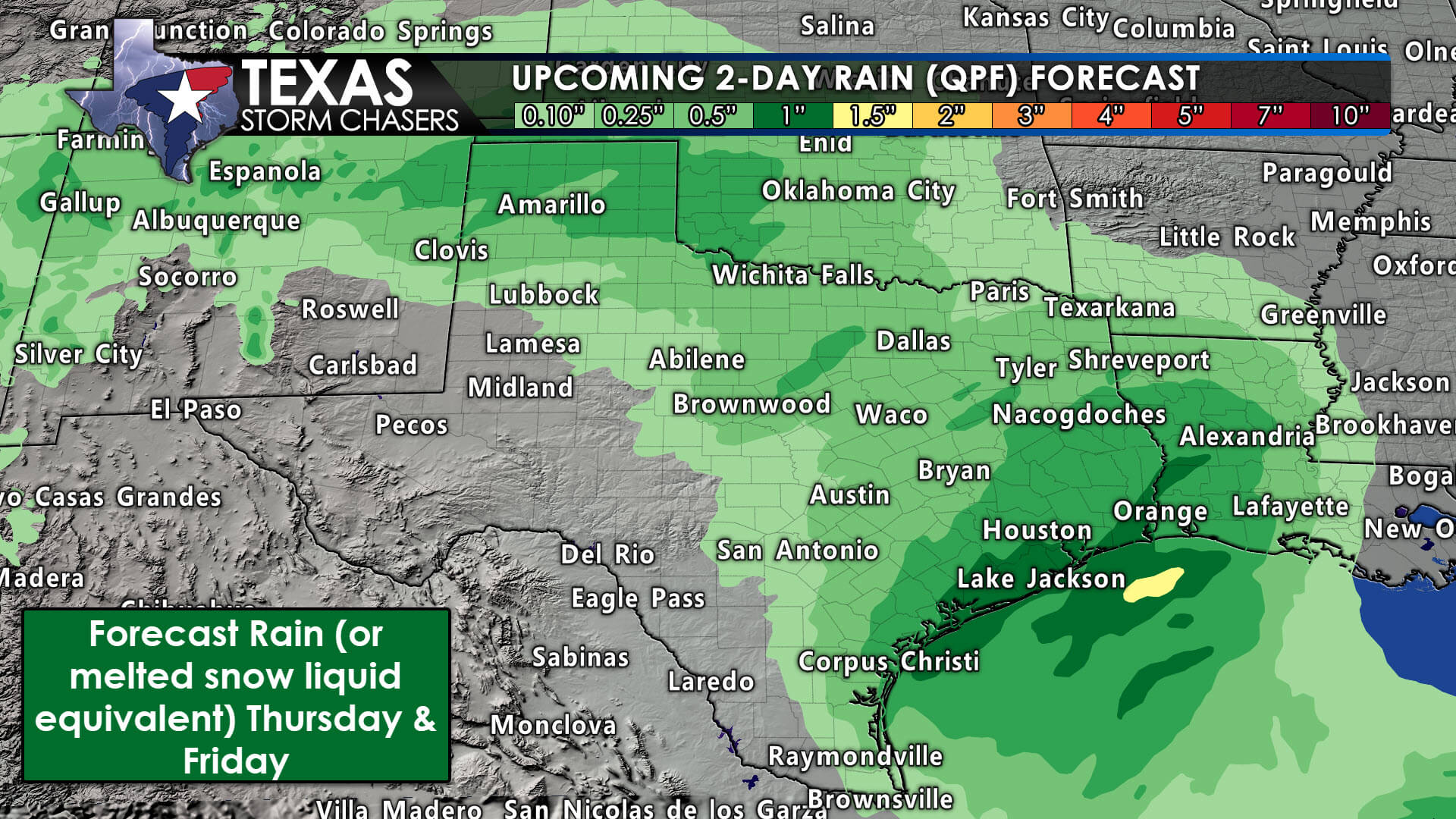
The fast-moving rain will limit rainfall amounts, but we’ll still likely pick up one-quarter to one inch of rain across the eastern third to the eastern half of Texas. There are no significant flooding or severe thunderstorm concerns with this system.
Rain will move east of Texas by Friday afternoon, leaving us mostly dry from Friday evening through Saturday. Another strong upper-level storm system arrives Sunday night and Monday, and we anticipate we’ll be a bit busy with thunderstorm potential in Southeast Texas and the possibility of accumulating snow and wind in the Panhandle. Strong winds are more likely with this upcoming system early next week state-wide.
Get the FREE Texas Storm Chasers Mobile App for your local weather forecast, interactive weather radars, live Texas weather coverage, and more! Available in your device’s app store.
0 Comments