
A Pacific cold front is moving through the northern part of the state this evening and will arrive along the Texas gulf coast by mid day tomorrow. This isn’t an especially strong front, and it’s arrival is not creating much of a fuss, but it will do a reasonable job of dropping temperatures back down to where they should be in late January bringing an end to the spring like weather we’ve enjoyed the past couple of days. We do have a chance at seeing some scattered showers early Wednesday across southeast Texas as the front makes its way towards the coastline, but beyond that, we remain mostly dry for the remainder of the work week.
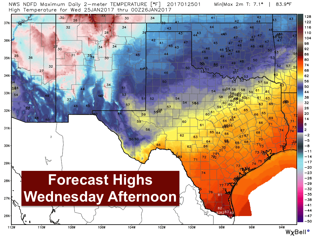
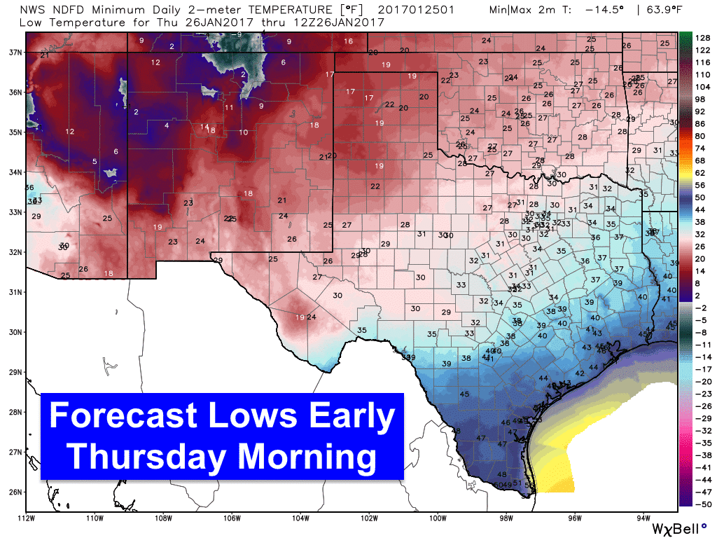
Forecast highs tomorrow will remain quite warm and pleasant across southeast, south central and deep south Texas before the front arrives. As you head further north though, daytime highs will drop off pretty significantly and into the 50s across parts of north Texas with 40s across much of the panhandle. Thankfully, we won’t be seeing the windy conditions that have plagued the panhandle and western parts of the state over the past couple of days; however, we will continue to see a threat of grass fires across southwest Texas including the Edwards Plateau region, Rio Grande Valley region and deep South Texas through tomorrow. Overnight lows going into Thursday morning will become quite chilly across the panhandle which will see lows in the teens and 20s. Much of north and central Texas will see lows dip down into the 30s and the coastal plains will see lows drop into the 40s. Another push of cooler air is expected to arrive Friday which will retain more seasonal temperatures for the state through the weekend ahead. Rain chances return by late Friday into Saturday across southwest Texas and the Rio Grande valley, but rainfall amounts look meager at best.


0 Comments