
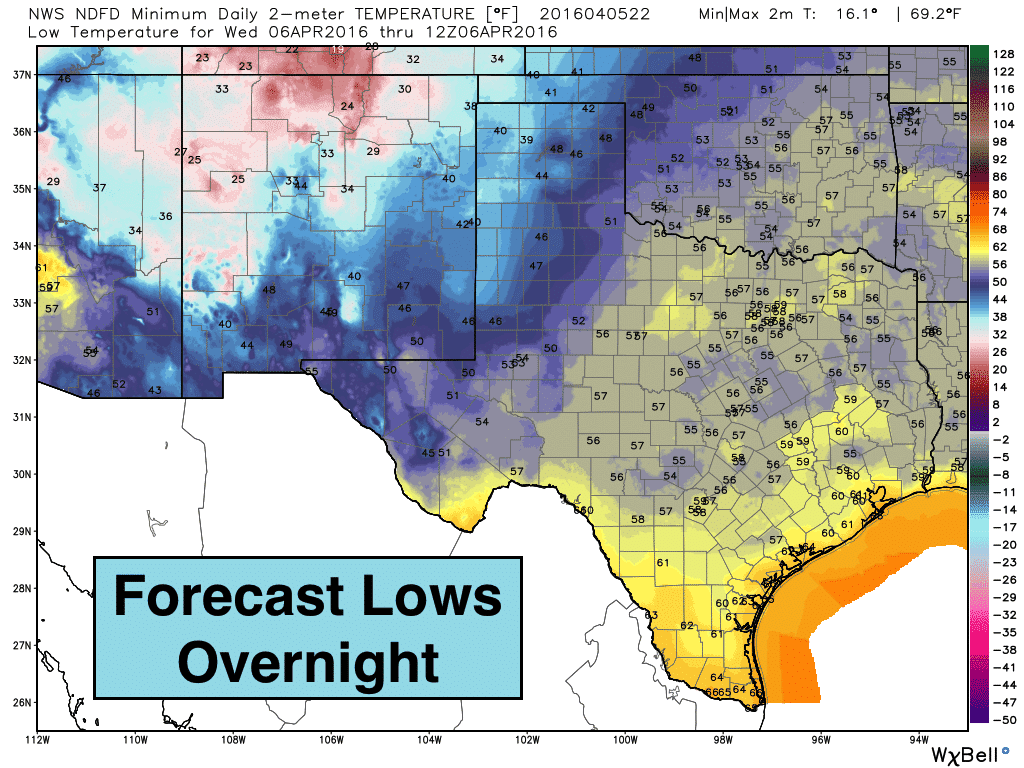
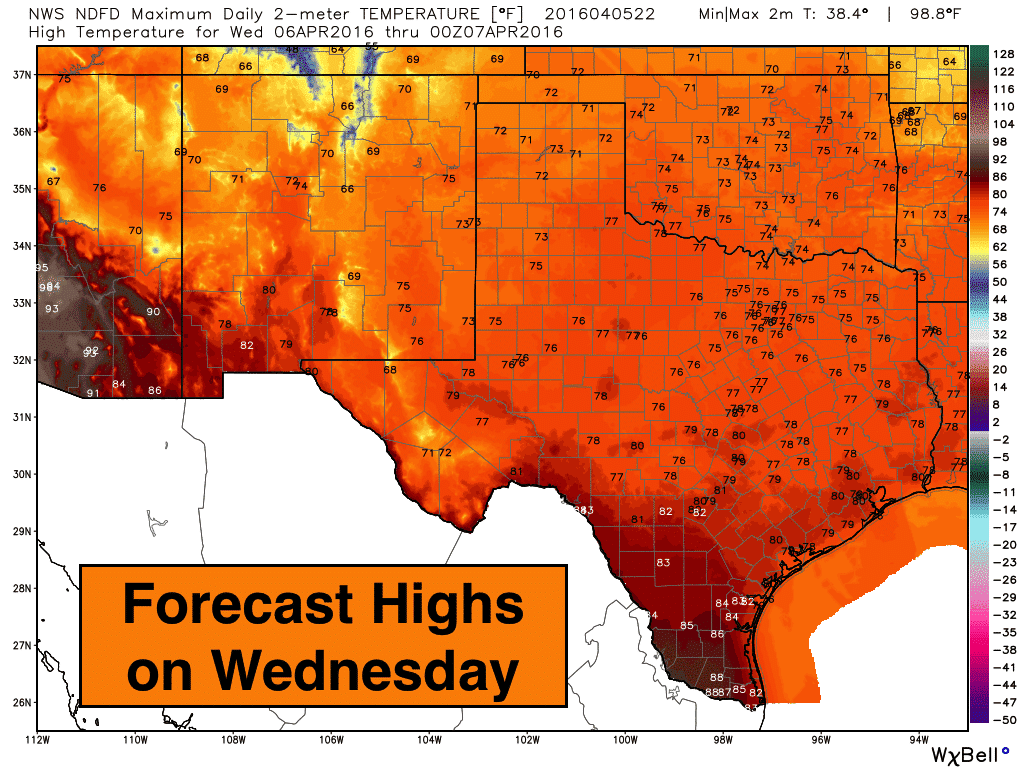
A cold front will push through the panhandle into northwest Texas before dawn tomorrow, and make its way down to the coast by the late afternoon hours. We have virtually no chance of meaningful rainfall with the passage of this front…just patchy to dense fog tomorrow morning with light drizzle/showers possible ahead of the front tomorrow morning for the coastal counties. This next front will also not have much of an impact on our daily highs tomorrow. We may have some gusty north/northwest winds behind it which will make it feel slightly cooler, but highs tomorrow are still expected to reach levels at or just above seasonal averages for this time of the year. The post frontal gusty winds will begin to diminish from north to south as we progress through Wednesday afternoon.
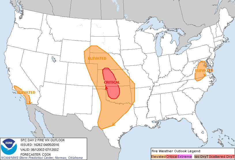
With continued lack of rainfall across much of the panhandle, west and western north Texas so far this season, the danger for wildfires will continue into Wednesday. Winds will be lighter tomorrow afternoon across the panhandle, which will preclude the issuance of a critical fire weather outlook like we saw today. But the danger for grass fires will remain present with low humidity and warm temps continuing across the region.
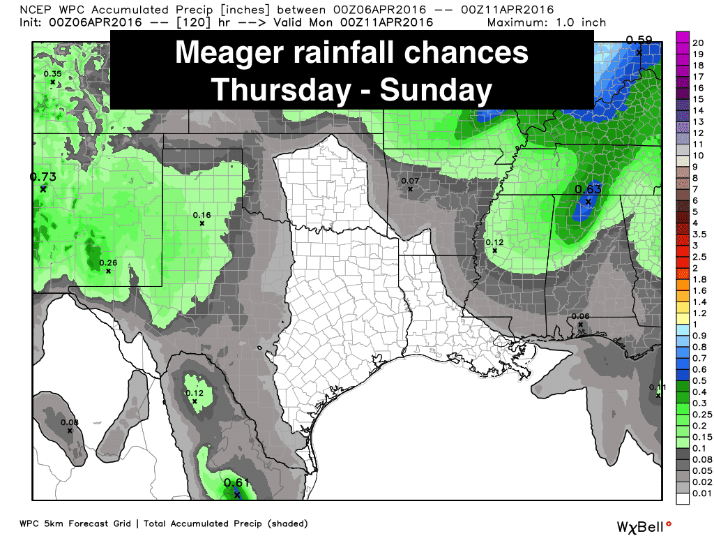
Rainfall prospects across the western half of the state for the coming weekend are still a bit unclear, but are beginning to shape up in the long-range models. A low pressure trough will move into the desert southwest region by Saturday. Mid to upper level moisture will increase across the western half of the state, but it won’t be until Sunday before we see much in the way of surface moisture work it’s way north and west across the region, and we need that surface moisture if we’re going to see any chance of rain or storm development as lift from the approaching upper level low arrives. For right now, slight chances look the most likely on Saturday across the western half of the state, with better chances arriving Sunday afternoon through Sunday night along and ahead of a dryline expected to develop somewhere across the western to central panhandle region. We could see the threat of some severe weather along the dryline Sunday afternoon and into the evening hours, but with that still being so many days out, we can’t get into specifics just yet. We will be keeping an eye on that, and the potential for a more unsettled rainy pattern setting up for next week as it gets closer.
Last but not least, don’t forget to check out or T-Spring campaign we have going on right now! We’ve brought back our most popular logo design for just one week ending Sunday! But wait, there’s more! This time, we’re offering a basic tee, sticker, premium unisex tee in multiple colors, and a women’s tee….all in sizes up to 5XL! Click on the link below to purchase!


0 Comments