
We interrupt your regularly scheduled summer weather for a short-duration treat – crashy the cold front! Yes, at least half of Texas is going to enjoy a brief respite from the summer heat and humidity over the next 36-48 hours. As someone who hates humidity more than mosquitoes, I’ll say I’m personally thrilled for a June cool front – even if it only sticks around for a day.
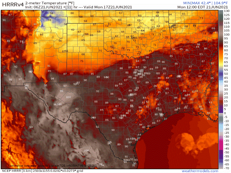
HRRR: Surface temperatures every 3 hours from 12 PM Today to 12 PM Tuesday
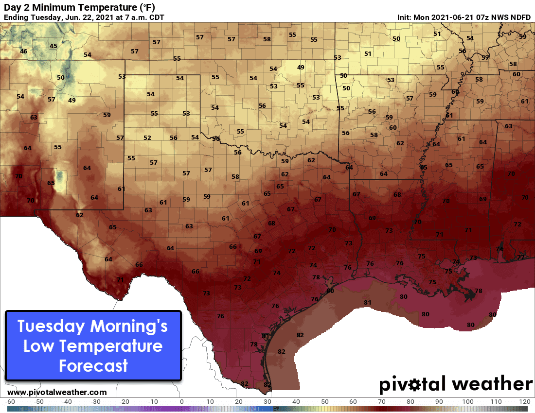
The cold front actually looks like it’ll make it south to Interstate 10 by Tuesday morning – a rather difficult feat for the summer months. Those across the northern half of Texas will have low temperatures drop into the 50s and 60s by sunrise Tuesday. The Hill Country and Central Texas may also get in on some less humid air for a time on Tuesday.
Unfortunately, the break from summer will be short-lived. Humid and hot weather will return to all of Texas by Wednesday. Those across the southern half of Texas won’t see any summer relief, but increased rain chances are forecast tonight and Tuesday.
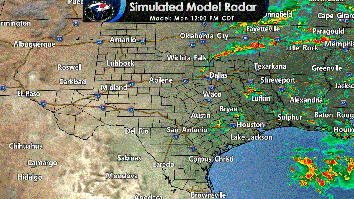
Scattered thunderstorms are expected to develop near the cold front as it moves south today. Given the summertime atmosphere ahead of the front, some storms will probably become rowdy with strong outflow winds and hail. Dangerous cloud to ground lightning will pose a hazard to those at camp or out on the lake. Scattered summer-time storms are also expected this afternoon and evening across East Texas and Southeast Texas. Storms this afternoon across northern Texas may move south into Central Texas this evening – with some storms producing strong winds and hail. A quick inch or two of rain is a good bet if you have a strong storm move overhead. So now it is time for a few of the ‘safety messages’
- When thunder roars, go indoors! This includes those at outdoor sporting events, camps, state parks, etc. Summer storms don’t play around in the lightning department.
- Get off the darn lake before the storm arrives. We don’t need anyone capsizing their boats because of outflow winds well before any rain falls.
- Turn around – don’t drown! Some street flooding is a good bet today. Don’t make it onto tonight’s news because you drowned out your vehicle.
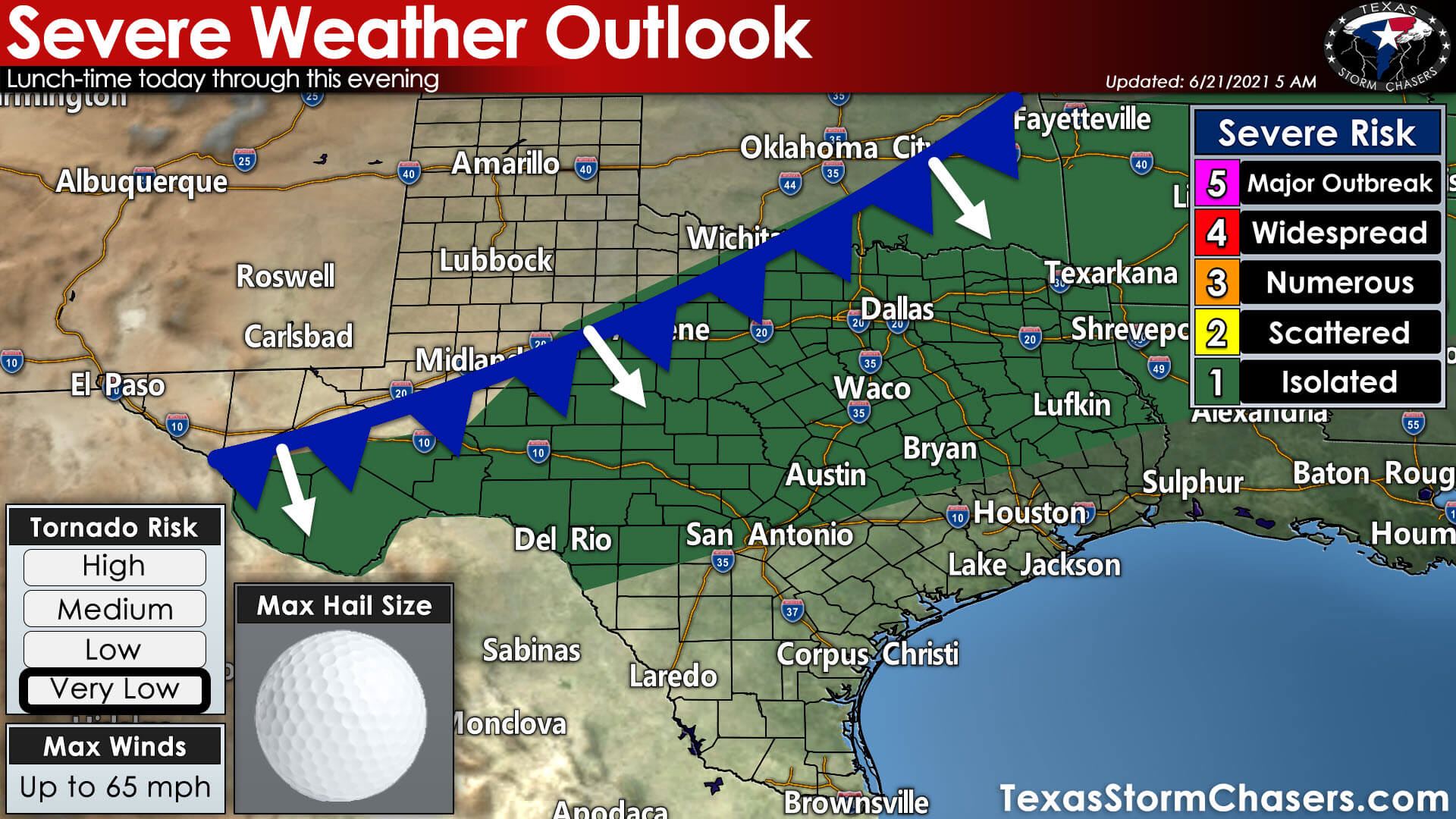
The Storm Prediction Center has highlighted an isolated severe weather risk today and tonight. As I described previously, stronger storms today could produce large hail and strong outflow winds. Today is not a ‘tornado day’ or one where widespread severe thunderstorms are expected. However, I do remind you that summer storms tend to produce abhorrent amounts of lightning – which is hazardous to anyone outdoors. Most folks will *not* be impacted by a ‘severe storm’ (1″+ hail or 58+ MPH winds). Yet, summer storms in a summer-time environment will try their best to capsize boats on lakes and shoot off enough lightning to make midnight look like it’s the afternoon.
Keep an eye on the sky and head indoors if a thunderstorm approaches your location. You can keep tabs on any stormy mischief with our interactive weather radar here (those using our free mobile app can click the ‘radar’ button on the bottom menu)


0 Comments