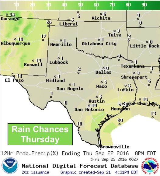
Big changes in the forecast this weekend with good chances for rain Saturday and Sunday along with much cooler temps through most of next week! But before we get to that, let’s take a quick look at tomorrow’s forecast. Highs once again will be above normal with widespread upper 80s to mid 90’s across the state. Thankfully, heat index values will not be quite as high tomorrow as drier air continues to filter in across the state. Cities along the coast will see the highest heat index values tomorrow above 100 degrees, but elsewhere, the values will be close to the actual temperature. Rain chances will also be slim with the best chances along the coastal plains with the daily seabreeze front.
Now let’s skip ahead to this coming weekend when couple of things will come together to bring us a good chance for rain and much cooler weather which looks to last well into next week. First, our resident dome of high pressure will begin to drift east and settle in over the deep south while a trough of low pressure arrives from the west. Rain chances will begin from west to east in earnest early Saturday ahead of a cold front which will slowly make its way through the state on Sunday. Not everyone will see rainfall all at once. What we’ll most likely see is rain chances beginning across the western half of the state early Saturday which will slowly work its way to the southeast ahead of the frontal boundary. By late Sunday, we’ll see rain chances ending across the northern half of the state as the widespread area of rain drifts into the southern half of the state. It’s still too early to narrow down the best locations for rain, but right now it looks like parts of north central, central and south central Texas could pick up a good 1-3 inches Sunday into early Monday with some pockets of higher rainfall totals likely.


Behind Sunday’s cold front, temps will cool considerably into early next week with highs a good 10 degrees or more degrees below seasonal averages Monday through at least Wednesday. If the current forecast remains consistent, we will see highs struggle to reach the mid 60s to low 70s across the panhandle on Monday. West Texas will likely see highs in the mid to upper 70s, with low 80s across parts of north and northeast Texas. Tuesday looks equally as pleasant with highs ranging from the low 70s to mid 80s across a majority of the state. Lows both days will drop down into the 50s and 60s and feel wonderfully crisp and pleasant for those early morning walks. This will certainly be a nice change from our current late season heat wave! We will be monitoring the latest forecast data as we head into the weekend, so be sure to check back for updates!


0 Comments