
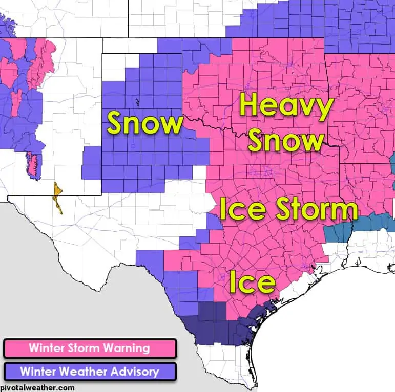
I hope you all have been able to stay warm overnight. At the time of this posting are over 4.2 million customers without electricity in Texas. This morning was the coldest recorded in the last thirty to one-hundred years. Several towns in East Texas set all-time new record lows well below zero. I wish I could say the weather would be better from this point on, but I’m afraid it is not. A significant winter storm, the third or fourth round of winter weather in the last week, is on our doorstep. We’re also far more concerned about an ice storm than we were with the Sunday event.
Timing and precipitation type
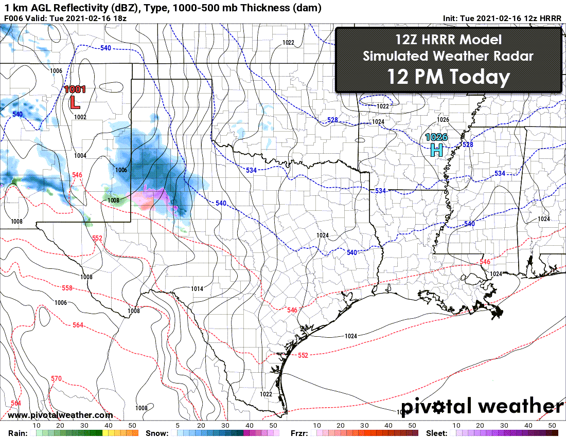
Simulated weather model radar for Texas.
Snow will be underway by lunch-time in parts of the Texas Panhandle and West Texas. By mid-afternoon, we should have snow extending from the Texas Panhandle south/southeast into Northwest Texas and the Big Country. We may have more of a wintry mix in the northern Concho Valley and Big Country at times. Most snow will be moving into the eastern Texas Panhandle, Oklahoma, and Texoma by dinner-time. The heaviest snows will probably be right on the Red River and up in Oklahoma.
Additional heavy precipitation will develop farther south across the eastern Permian Basin, Concho Valley, and Hill Country this evening. By midnight, significant winter precipitation should be underway across much of North Texas, Central Texas, the Hill Country, Northeast Texas, and some of East Texas. Precipitation across the Hill Country and Central Texas will likely be freezing rain or sleet.
Freezing rain will be falling overnight in South-Central Texas, Central Texas, the Brazos Valley, and parts of Southeast Texas and East Texas. Our first round of heavy winter precipitation will be exiting Texas to the east around lunch-time Wednesday. Patches of light winter precipitation are possible Wednesday afternoon and Wednesday evening. Where those occur, travel conditions, if not already rotten, certainly won’t get any better.
Roads and other impacts…
Any winter precipitation that falls tonight and tomorrow will accumulate on top of whatever fell on Sunday. Any roads that may have been cleared will quickly become slick and hazardous. We note that this event will include much more sleet and freezing rain. Freezing rain is a big problem for power lines, trees, and travel conditions. Sleet will turn roads into ice hockey playing fields (with the hockey puck being vehicles). Sleet doesn’t pose as high of a threat to power infrastructure and trees. Snow will likely be wetter than the dry/powdery stuff we saw on Sunday, but again, it is quite preferable to freezing rain.
This can be a significant ice storm for southern North Texas and East Texas. Damage to power infrastructure and tree damage is becoming increasingly likely. I realize there is irony in talking about power infrastructure damage when so many are already without power. However, damage to power infrastructure could result in outages lasting for days in spots in those areas.


0 Comments