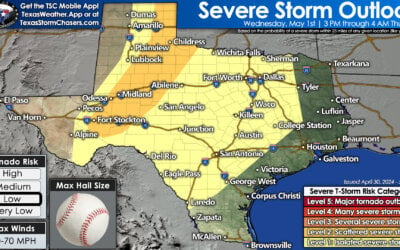
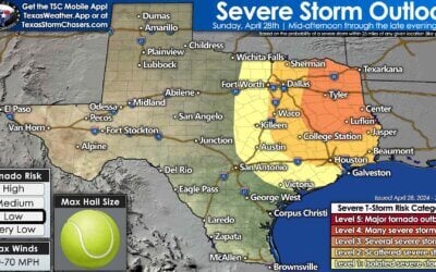
Rain and storms today across the southern half of the state should begin to decrease after the sun sets and we lose the effects of daytime heating. Widespread patchy dense fog is likely across south central and coastal Texas overnight and into tomorrow morning along with chances for some scattered showers. Temps overnight will be quite mild for this time of the year everywhere except for the panhandle region where a weak cold front is in the process of pushing south across the region. This front will move into the north Texas region by early tomorrow morning, eventually stalling out somewhere along the I-20 corridor by mid-afternoon.

Chances for rain and thunderstorms will increase once again tomorrow as the aforementioned cold front pushes south towards the I-20 corridor. Parts of north Texas will see showers develop tomorrow morning as the front moves through the region, eventually stalling somewhere along the I-20 corridor. As we get into the afternoon hours and peak daytime heating, additional more widespread rain and storm development will be likely for areas south of the front. This will include west central Texas, central Texas, the Rio Grande Plains and coastal plains. Widespread severe weather is not expected, but a few storms could become strong with gusty winds and lightning as the primary threats. Much like today, not everyone will see rain or storms. But for those that do end up under one of the stronger storms, they will also have the potential for brief periods of torrential rain.
Rain chances carry on into the weekend as well as Friday’s front retreats back to the north as a warm front before the next, stronger, cold front arrives late Saturday. Scattered showers are likely out ahead of the second front, but the best chances for seeing rain and storm development will be Saturday afternoon and overnight along the southward advancing front. The threat of severe weather ahead of the front Saturday evening and overnight looks pretty low at this time, but we’ll continue to monitor for any changes to the current outlook. One the front blows through, it looks like we’ll enjoy several days of cooler and much more seasonal weather before we heat back up again by the middle of next week.


0 Comments