
www.drivetexas.org
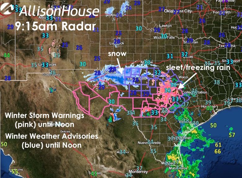
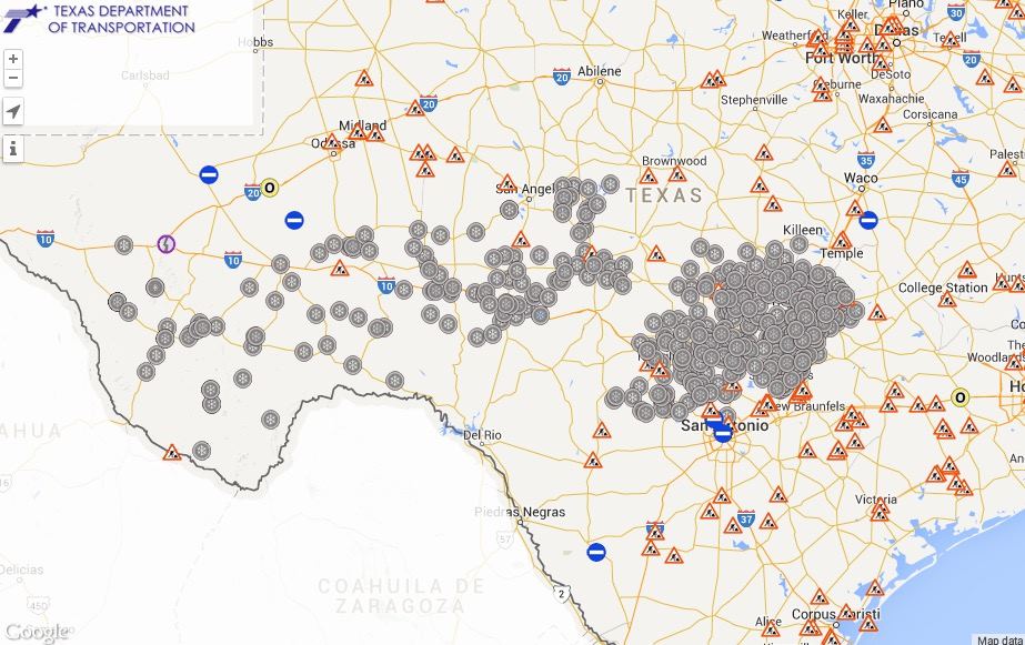
Areas of rain, freezing rain and sleet continue across parts of the Hill Country and west/west central Texas this morning. Further west between San Angelo and out towards Midland/Odessa a mixed bag of winter precip including some snow flurries is being reported. Winter Storm Warnings remain in effect for the Hill Country and Southern Edwards Plateau region, as well as the Marfa and Stockton Plateau region, Presidio Valley, Davis and Apache Mountains, Big Bend area and lower Trans Pecos region through noon today. So far, most of the ice accumulation reports have been coming in from the Austin/San Antonio area and counties just west of there. Local media in those areas are reporting that ice has/is shutting down some roadways in the area, so be sure to check local media or www.drivetexas.org for the latest details on roadway hazards.
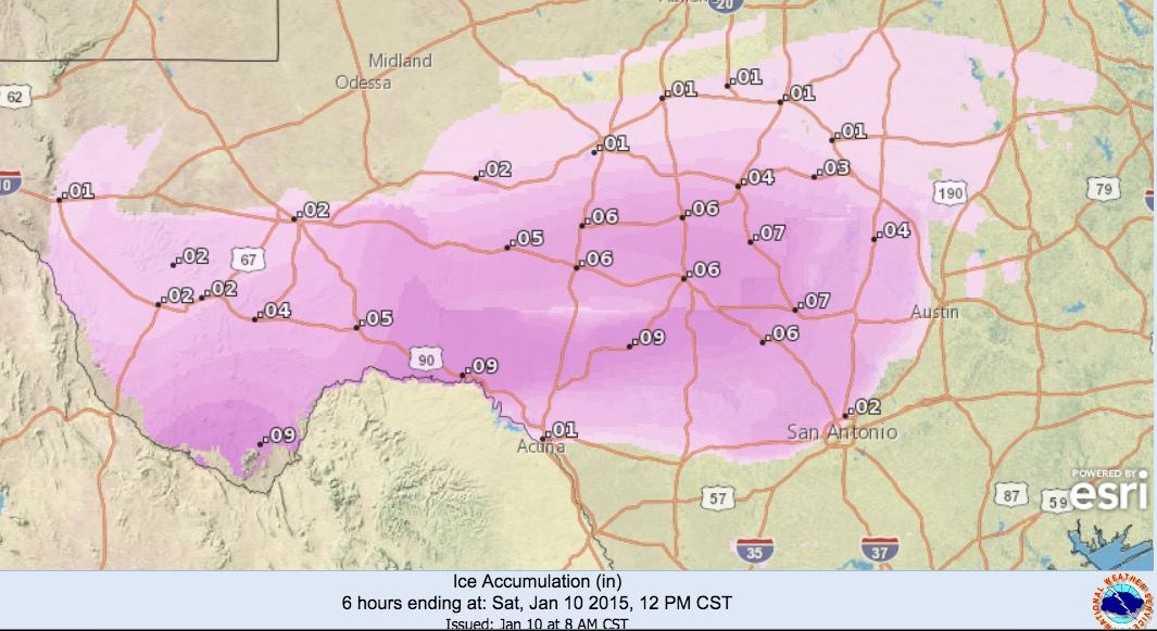
Ice Accumulations Expected Today
Temps across the Hill Country region are running between 29 and 32 degrees, so we can expect to see continued batches of freezing rain and sleet for several more hours until the temps rise to just above freezing and the precip will transition over to mostly rain. Not sure at this time if temps will get above freezing across the region long enough to really melt off all of the ice accumulations on roads and bridges, so residents in the area will need to remain cautious of re-freezing as we head into the evening hours.

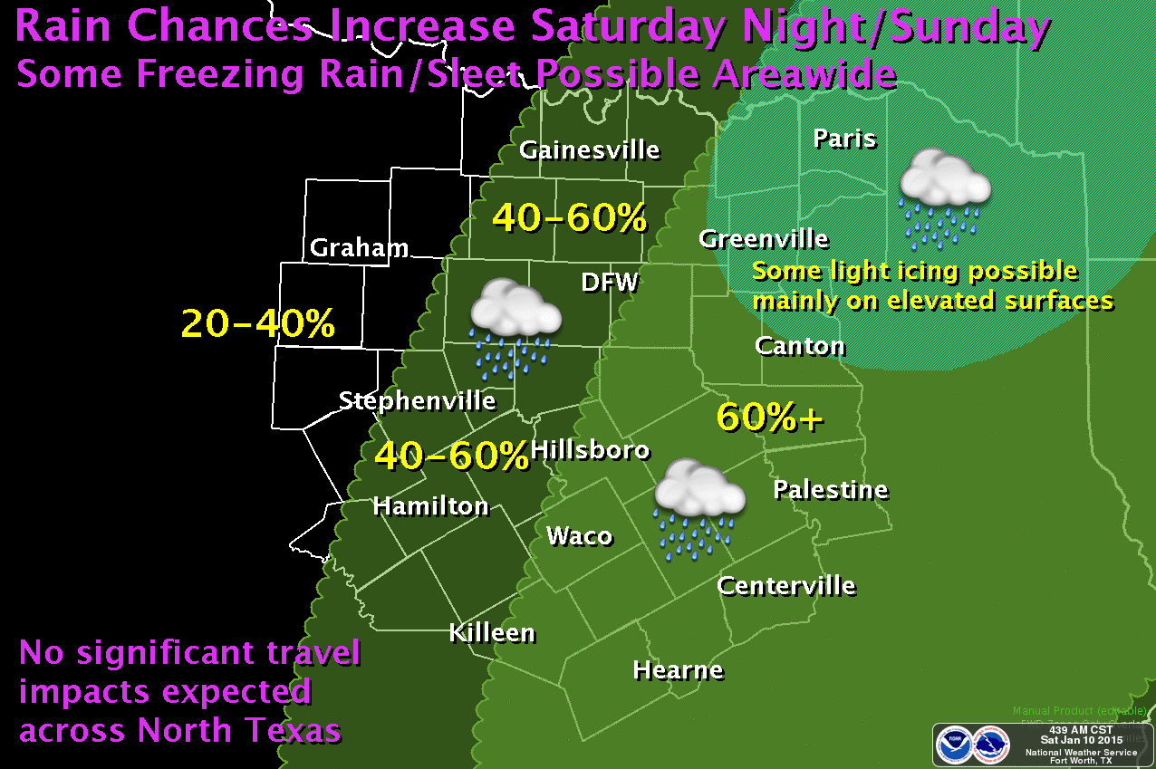
This entire area of precipitation will be moving north and east today eventually spreading across the northern and eastern half of the state by later this evening and overnight. Areas between Austin and Waco/Killeen could see continued chances for some freezing rain and sleet late morning and early afternoon. Parts of north Texas could see some freezing rain or sleet late this evening and overnight, but it’s expected that temps will warm and stay right at or above freezing today and tonight. Best chances for seeing any winter precip across north central and northeast Texas this evening or overnight will be up along the Red River valley region. The DFW metroplex is expected to remain mostly free of any winter weather impacts other than just wet roadways and the typical hydrologically challenged drivers. We’ll continue to keep an eye on this and provide updates as we head into the evening hours.

0 Comments