
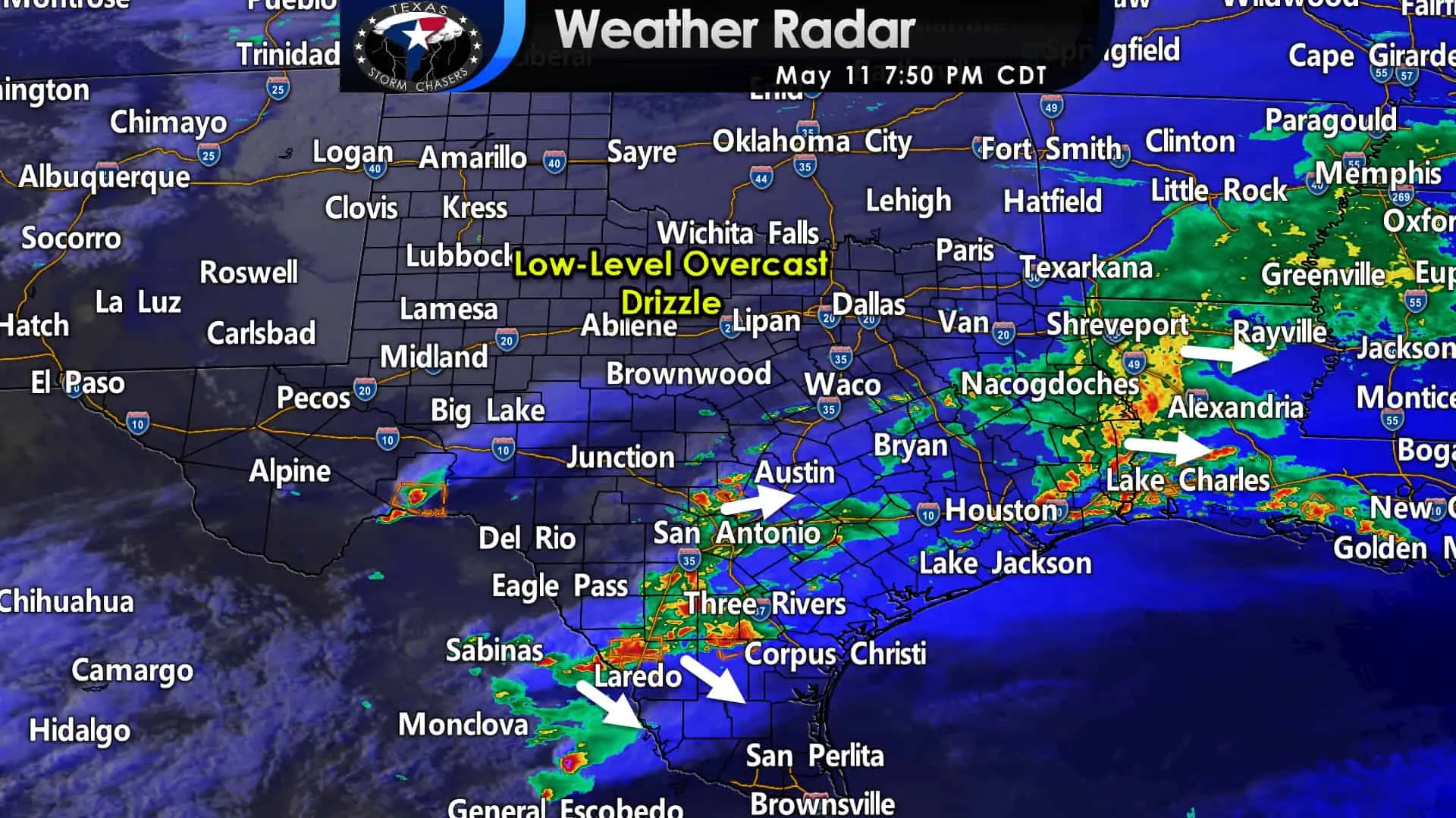
Scattered to numerous thunderstorms continue this evening in the eastern Hill Country, South Texas, eastward across East Texas and the Golden Triangle. The threat of thunderstorms has ended across the northwest half of Texas. A few showers, drizzle, and low-level overcast will continue through the night. Temperatures will also remain quite cool by mid-May standards.
South-Central Texas, South Texas, and the Rio Grande Valley
Multiple severe thunderstorms are underway early this evening. We’ve got a couple of storms with hail from Johnson City to Blanco to Comfort. Those storms may bring additional rain and perhaps some hail to the I-35 corridor around Austin through 10 PM.
Further south, storms are producing large hail and damaging winds near Encinal to Freer, north to Persall. Those storms are moving southeast. Additional storms west of the Rio Grande are likely to move into South Texas over the coming few hours.
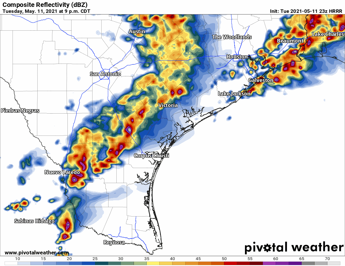
Simulated weather model radar this evening through Wednesday morning.
The High-resolution Rapid Refresh (HRRR) model shows storms growing upscale into a squall line/cluster this evening. As upscale growth occurs, we expect storms to accelerate southeastward toward the coast.
There is the potential for the strongest storms to produce damaging winds, hail, and a quick two to four inches of rain. A brief tornado can’t be ruled out this evening. The primary issue should trend toward localized damaging winds and heavy rain tonight.
Further northeast up the coast, we could see some heavy rain produce localized flooding in the Coastal Plains and Southeast Texas near the coast.
We’ll be here overnight to provide weather updates. You can keep tabs on rain with our interactive weather radar here.


0 Comments