
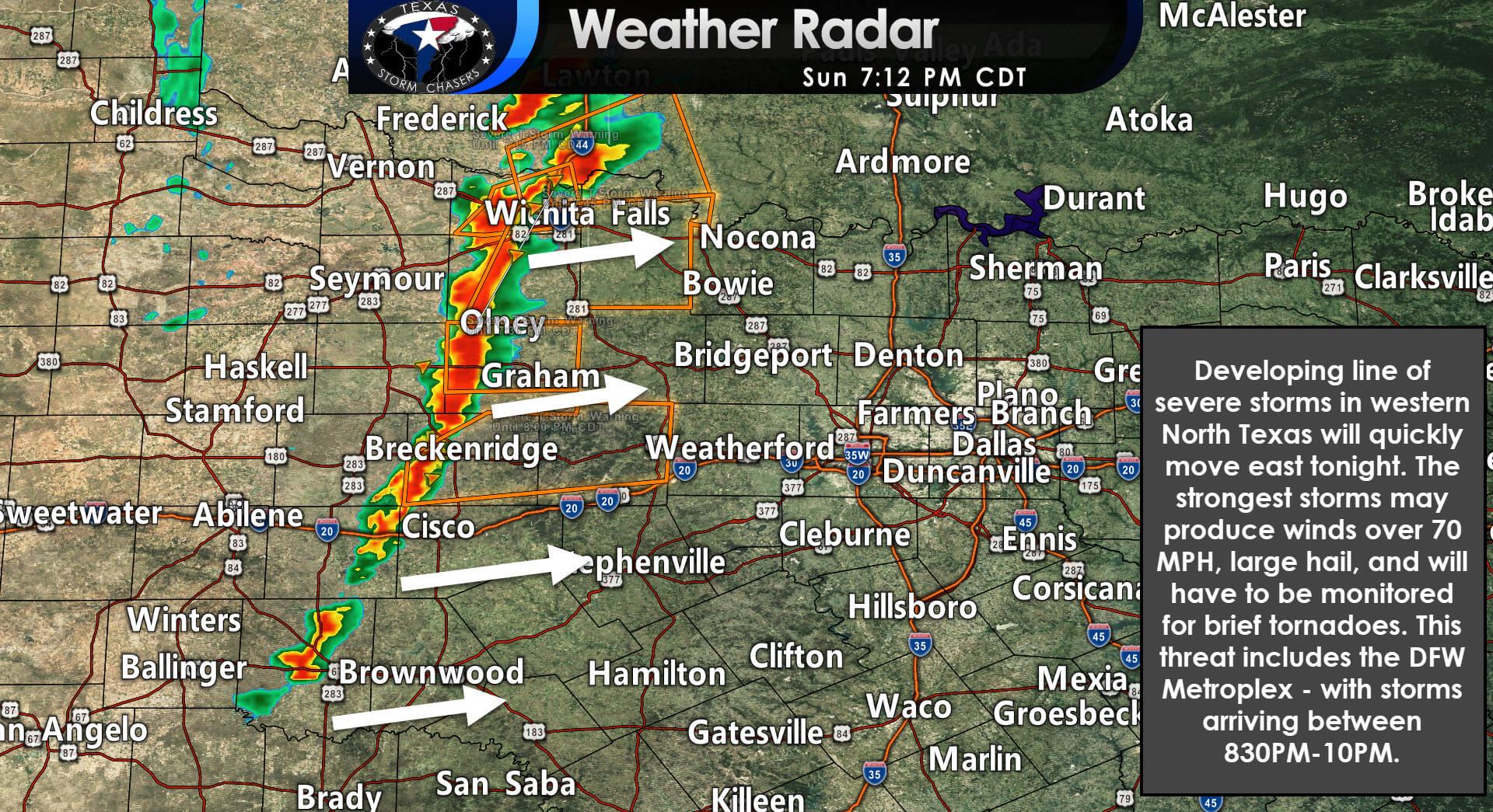
A line of developing severe storms extends from Burkburnett to Iowa Park to the west of Breckenridge. Storms will likely continue developing to the south over the next hour or two. The strongest storms may produce hail up to the size of golfballs and destructive winds over 75 MPH. We’re closely monitoring storms for signs of low-level rotation and tornado potential. The squall line is quickly moving east and will be approaching I-35/I-35W (west side of D/FW) by 8:30-9 PM. Severe weather is expected.
We’ll go live for digital weather coverage when needed. I’m personally located on the south side of Oklahoma City, so I’m having to deal with an approaching tornadic supercell. Once that ‘issue’ corrects itself, we’ll go live for the evening.


0 Comments