
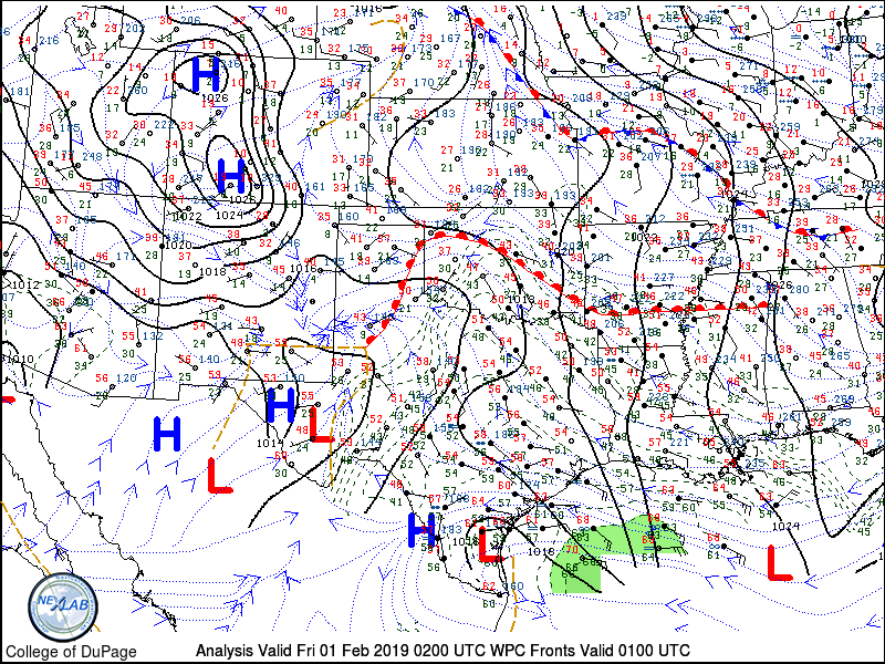
It’s a relatively warm evening for January across much of the state. A warm front is moving north across West Texas and into the Texas Panhandle. Temperatures south of this front are in the 40s and 50s with dewpoints not much lower. That makes for a good recipe for fog and mist, so expect some patchy dense fog to develop overnight and into Friday morning. Some of the fog may become quite dense in spots, especially in areas where soils are saturated.
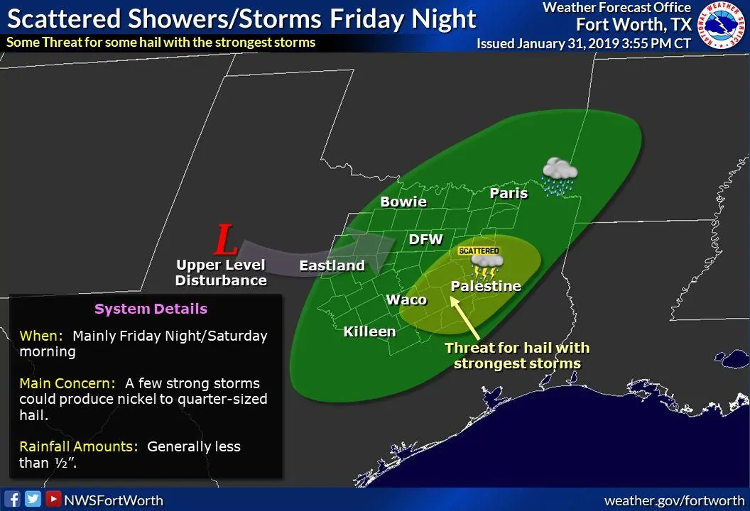
A few thunderstorms remain possible overnight Friday across North Texas, Central Texas, into Northeast Texas. However, we no longer expect a severe weather threat. The level one risk that was in effect has been removed. This evening’s higher resolution weather models aren’t developing any storms at all tomorrow night. A fast-moving upper-level storm system may still spark off a few storms.
If storms do develop a few of them may produce small hail and very brief heavy rainfall. Otherwise, low clouds, patchy fog, and light showers can be expected across much of Texas tomorrow night – much like tonight.
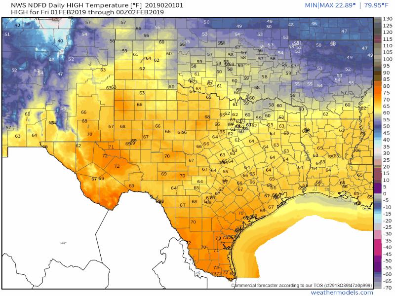
Daily high temperatures from Friday through Wednesday of next week. Data from the National Weather Service.
After tomorrow night the main story will be the spring preview in the temperature department. Temperatures of 10 to 25 degrees above average for early February are expected on Saturday, Sunday, Monday, and into Tuesday. High temperatures across Texas will range from the middle 60s up into the lower 80s. Most of the state should be in the 70s on Sunday. Cloud cover may hold tough for some folks, but that won’t put much of a damper on the warmer temperatures. Overnight low temperatures will also be well above average and more reminiscent of early April. Warm weather fans will be rejoicing, but one doesn’t have to look far to see that winter isn’t over. 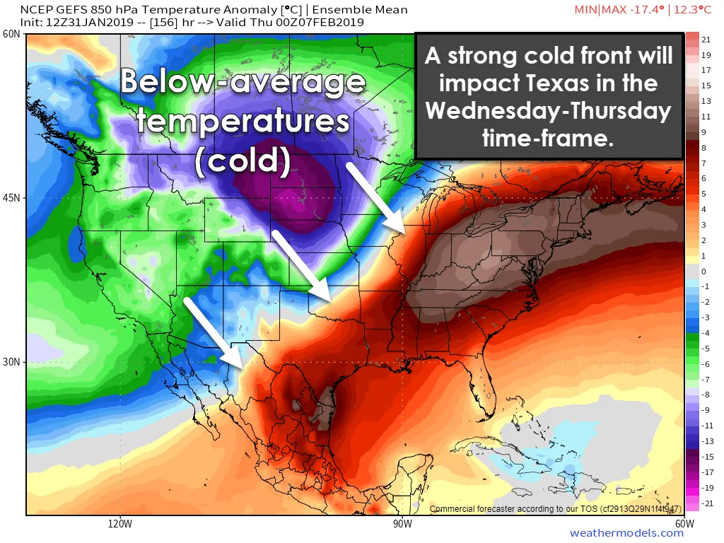
The next surge of arctic air will invade the continental United States early next week. Unlike the last system, this next bout of colder air should make it into the Southern Plains, including Texas. At this point, the cold front could arrive in the Wednesday to Thursday timeframe. Strong northerly winds will result in temperatures dropping into the 20s, 30s, and 40s.
Wind chill values will be lower and undoubtedly give a harsh reminder that one must pay for the 70s and 80s in February. Mother nature intends to collect that payment. While we will see a warm up by next weekend the extended range model ensembles suggest that additional arctic invasions will occur over the coming two weeks.
There is some indication that an upper-level storm system may arrive in the Thursday-Friday timeframe of next week. Given the colder airmass in place, we’d have to watch for the possibility of some winter weather mischief. That will be monitored as we get closer, but it remains out in the land of weather model voodoo at this juncture. Winter is far from being over.
Please be wary of raw weather model snow output graphics being shared on social media. There are several weather models that are run multiple times a day. It’s best to use an ensemble approach versus using one deterministic weather model.


0 Comments