
The ongoing situation is matching previous forecasts fairly well. No major adjustments are needed this evening.
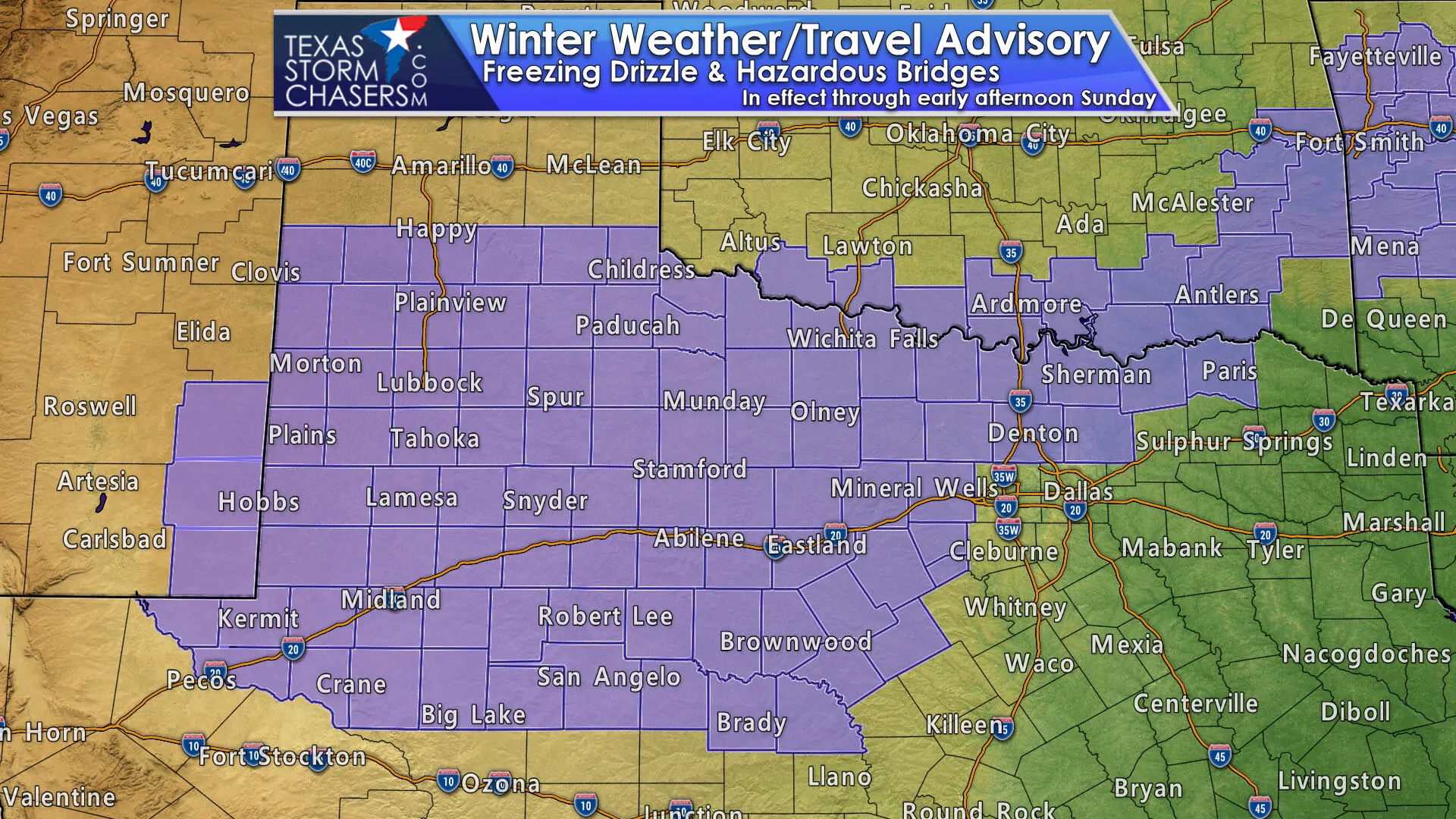
- Freezing drizzle is ongoing across West Texas, the Permian Basin, Northwest Texas, the Big Country, the Concho Valley, Texoma, and portions of North Texas. Hazardous driving conditions in the form of iced over bridges have been reported in parts of the Big Country and Northwest Texas this evening.
- Freezing drizzle will continue into the morning hours Sunday and potentially increase in coverage. Ice Accumulations are expected to be very light – under 0.05″. However, surface temperatures in the 20s will allow for that to easily accumulate on bridges, overpasses, and even surface roadways. It only takes 0.01″ of ice to turn surfaces into a slippery slope. Freezing drizzle is more dangerous because folks tend to underestimate its impact on driving surfaces.
- At this time freezing drizzle is ongoing just west and north of Tarrant and Dallas counties. Drier air that filtered in earlier this evening is keeping the ‘core’ of D/FW mostly dry for now. As surface temperatures continue to drop and ascent aloft increases we could see some slick bridges and overpasses develop in D/FW proper during the morning hours Sunday. This threat would likely be short-lived as the freezing drizzle should move out around 9-10 AM CT.
- There is a slight chance of minor ice accumulation on a few bridges by Sunday afternoon in Central Texas and East Texas. Unlike farther west tonight, freezing drizzle will only occur for a short time before drier air moves in. This should limit the potential for more widespread ice issues, but stay a tune to forecast updates.
The High-Resolution Rapid Refresh (HRRR) model seems to have a decent picture of tonight’s scenario. Widespread freezing drizzle will start to end from north to south on Sunday as drier air filters in from the north. This drier air will also be a secondary surge of arctic air, helping to drop temperatures even more – along with introducing dangerously cold wind chill values.
Advertisements


0 Comments