
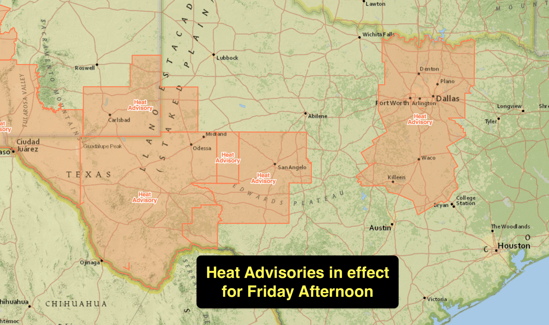
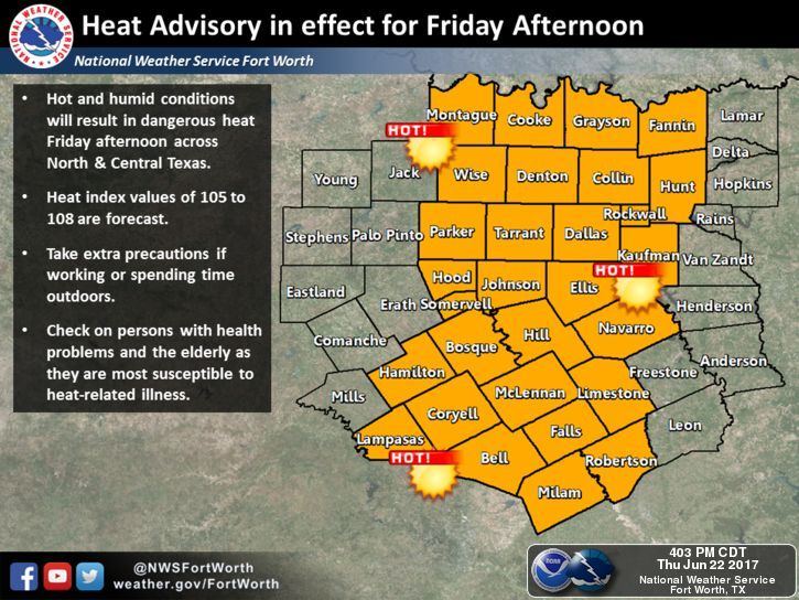
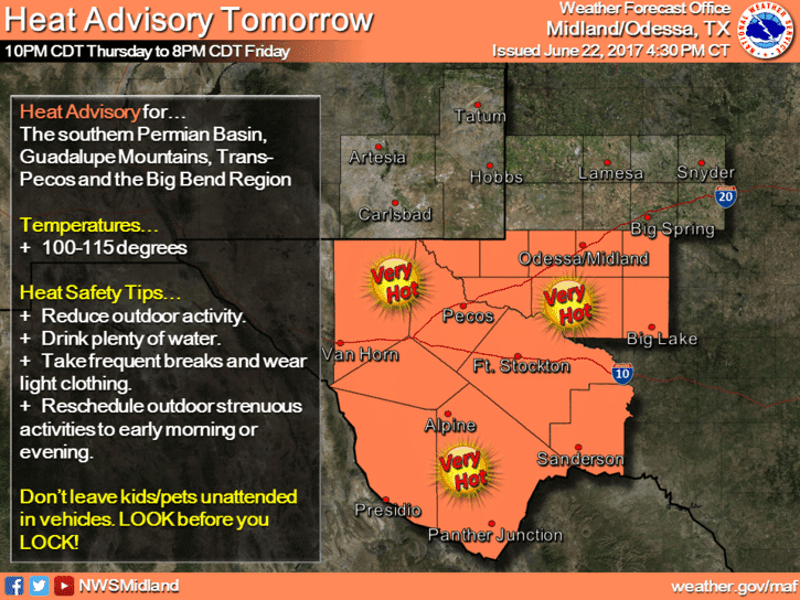
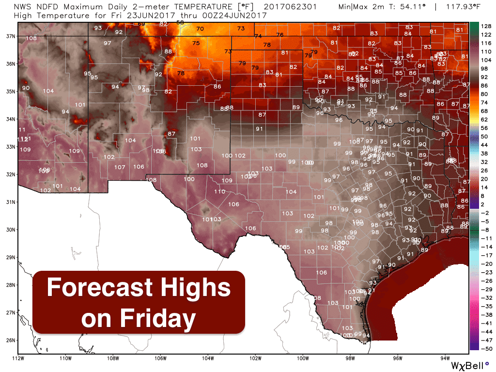
A cold front will move into the panhandle overnight which will result in a pretty significant drop in high temperatures tomorrow across the region. Areas seeing upper 90s to 100s today will be a good 20 degrees cooler tomorrow, and into the weekend as well. In fact, it looks like most of the panhandle will see highs only in the 70s by Saturday! Areas south of the front will still be quite hot tomorrow, especially across the western half of the state which will see highs ranging from 100 to 110. While parts of north and central Texas will not see many 100s, we will see upper 90s with lots of humidity in place which will make it really miserable by the early afternoon hours. Heat Advisories will be in effect tomorrow for portions of north central Texas including all of the DFW metro, parts of central Texas around Waco to Killeen, the Permian Basin/Trans Pecos region including San Angelo, Midland/Odessa, Ft. Stockton and the Big Bend Region, and far western Texas including El Paso. Make sure to stay hydrated and limit outdoor activity during the afternoon hours as much as possible!
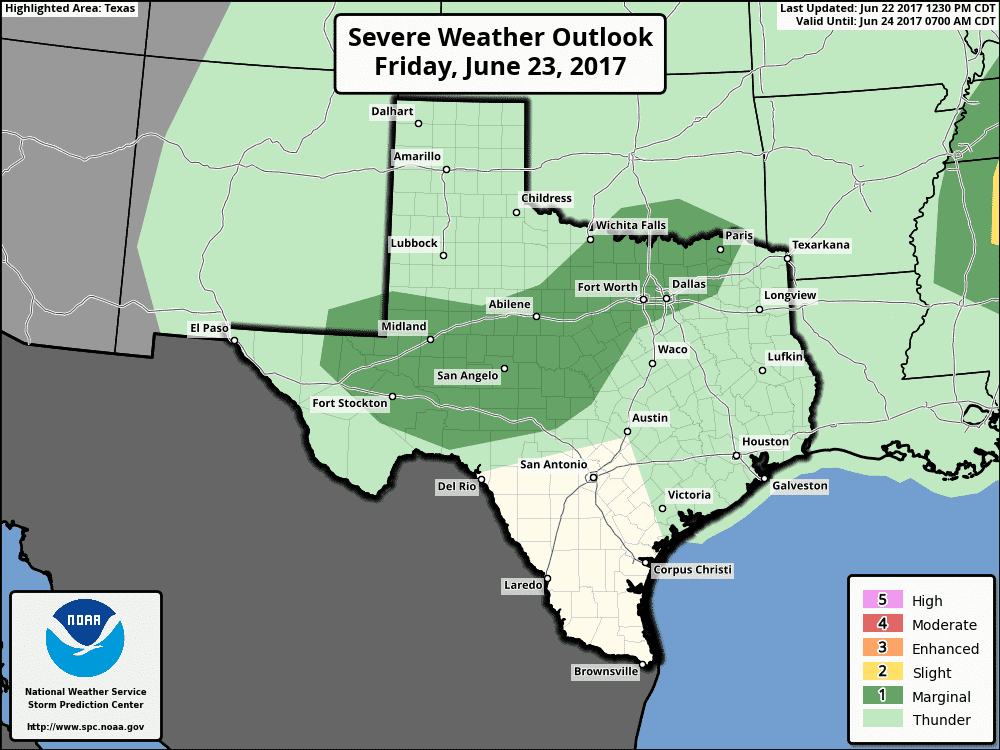
Tonight’s cold front will bring chances for rain and some thunderstorms on Friday as it slowly drifts south through the state. The Storm Prediction Center outlook for tomorrow has a Marginal Risk (Level 1) for severe weather across parts of north central Texas, west central Texas and the eastern portions of far western Texas for tomorrow afternoon. Intense heating will allow for moderate instability to build ahead of the frontal boundary which should be draped along or near the I-20 corridor by early tomorrow afternoon. Storms are expected to fire up first near Midland/Odessa then develop across north central Texas by mid to late afternoon. Large hail and damaging winds will be the main threats as these storms drift south/southeast through the evening hours. Heavy rainfall under the more prolific storms may also cause isolated issues with flash flooding. Additional chances for rain and storms will exist on Saturday both along the frontal boundary…which is expected to be draped across central Texas by Saturday…and behind the frontal boundary as well.
Here’s an animated peek at one of the short-range high resolution forecast models with a look at how the radar may shape up between 3pm Friday and 6am Saturday. Keep in mind this is just a model forecast, so don’t get too caught up on exact location of any storms. A lot will depend on where the frontal boundary ends up by tomorrow afternoon.
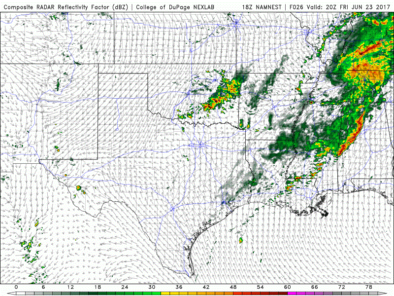
Simulated Radar Animation 3pm Friday to 6am Saturday


0 Comments