
A new tornado watch has been issued through 6 PM for East Texas and Southeast Texas. Tyler, Lufkin, Conroe, and Houston are a few towns included. Pretty much, all locations east of I-45 and south of I-20 are now in a tornado watch. The strongest storms through the afternoon may produce damaging straight-line winds up to 75 MPH, hail up to the size of tennis-balls, and tornadoes. The threat for strong/long-track tornadoes will increase this afternoon with any discrete supercells in East Texas. The threat for damaging winds will be highest with the squall line now moving just east of Interstate 35.
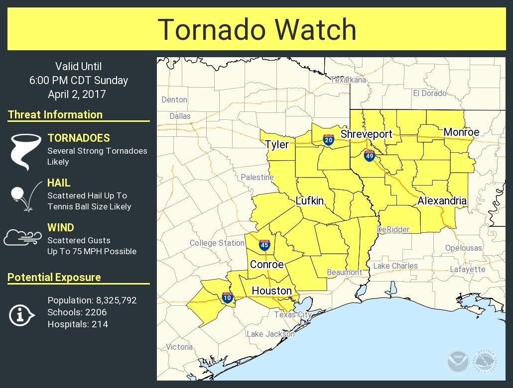
Tornado Watch Number 109
NWS Storm Prediction Center Norman OK
1035 AM CDT Sun Apr 2 2017
The NWS Storm Prediction Center has issued a
* Tornado Watch for portions of
Northern and Central Louisiana
East and Southeast Texas
* Effective this Sunday morning and evening from 1035 AM until
600 PM CDT.
* Primary threats include…
Several tornadoes and a couple intense tornadoes likely
Scattered large hail likely with isolated very large hail events
to 2.5 inches in diameter possible
Scattered damaging winds and isolated significant gusts to 75
mph possible
SUMMARY…Scattered thunderstorms will continue to affect the watch
area this afternoon and evening. The environment is very favorable
for supercells capable of tornadoes in those storms that form in the
warm/humid air.
The tornado watch area is approximately along and 70 statute miles
north and south of a line from 20 miles south of Monroe LA to 30
miles west southwest of Huntsville TX. For a complete depiction of
the watch see the associated watch outline update (WOUS64 KWNS
WOU9).
Here’s a simulated radar loop from the HRRR through the afternoon hours. We’ll really have to watch any discrete storms in East Texas for tornado potential.


0 Comments