
The remainder of today and much of Thursday will be storm-free. The weather will begin to become more active late tomorrow afternoon in the southeast Texas Panhandle and far Northwest Texas. There is a conditional risk for a few supercells to develop in those two regions after 4 PM tomorrow. Uncertainty remains on the availability of moisture and how unstable the atmosphere will become. We could easily end up with no surface-based storms tomorrow afternoon. Either way the primary show will occur after dark tomorrow night and into the early morning hours Friday. A surface warm front will move north from Central Texas tomorrow night through the Red River over time. As the warm front moves north conditions will become more unstable. We’ll likely see elevated thunderstorms fire up late tomorrow night in portions of Northwest Texas and North Texas. The strongest storms will likely produce hail up to the size of ping-pong balls and frequent cloud to ground lightning. Since storms will be elevated above the ‘cap’ the threat of tornadoes and damaging wind gusts should be very low. It could be stormy morning commute on Friday in North Texas. Tomorrow night won’t be a major severe weather event but will probably be loud.

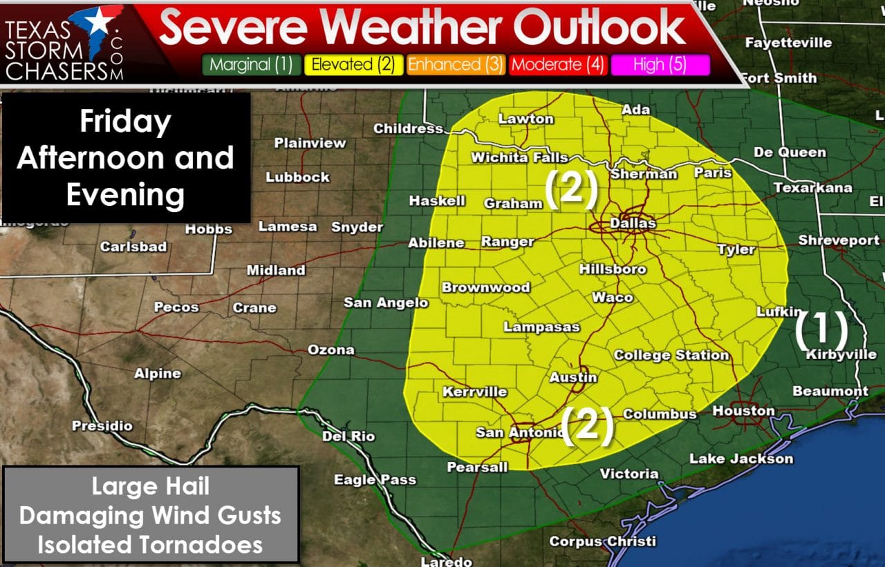
Depending on what transpires Thursday Night and the morning hours on Friday we could see another round of severe weather Friday afternoon and Friday night. Since we’re still 48+ hours out we’ll just have to wait and see what comes together. If we have widespread rain/clouds persist on Friday the threat of severe weather will be mitigated. If conditions come together as some models are indicating we could have severe weather issues. The Storm Prediction Center has broad brushed a category 2 severe weather risk across Northwest Texas, North Texas, Northeast Texas, Central Texas, the eastern Big Country, eastern Concho Valley, South-Central Texas, and the Brazos Valley. The strongest storms could produce large hail and damaging wind gusts. The magnitude of any tornado threat will become more clear as we get closer and get through Thursday.
The chance of heavy rain will increase Friday, Friday Night, and into Saturday. Some locations in Northeast Texas and East Texas could receive 2 to 4 inches of rain through the weekend. The threat of flash flooding may return for some locations. We’ll also have to refine this risk as we get closer but a dual threat of severe storms and heavy rain could exist.

Flash Flood Outlook for Friday and Friday Night

0 Comments