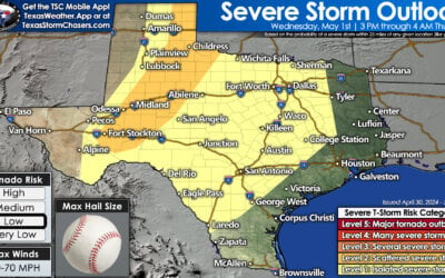
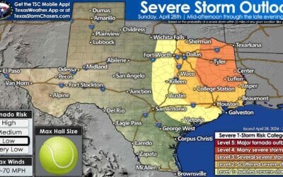
There will be two rounds of thunderstorms possible late Tuesday afternoon into Tuesday night. The first round is conditional on the cap being able to break just ahead of the dryline in North Texas and the Hill Country. If temperatures are able to warm enough and the cap weakens a couple discrete supercell thunderstorms may develop during the late afternoon hours. These storms would be in an extremely unstable enviornment with moderate wind shear values. Storms would likely become severe rapidly with a threat of extremely large hail, localized damaging wind gusts, and a possible tornado threat. Compared to Oklahoma, Kansas, and Nebraska our low-level wind shear will be a bit less favorable for significant tornado activity Tuesday afternoon. Cloud bases will also be higher which would also tend to limit – but not eliminate by any means – the tornado threat. Very large hail – perhaps giant hail up to softball size – would be a big problem though. Should model data later today indicate an increased likelihood of storm initiation the severe weather risk level will have to be increased. We’re teetering on the edge of a fairly significant severe weather threat with storm coverage one uncertainty.
A second round of storms – which appears more likely to develop – would fire up just east of the dryline near sunset or in the evening hours Tuesday in North Texas into Central Texas. The atmosphere would be supportive of severe thunderstorms with all modes of severe weather possible. Threats may include hail up to the size of baseballs, damaging straight-line winds over 70 MPH, and tornadoes. Initial discrete storms may produce hail up to the size of softballs and tornadoes. Once storms congeal into a squall line the threat for widespread straight-line winds of 70 to 80 MPH would increase. The threat of very large hail would come down while the threat of brief tornadoes would continue. Depending on how forecast data trends later today this could become a fairly significant severe weather threat Tuesday night. We note this event would likely occur after dark and continue well into the night towards Wednesday morning. The atmosphere will remain very unstable and wind shear values will only increase as Tuesday night goes on. Storms would move towards Northeast Texas and East Texas well after midnight.


0 Comments