
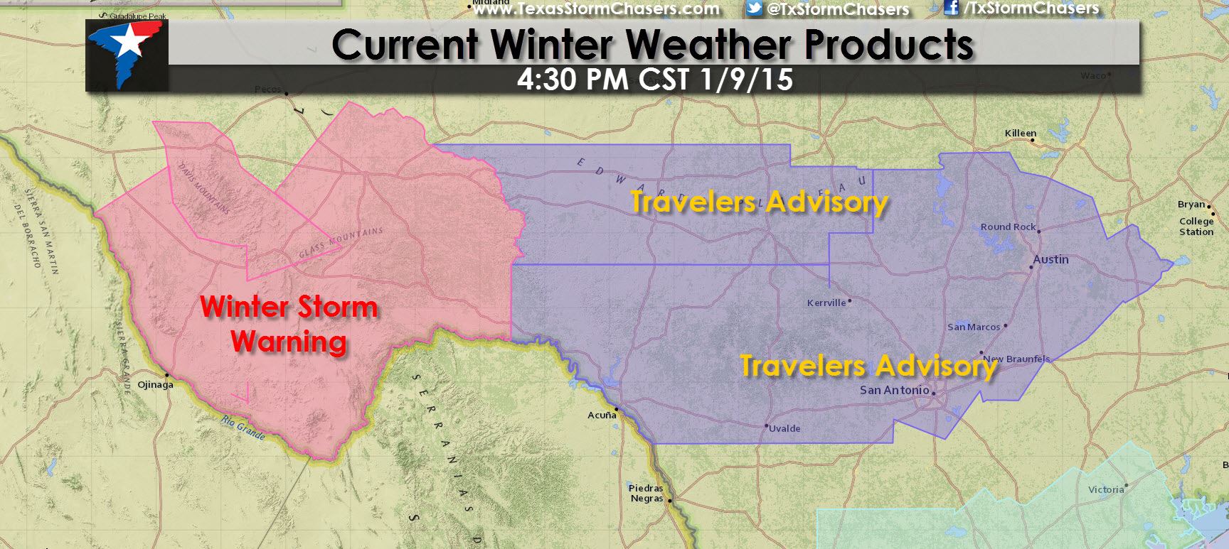
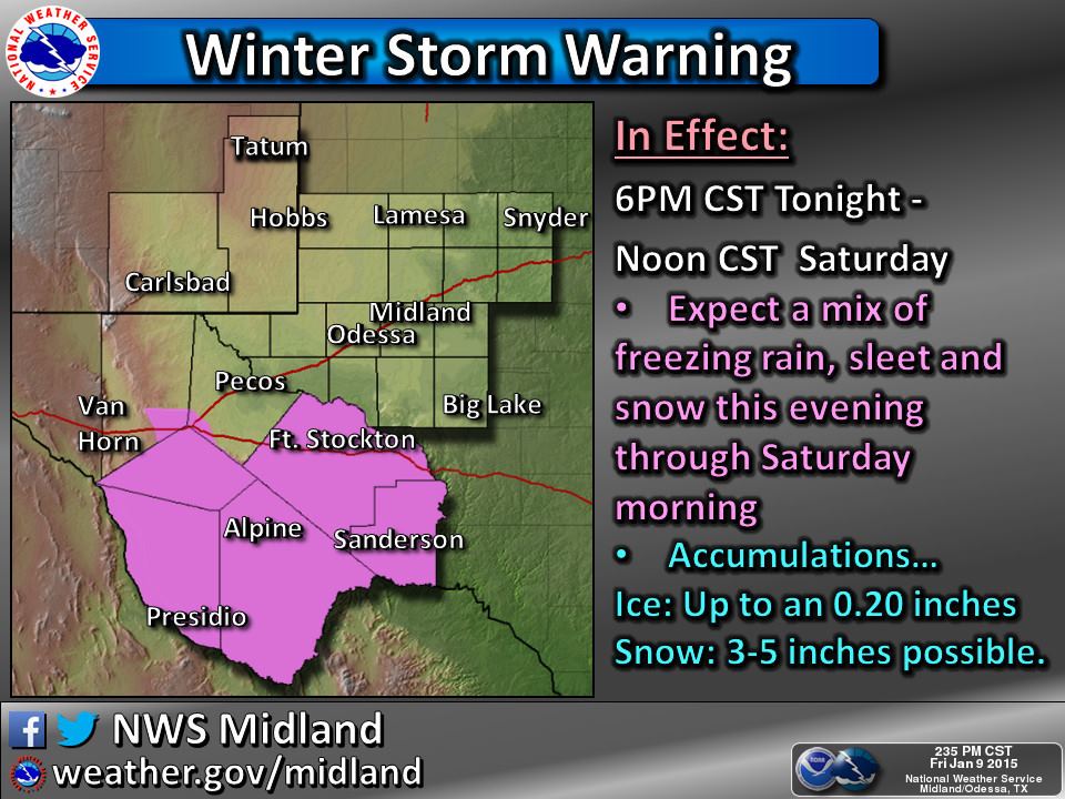
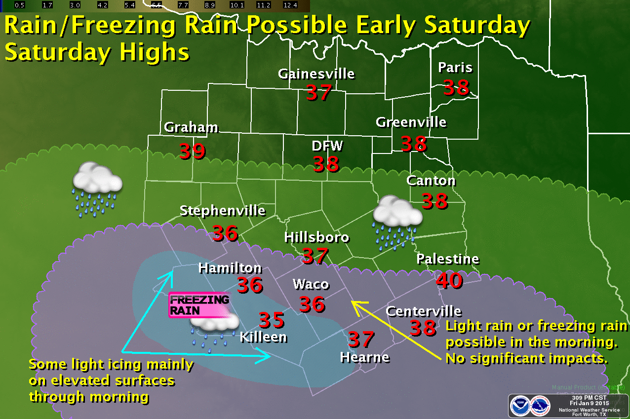
* WINTER STORM WARNING for the Davis Mountains, Marfa Plateau, Big Bend Area, Stockton Plateau, Lower Trans-Pecos through Saturday Morning including Marfa, Alpine, and Fort Stockton. Ice accumulations up to 0.25″ are expected in the lower elevations with snow accumulations of 3 to 5 inches possible in the higher elevations. A Winter Storm Warning means significant accumulations of ice and snow will cause widespread travel disruptions.
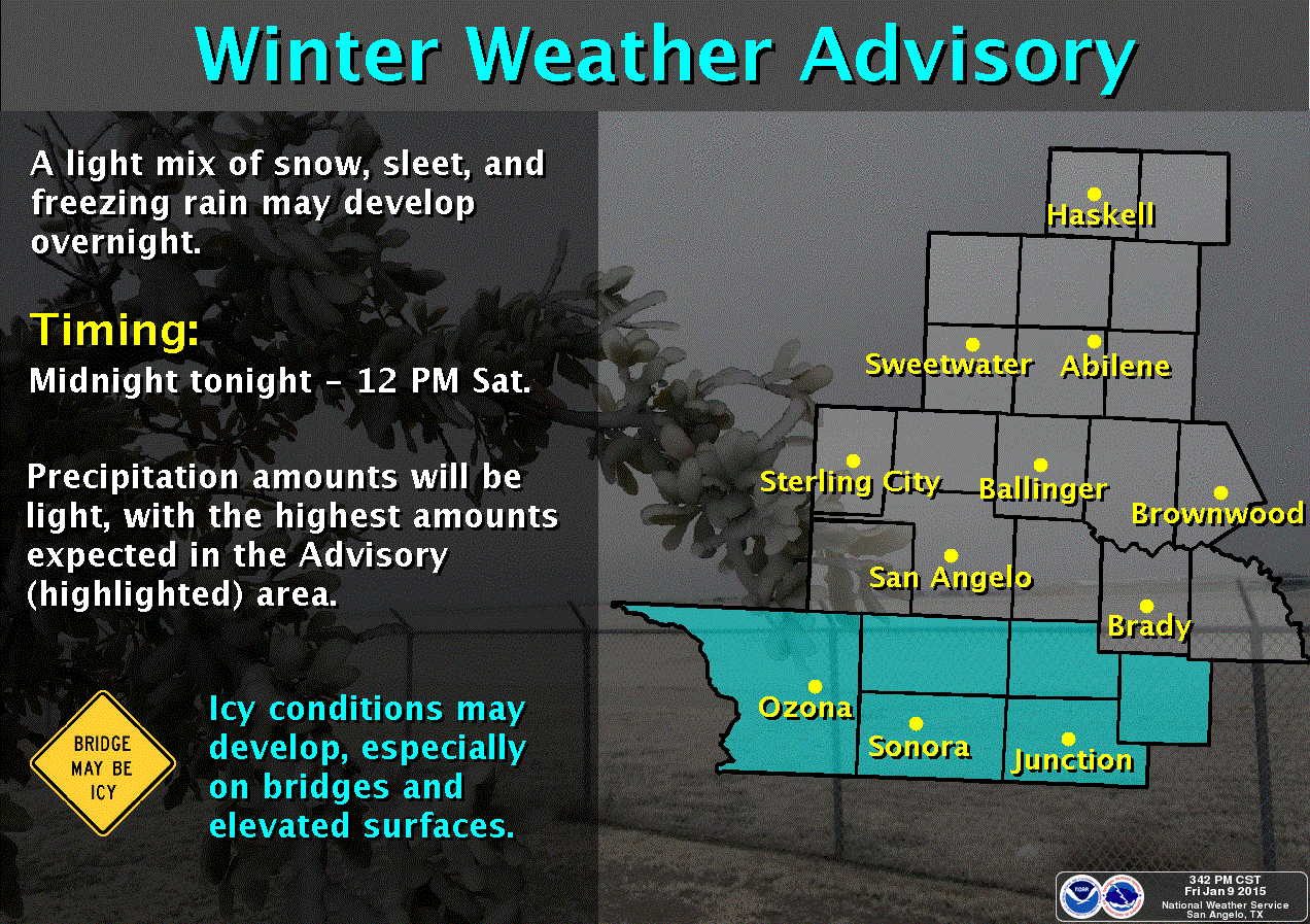
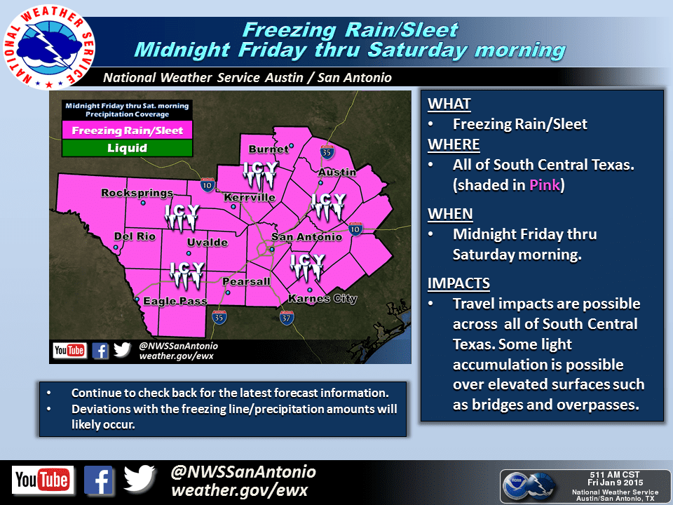
* WINTER WEATHER/TRAVELERS ADVISORY for portions of West-Central and South-Central Texas through Saturday Morning. Giddings, Bastrop, Tayler, Georgetown, Austin, New Braunfels, San Antonio, Kerrville, Uvalde, Junction, Sonora, Del Rio, Eldorado, and Ozona are all included. Light freezing rain or drizzle will be possible tonight in locations that fall below 32 degrees. A light coating of ice will be possible mainly on elevated surfaces which may result in icy spots on bridges and overpasses. A Winter Weather Advisory means accumulations of ice may create travel disruptions.
Remember it only take 0.01″ of ice accumulation to turn elevated surfaces into skating rinks. Be mindful of that tonight and on Saturday in locations that fall below freezing.


0 Comments