
Widespread clouds and fog are occuring this morning. A few light showers are noted on radar. Severe weather is not expected with activity through early afternoon. A few elevated showers and thunderstorms may develop later this morning into the early afternoon hours. The atmosphere is expected to remain capped and this activity should remain sub-severe.
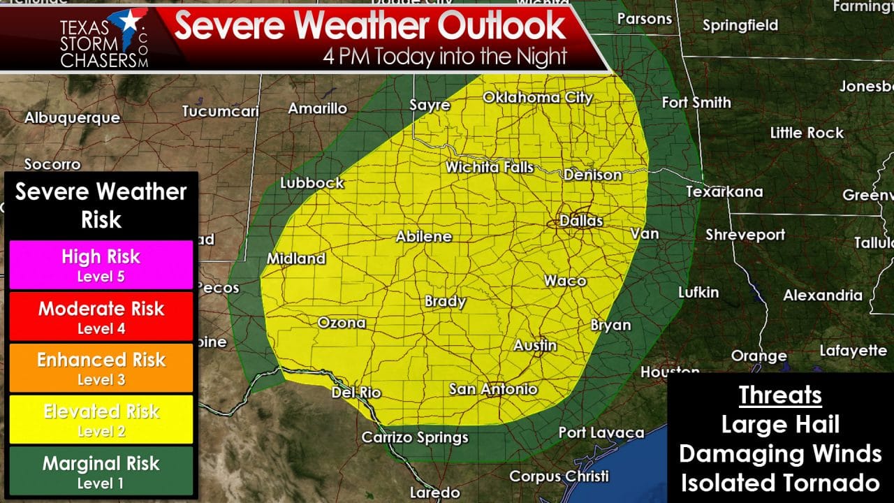
The setup by late afternoon will be characterized as follows. A dryline will setup near Highway 281. Dewpoint values will be in the 60s to the east of the dryline. West of the dryline dewpoints will plummet into the teens and temperatures will soar into the 80s. Fire danger will be very high to critical west of the dryline today. The atmosphere immediately along and within 100 miles east of the dryline will be quite unstable. Fortunately the cap will be strong and in place much of the day. There is a slight potential that the cap will errode enough for a storm or two to fire up just east of the dryline this afternoon. Should a surface-based storm bust through the cap it will rapidly become severe. Conditions will be favorable for very large hail, damaging wind gusts, and tornadoes.

Simulated Radar at 6 PM Today from the 11Z run of the HRRR weather model
A weak upper level storm system is forecast to move over North Texas by late afternoon. The more likely scenario is that a couple elevated thunderstorms will develop by late afternoon. By elevated I mean the storms would form above the cap. That would drastically reduce the chance of a tornado or significant damaging wind risk. The threat for large hail up to the size of golfballs would exist with these elevated storms. There is the potential that the storms could move into the D/FW Metroplex during evening rush hour. We’ll have to closely monitor the storms in case they attempt to become surface based. Should they become surface based they would have the potential to produce damaging winds and acquire low-level rotation. That is a low probability at this time.
The threat for severe thunderstorms will spread west tonight. The dryline will retreat westward after sunset. At the same time a powerful upper level storm system will send another piece of energy into West Texas. Thunderstorms may develop in the higher elevations of northern Mexico this afternoon. Those storms may move into Southwest Texas this evening with a large hail threat. Additional thunderstorms are expected to form closer to midnight across West Texas and Northwest Texas. This activity will move northeast with a threat of hail tonight. Eventually they’ll move into Oklahoma towards or after sunrise. That’ll take us into another set of issues on Tuesday.
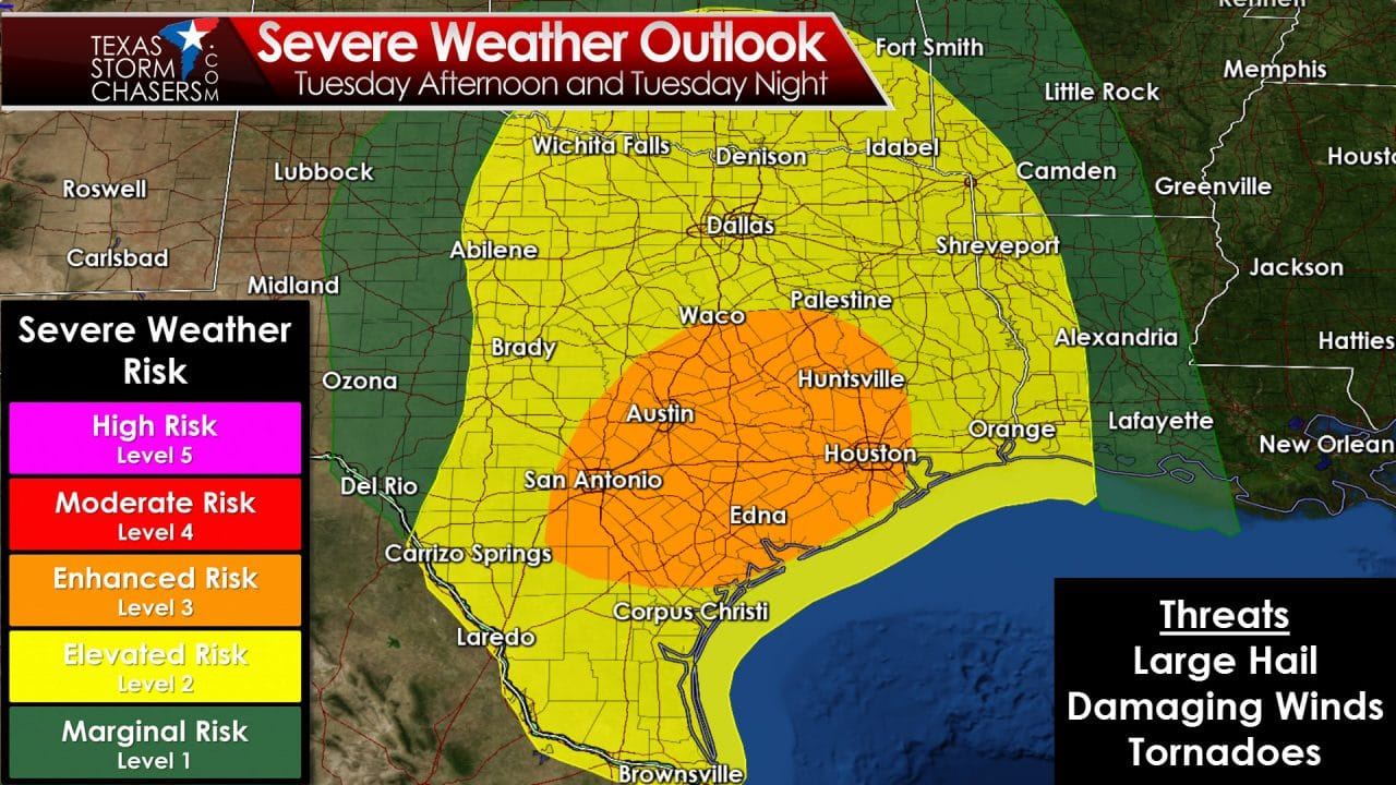
The overnight and Tuesday morning round of storms will play a role in what may occur Tuesday afternoon and evening. If the storms move out by late morning and the cloud cover clears then we may be in for a busy afternoon. We’ll have to wait and see how today’s event unfolds since it will play a critical role in tomorrow’s setup. The cap ahead of the dryline will be weaker compared to today. Instability values will be unseasonably high and wind shear will support an organized thunderstorm mode. Discrete supercells may develop by mid to late afternoon near Highway 281 from the Red River into western North/Central Texas. Any storms that develop could rapidly become severe as they move east. Very large hail up to the size of baseballs, damaging wind gusts, and tornadoes would be possible with those cells. They may approach Interstate 35 by the early evening hours. Once again this scenario is likely to change as we need to get through today and tonight first.
Widespread thunderstorm development is expected tomorrow evening across northern Mexico into the Concho Valley and North Texas. This activity may be in the form of a large cluster or intense squall line. As it moves east there will be an enhanced threat of damaging wind gusts. Large hail and brief tornadoes would also be possible. The Storm Prediction Center has highlighted this potential by issuing an enhanced risk (level 3 out of 5) for Central Texas, the Brazos Valley, Coastal Plains, and Southeast Texas. This would be for Tuesday evening and Tuesday night. If any isolated storms were to develop ahead of the squall line they would have the potential to rotate. I wouldn’t be surprised to see the enhanced risk extended northward in later outlooks if forecast confidence increases. We’ll deal with Tuesday’s issues once we get through today.
Forecast rain totals through Friday evening
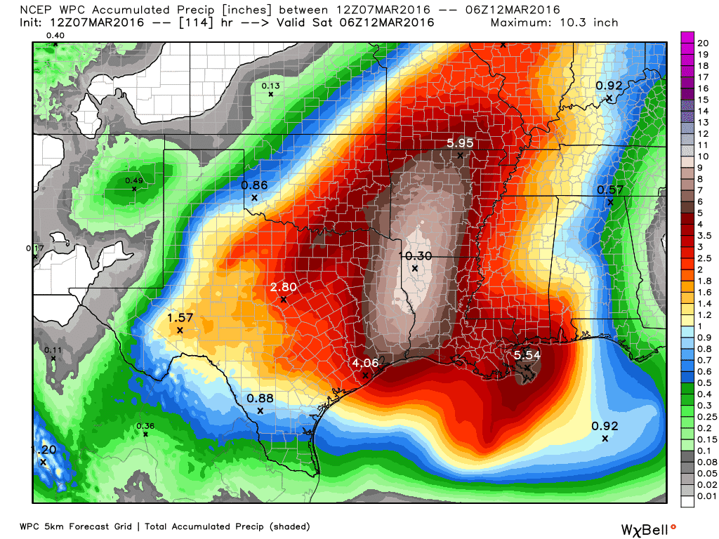
Heavy rain and potential flooding will also be a problem over the next few days. The batch of storms today may produce localized rain totals up to 2 inches in North Texas. Tuesday and Wednesday will bring heavier rains to a larger section of Texas. Widespread rain accumulations of 4 to 10 inches are expected across Northeast Texas, East Texas, and Southeast Texas through Friday. Much of that rain may fall with the Tuesday Night and Wednesday system. There will certainly be a risk of flash flooding in those areas. The ground can absorb about 2-3 inches before problems begin. Since the forecast has twice that amount forecast it does appear we’ll have to deal with flooding. The specific flash flood hazards will become more clear on Tuesday as mesoscale factors become evident.
0 Comments