
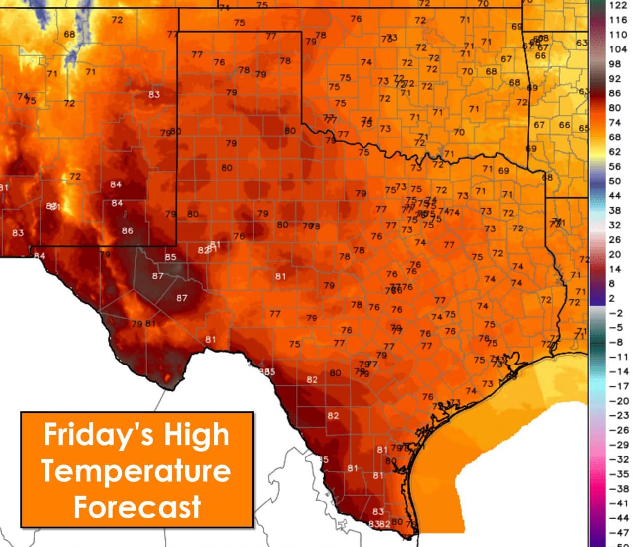
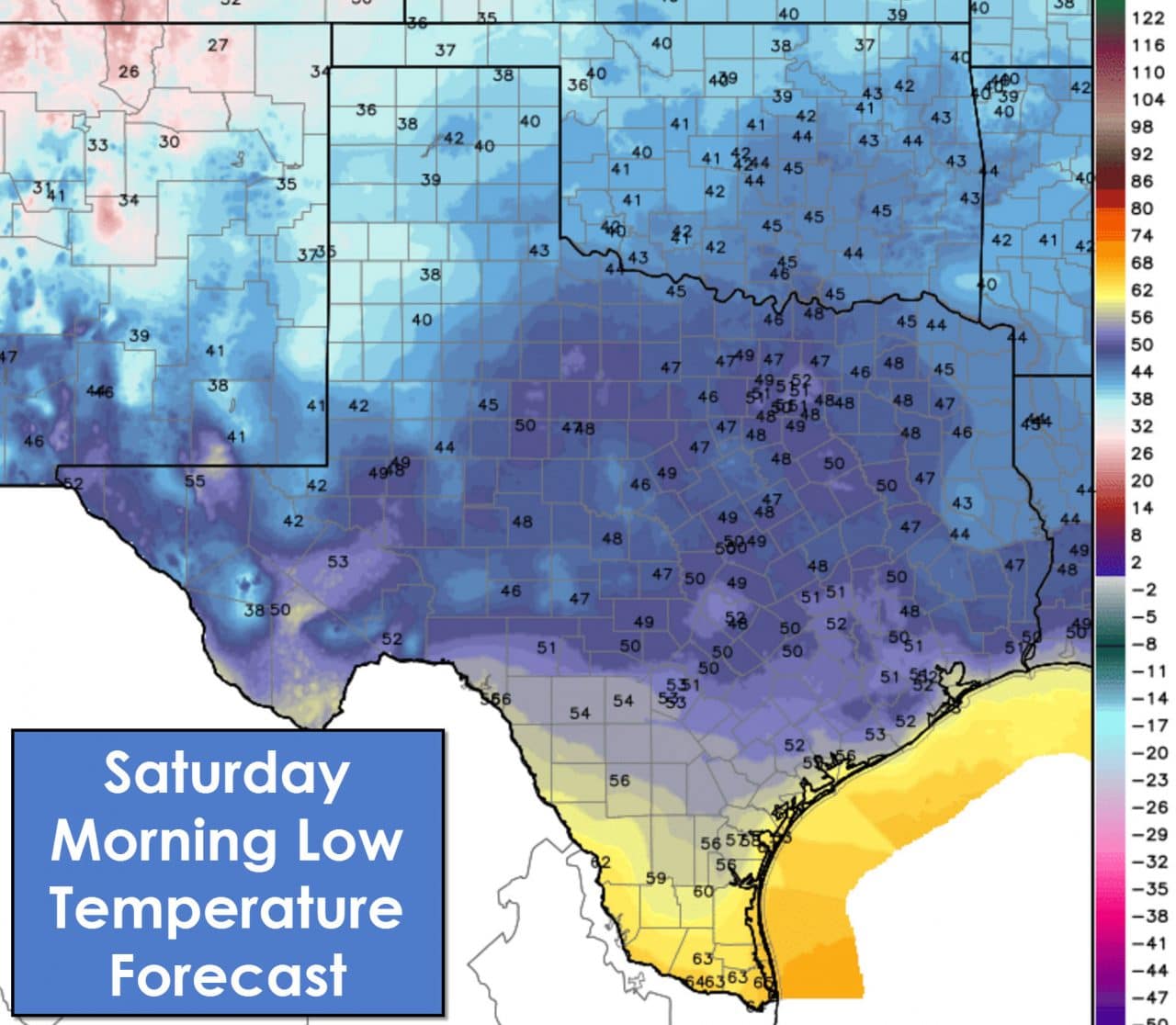
Temperatures are trending up today with more spring-like weather. The eastern half of Texas will experience highs this afternoon from 70 degrees up to 78-79 degrees. Folks in the Panhandle, West Texas, the Permian Basin, and Far West Texas will top out in the upper 70s to upper 80s.Deep South Texas and the Rio Grande Valley will be in the upper 70s to middle 80s. Winds in the northwest half of Texas will become gusty out of the southwest this afternoon. Tonight’s temperatures will be similiar to what they are this morning.
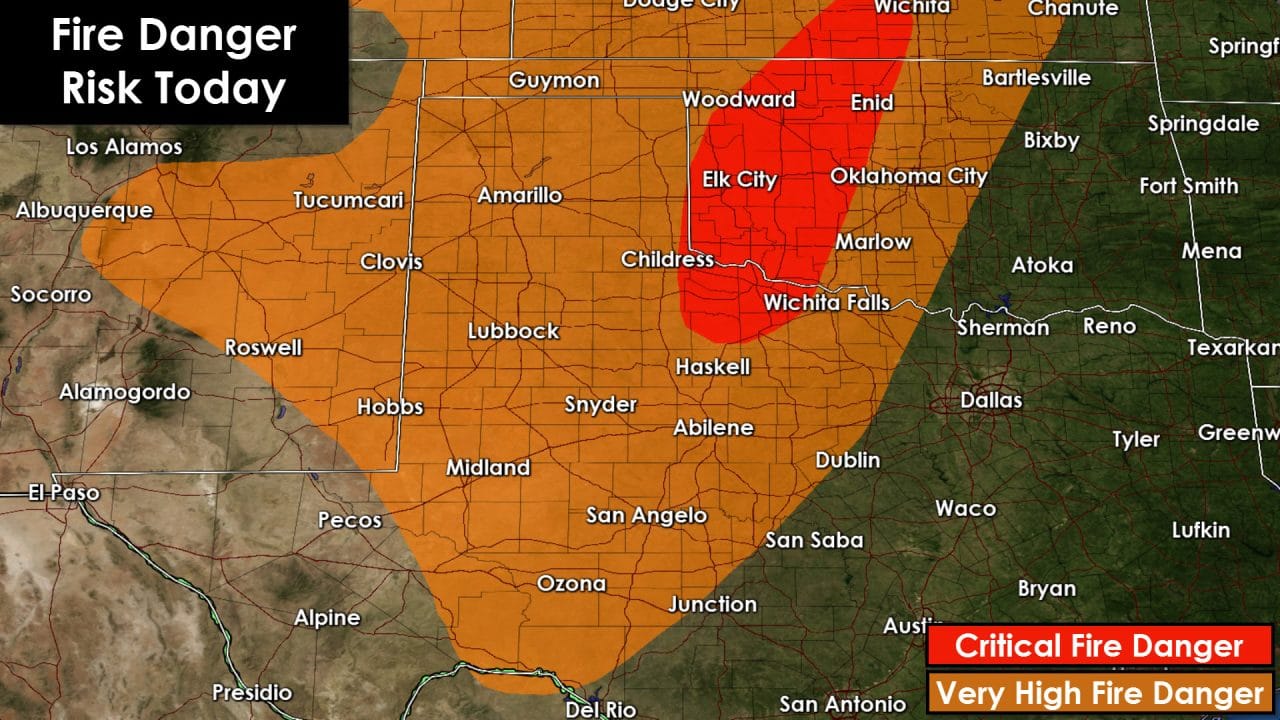
Fire danger will be very high to near critical across the Texas Panhandle, West Texas, the Permian Basin, the Concho Valley, the Big Country, and western North Texas. Fire danger will be in the critical category across Northwest Texas today. These delineations are issued daily based on expected weather conditions and surface fuel conditions.
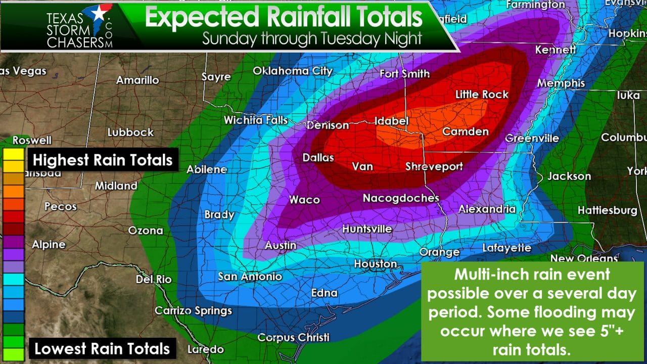
Precipitation chances will increase late Sunday Night into Monday. Several rounds of precipitation are probable beginning on Monday and continuing through at least Wednesday. It won’t be raining all the time. The highest rain totals look to be across Central Texas, North Texas, Northeast Texas, and East Texas. Some locations in Northeast Texas could receive over five inches of rain based on the current forecast. Some flooding concerns may develop by Tuesday and Wednesday. We’ll have to see how the forecast trends over the weekend. Soil conditions will allow at least 3-4 inches of rain to fall before we start seeing flooding develop. If rain totals go up than we could become a bit more concerned about flooding. Monday through Wednesday definitely looks wet though!
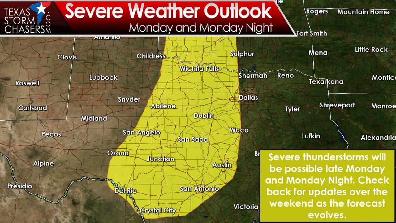
The dynamic nature of the upper level storm system along with the spring-like nature of our enviornment may result in severe thunderstorms on Monday and Tuesday. The Storm Prediction Center has placed South-Central Texas, the Hill Country, the Big Country, Concho Valley, Northwest Texas, and western North Texas in a risk of severe weather for Monday and Monday Night. Large hail and localized damaging winds look to be the primary threats at this point.
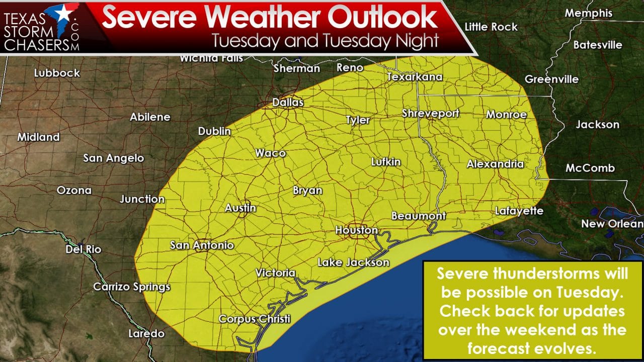
The severe weather risk continues on Tuesday across South-Central Texas, the Coastal Plains, Central Texas, North Texas, the Brazos Valley, Northeast Texas, East Texas, and Southeast Texas. The atmosphere may be more unstable on Tuesday compared to Monday. We’ll have to be on the look out for all modes of severe weather. There will be changes to the forecast over the weekend so please check back for updates.

0 Comments