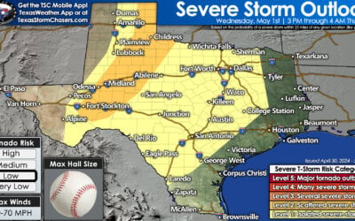
It has been a mostly cloudy day across Texas. Pockets of drizzle to light rain have made surfaces wet across North Texas into the Hill Country, Concho Valley, eastward into the Brazos Valley and Southeast Texas. Most locations have only recorded less than a tenth of an inch of rain so far. Over the past two hours we have seen an uptick in precipitation intensity from southeast of Stephenville with another batch of heavier rain near Junction. Widespread light rain encompasses the Hill Country into western sections of Central Texas. The expanding area of rain is making progress to the east. A couple of the stronger cells have produced cloud to ground lighting. Severe weather is not expected tonight but some very small hail may occur.
The 4 PM run of the High Resolution Rapid Refresh (HRRR) weather model has precipitation increasing across southern sections of North Texas by 8 PM. At this point it looks like the heaviest rains will remain south of the immediate D/FW Metroplex. Some rain may be locally heavy by this point. Light to locally heavier rain could extend southwest through the Hill Country towards Del Rio.
By midnight the heaviest rain will be underway across East Texas into Central Texas. A couple strong storms may contain very small hail and cloud to ground lightning. A large area of light rain should be falling across Southwest Texas, South-Central Texas, into the Brazos Valley. Most activity will be moving east/southeast later tonight.
Convection may end up forming a cold pool late tonight. That would help organize the showers and storms into a west-to-east oriented line. The HRRR has that line located from near Austin east through the Brazos Valley into Deep East Texas. Another area of rain would be falling across Southwest Texas into the Rio Grande Valley. Some of the rain may be heavy at times.
Around sunrise on Monday we should have a large area of light to moderate rain underway across Northeast Texas, East Texas, Southeast Texas, Central Texas, the Brazos Valley, South Texas, and the Rio Grande Valley. Isolated showers may be underway across North Texas again by this point. I don’t anticipate we’ll have as much heavy rain falling but there will still be pockets. A lull in precipitation should occur in the afternoon hours on Monday. Round 2 begins Monday Night into Tuesday Morning as a powerful storm system moves over the state.
Some locations across Central Texas, the Brazos Valley, and Far East Texas could receive up to 2.5 inches of rain tonight. Those amounts would be localized to areas that end up under that heavier band of rain overnight. Most folks across Northeast Texas and East Texas could receive half an inch to one inch of rain. Southeast Texas, South-Central Texas, and South Texas should average between a tenth of an inch to half an inch of rain. Those amounts are all generalized and will vary locally.


0 Comments